
Home / Landslides; The Most Significant Secondary Hazard Induced by Earthquakes in Iran
Slope instabilities (landslides) are recognized as one of the most significant earth-changing factors and among the most important geological hazards. Every year, they cause considerable damage to people’s lives and assets, infrastructure, and the environment, imposing significant economic challenges on governments. Therefore, landslides have been identified as one of the most important natural disasters of the present decade by the United Nations.
This phenomenon involves the downward movement of materials that form the slopes (rocks and soil) due to the gravity. Landslides can occur in various scales, from a single block to large masses, and they may move in different forms, including slumping, falling, toppling, and flowing. Often, external triggers such as earthquakes, heavy rainfall, river erosion, or human interventions in nature play a role in the occurrence of this phenomenon. Landslides also occur on submarine slopes in seas and oceans, and they can cause damaging consequences to submarine installations, such as underwater pipelines, communication cables, and other marine infrastructure.
Given Iran’s mountainous topography, prone geological deposits and structures, and diverse climatic conditions, the country is highly susceptible to a wide range of slope movements. This phenomenon causes significant annual economic and human losses. For example, the landslides resulting from the 1990 Manjil-Rudbar earthquake led to the burial of three villages—Fatlek, Fisham, and Bakhlour—along with all their inhabitants under massive debris of rocks and soil. In April 1998, following heavy rainfall, the village of Abikar-lebd-e Olya, located in county of Kuhrang, was buried with 52 residents under landslide debris originating from the slope facing the village. Only 13 people, who were outside the village at the occurrence time of recorded landslide, survived (alef.ir news website). More recent examples include landslides induced by the November 2017 Sarpol-e Zahab earthquake and landslides caused by rainfall in March 2019 and April 2019 across various provinces in Iran, which resulted in extensive financial and human losses.
The occurrence of thousands of landslides in different provinces such as Lorestan, Golestan, Semnan, North Khorasan, Kermanshah, Gilan, Mazandaran, Alborz, and Qazvin due to the heavy rainfall in April 2019 highlights the widespread exposure to this hazard in the country. The damage to 300 rural homes in Hosseinabad Kalpoush village in Semnan province (according to IIEES, 2019: report of stabilization studies of Hosseinabad Kalpoush), as well as more than 1400 landslides, only in Lorestan province that result in significant economic losses and threats to rural residential areas, are notable examples of losses caused by these heavy rains.
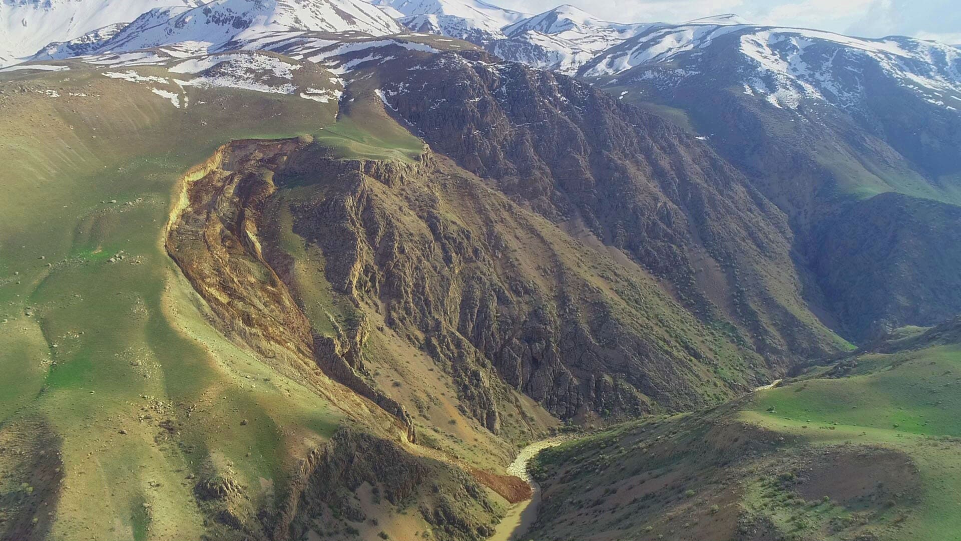
One of the most destructive impacts of landslides is related to damage of lifelines, including roads and oil and gas pipelines. For example, in April 2019, in the Taleqan region, a landslide caused a rupture and explosion of gas pipeline, transporting gas to Taleqan in Alborz province. As an example of landslide-related damages to roads in recent years the landslide in Phase 4 of the Tehran-North Freeway in December 2019, which caused the closure of the freeway for several days and created heavy traffic near the New Year holidays in the area (Tasnim News Agency). Therefore, accurately identifying both older landslide-prone areas and regions at high risk for future landslides can significantly help to reduce the associated costs.
In this regard, the Geohazards and Geotechnical hazard Research Group of the International Institute of Earthquake Engineering and Seismology (IIEES) has made landslide inventory and hazard zonation for various regions as one of its objectives since its establishment.
Executive managers and government offices must be aware of regional environmental hazards, such as slope instabilities, before undertaking civil and infrastructure construction. Recognizing the importance of hazard and risk studies plays a crucial role in disaster prevention and management.
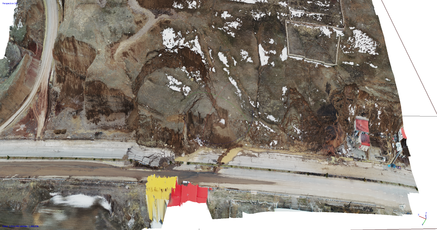
Figure 1: The landslide in the Taleqan region, which caused a rupture and explosion in the gas pipeline (Masoumeh Rakhshandeh)
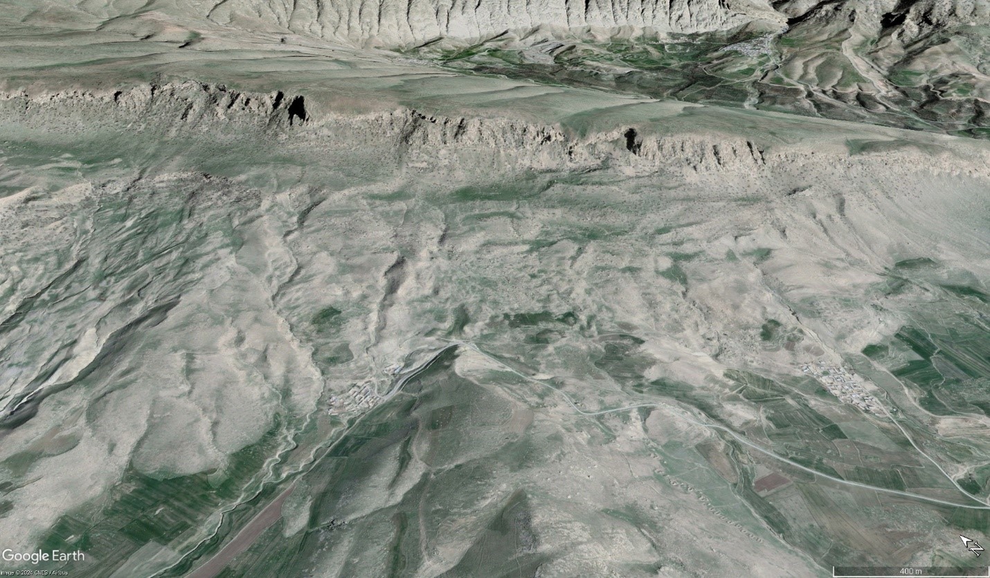
Figure 2: Pre-landslide image of Malleh Kabood-Qorchi Bashi (November 2017 Sarpol-e Zahab earthquake) - Google Earth
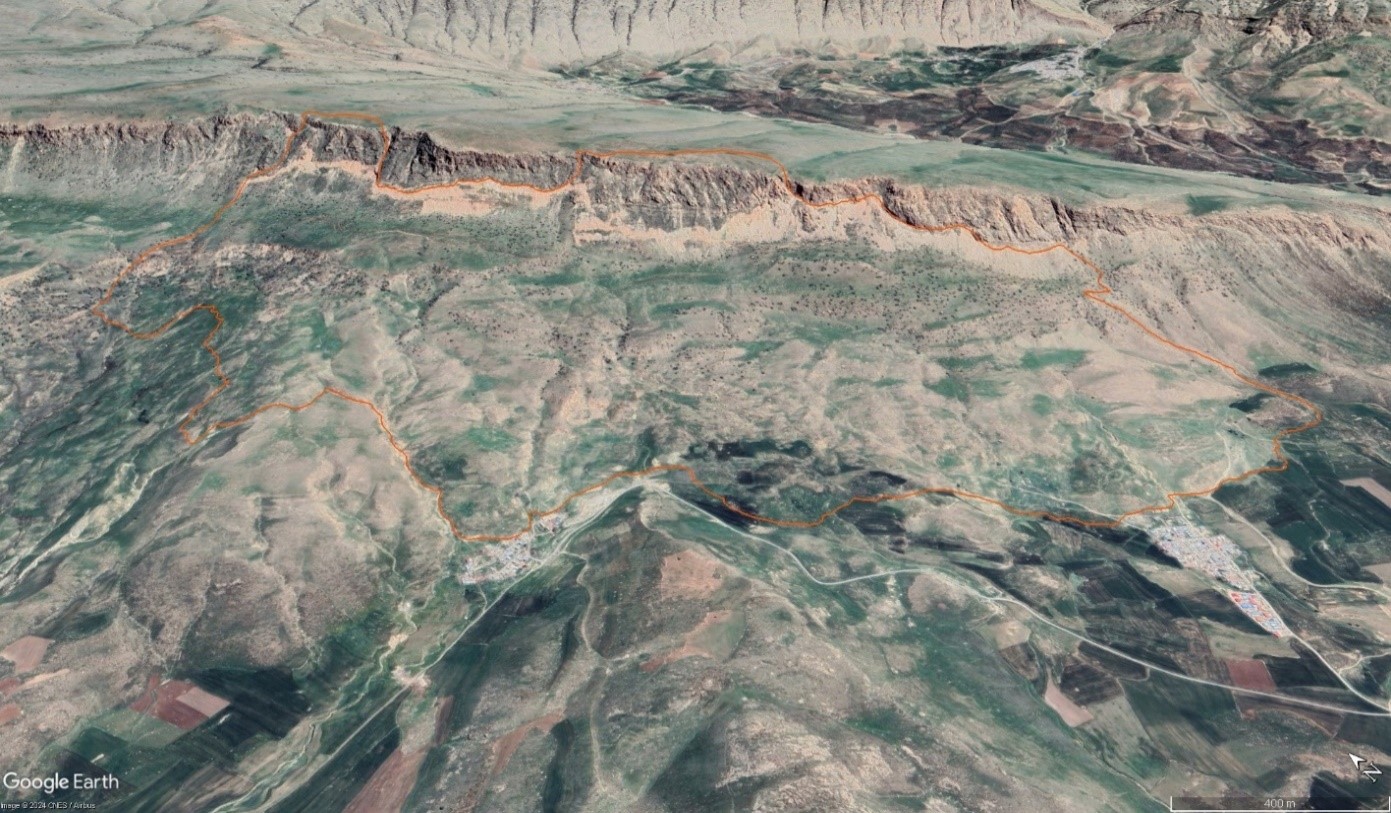
Figure 3: Post-landslide image of Malleh Kabood-Qorchi Bashi (November 2017 Sarpol-e Zahab earthquake) on Google Earth
References:
(Image: Masoumeh Rakhshandeh)