
Magnitude |
2.9 |
| Date & Time (UTC) | 2015-08-19 20:32:14.1 |
| Date & Time (Local) | 1394/5/29 01:02:14.1 |
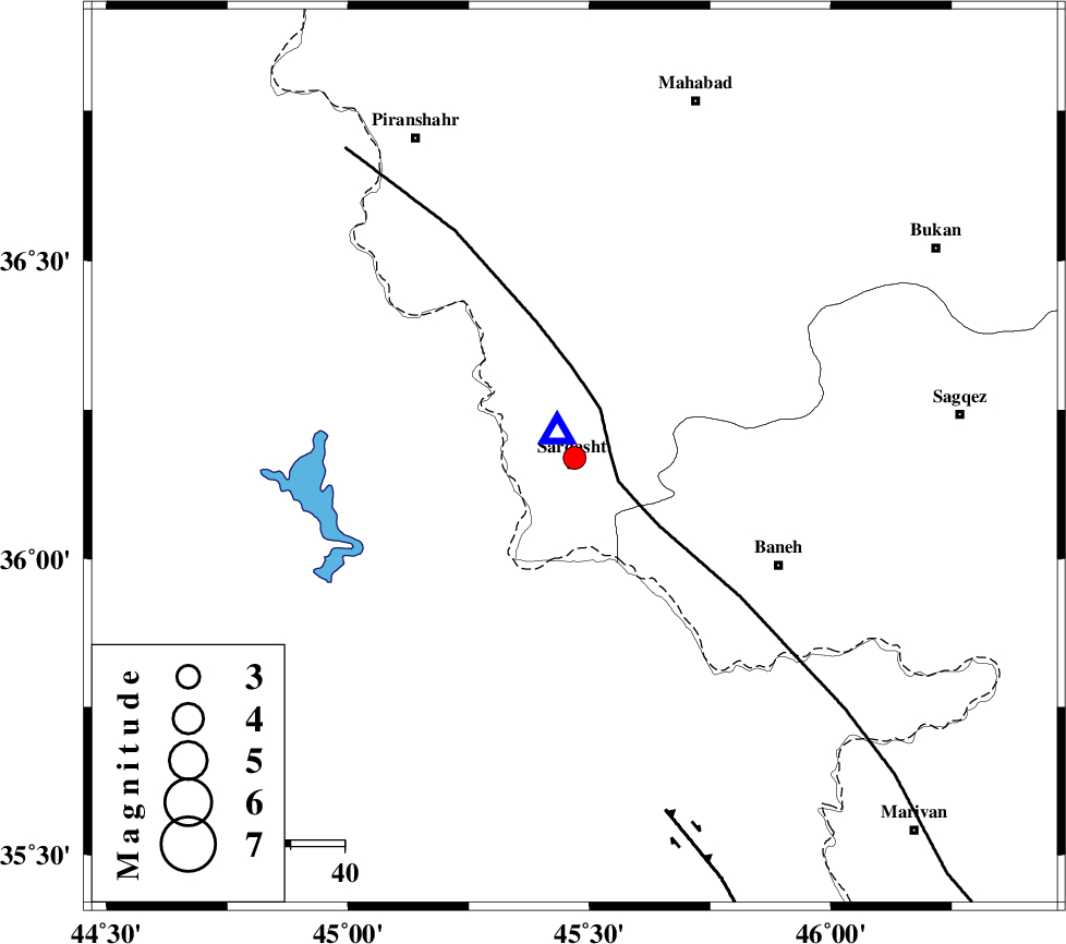
| Location | Lat:36.17 Lon: 45.469 |
| Region | Azarbaijan Gharbi Province, 1 km of Sardasht |
Nearest Cities |
|
| 1 km North of Sardasht, Azarbaijan Gharbi Province | |
| 7 km North of Bersiv, Azarbaijan Gharbi Province | |
| 8 km of Rabat, Azarbaijan Gharbi Province | |
| 8 km of Bivaran-e sofla, Azarbaijan Gharbi Province | |
| 12 km South of Felas, Azarbaijan Gharbi Province | |
| Depth | 14 km |
| Agency | |
Faults within 150 km: |
|
| PIRANSHAHR_F (Length: 253 km) , Distance to epicenter: 7 km | |
| HZF4 (Length: 492 km) , Distance to epicenter: 68 km | |
| Number of Phases | 5 |
| RMS | 0.2 |
| Number of Stations | 3 |
| Error in Latitude | >3.3 km |
| Error in Longitude | 6.3 km |
| Error in Depth | 9.4 km |
Download waveform in seisan format
to download seisan software Click here
to access information about IIEES stations Click here
Amplitude | ||||||||
| UID | Agency | Station | Component | Amplitude | Period | Arrival Time | Proccessing Time | Signal Clip |
| 100414 | IIEES | ZNJK | N | 54.9 | 0.4 | 2015-08-19 20:33:40 | 2015-08-22 08:14:00 | n |
Phase | ||||||||||||
| Agency | Station | Component | Phase Type | Phase Quality | First Motion | Observed Arrival Time | Time Residual | Loc. Flag | Input Weight | Distance | Azimuth | |
| IIEES | SNGE | Z | Pg | E | 2015-08-19 20:32:48 | -0.26 | y | 208 | 125 | |||
| IIEES | SNGE | N | Sg | E | 2015-08-19 20:33:13 | 0.17 | y | 208 | 125 | |||
| IIEES | ZNJK | Z | Pn | E | 2015-08-19 20:32:58 | 0.13 | y | 294 | 78 | |||
| IIEES | ZNJK | N | Sg | E | 2015-08-19 20:33:36 | -0.1 | y | 294 | 78 | |||
| IIEES | GRMI | Z | Pn | E | 2015-08-19 20:33:07 | 0.06 | y | 363 | 35 | |||

 IIEES All Rights Reserved