
Magnitude |
2.7 |
| Date & Time (UTC) | 2016-06-06 20:54:30.6 |
| Date & Time (Local) | 1395/3/18 01:24:30.6 |
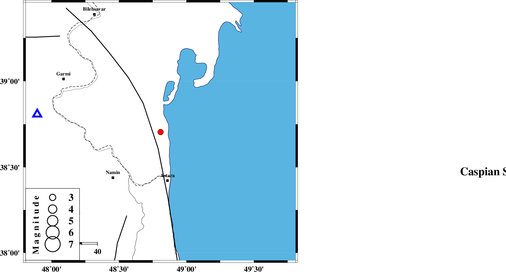
| Location | Lat:38.705 Lon: 48.808 |
| Region | Azerbaijan, 32 km North of Astara |
Nearest Cities |
|
| 32 km North of Astara, Gilan Province | |
| 38 km North East of Anbaran, Ardebil Province | |
| 39 km North East of Kiladeh, Gilan Province | |
| 43 km North East of Namin, Ardebil Province | |
| 43 km North East of Lurun, Ardebil Province | |
| Depth | 18 km |
| Agency | |
Faults within 150 km: |
|
| TALESH_F (Length: 258 km) , Distance to epicenter: 11 km | |
| SANGAVAR_F (Length: 61 km) , Distance to epicenter: 59 km | |
| BOZQUSH (Length: 70 km) , Distance to epicenter: 74 km | |
| Number of Phases | 5 |
| RMS | 0.2 |
| Number of Stations | 3 |
| Error in Latitude | >4.6 km |
| Error in Longitude | 8.5 km |
| Error in Depth | 9.8 km |
Download waveform in seisan format
to download seisan software Click here
to access information about IIEES stations Click here
Amplitude | ||||||||
| UID | Agency | Station | Component | Amplitude | Period | Arrival Time | Proccessing Time | Signal Clip |
| 106677 | IIEES | GRMI | E | 467.6 | 0.2 | 2016-06-06 20:54:54 | 2016-06-07 04:51:00 | n |
| 106678 | IIEES | GRMI | N | 272.7 | 0.1 | 2016-06-06 20:54:54 | 2016-06-07 04:51:00 | n |
| 106679 | IIEES | ZNJK | N | 33.3 | 0.37 | 2016-06-06 20:55:37 | 2016-06-07 04:51:00 | n |
Phase | ||||||||||||
| Agency | Station | Component | Phase Type | Phase Quality | First Motion | Observed Arrival Time | Time Residual | Loc. Flag | Input Weight | Distance | Azimuth | |
| IIEES | GRMI | Z | Pg | E | 2016-06-06 20:54:44 | 0.3 | y | 80.3 | 279 | |||
| IIEES | GRMI | N | Sg | E | 2016-06-06 20:54:54 | -0.18 | y | 80.3 | 279 | |||
| IIEES | DAGI | Z | Pn | E | 2016-06-06 20:55:05 | -0.03 | y | 220 | 154 | |||
| IIEES | ZNJK | Z | Pn | E | 2016-06-06 20:55:06 | -0.18 | y | 226 | 183 | |||
| IIEES | ZNJK | N | Sg | E | 2016-06-06 20:55:34 | 0.09 | y | 226 | 183 | |||

 IIEES All Rights Reserved