
Magnitude |
2.5 |
| Date & Time (UTC) | 2016-06-08 12:16:39.4 |
| Date & Time (Local) | 1395/3/19 16:46:39.4 |
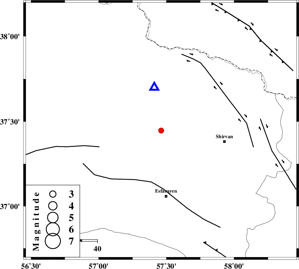
| Location | Lat:37.447 Lon: 57.461 |
| Region | Khorasan(north) Province, 12 km -East of Bojnurd |
Nearest Cities |
|
| 8 km of Hesar-egarmkhanh, Khorasan(north) Province | |
| 12 km East of Void, Khorasan(north) Province | |
| 12 km East of Bojnurd, Khorasan(north) Province | |
| 28 km North West of Zavarom, Khorasan(north) Province | |
| 35 km South West of Tukur, Khorasan(north) Province | |
| Depth | 14 km |
| Agency | |
Faults within 150 km: |
|
| ESFARAYEN_F (Length: 111 km) , Distance to epicenter: 34 km | |
| ROBATE_QARABIL_F (Length: 168 km) , Distance to epicenter: 42 km | |
| BAGHAN_GERMAB_F (Length: 79 km) , Distance to epicenter: 48 km | |
| Number of Phases | 6 |
| RMS | 0.2 |
| Number of Stations | 5 |
| Error in Latitude | >3.2 km |
| Error in Longitude | 5.7 km |
| Error in Depth | 7.4 km |
Download waveform in seisan format
to download seisan software Click here
to access information about IIEES stations Click here
Amplitude | ||||||||
| UID | Agency | Station | Component | Amplitude | Period | Arrival Time | Proccessing Time | Signal Clip |
| 106707 | IIEES | BJRD | E | 792.7 | 0.37 | 2016-06-08 12:16:50 | 2016-06-11 06:43:00 | n |
Phase | ||||||||||||
| Agency | Station | Component | Phase Type | Phase Quality | First Motion | Observed Arrival Time | Time Residual | Loc. Flag | Input Weight | Distance | Azimuth | |
| IIEES | BJRD | Z | Pg | E | 2016-06-08 12:16:44 | -0.21 | y | 28.4 | 351 | |||
| IIEES | MRVT | Z | Pg | E | 2016-06-08 12:17:00 | 0.22 | y | 123 | 281 | |||
| IIEES | SHRO | Z | Pn | E | 2016-06-08 12:17:12 | 0.2 | y | 205 | 219 | |||
| IIEES | SHRO | E | Sg | E | 2016-06-08 12:17:37 | -0.18 | y | 205 | 219 | |||
| IIEES | TABS | Z | Pn | E | 2016-06-08 12:17:39 | -0.26 | y | 422 | 184 | |||
| IIEES | SHRT | Z | Pn | E | 2016-06-08 12:17:48 | 0.25 | y | 494 | 148 | |||