
Magnitude |
2.9 |
| Date & Time (UTC) | 2016-08-07 16:33:09.6 |
| Date & Time (Local) | 1395/5/17 21:03:09.6 |
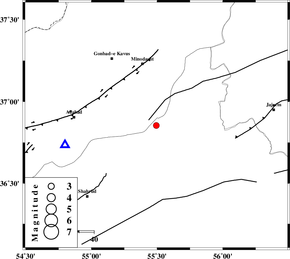
| Location | Lat:36.854 Lon: 55.494 |
| Region | Semnan Province, 43 km South-East of Minodasht |
Nearest Cities |
|
| 12 km of Farsian, Golestan Province | |
| 20 km South West of Qaleh qafeh, Semnan Province | |
| 21 km South of Qale-ye qafeh, Golestan Province | |
| 26 km North East of Kalateh khanj, Semnan Province | |
| 31 km South of Duzin, Golestan Province | |
| Depth | 6 km |
| Agency | |
Faults within 150 km: |
|
| ROBATE_QARABIL_F (Length: 168 km) , Distance to epicenter: 6 km | |
| SHAVAR_F (Length: 87 km) , Distance to epicenter: 27 km | |
| KHAZAR_F (Length: 523 km) , Distance to epicenter: 50 km | |
| Number of Phases | 10 |
| RMS | 0.3 |
| Number of Stations | 10 |
| Error in Latitude | >3.2 km |
| Error in Longitude | 5 km |
| Error in Depth | 7.3 km |
Download waveform in seisan format
to download seisan software Click here
to access information about IIEES stations Click here
Amplitude | ||||||||
| UID | Agency | Station | Component | Amplitude | Period | Arrival Time | Proccessing Time | Signal Clip |
| 108383 | IIEES | TABS | N | 21.6 | 0.62 | 2016-08-07 16:35:18 | 2016-08-08 04:35:00 | n |
| 108384 | IIEES | YZKH | N | 8.9 | 0.59 | 2016-08-07 16:35:16 | 2016-08-08 04:35:00 | n |
| 108385 | IIEES | YZKH | E | 7.8 | 0.74 | 2016-08-07 16:35:40 | 2016-08-08 04:35:00 | n |
| 108386 | IIEES | NASN | E | 4.8 | 0.64 | 2016-08-07 16:35:44 | 2016-08-08 04:35:00 | n |
Phase | ||||||||||||
| Agency | Station | Component | Phase Type | Phase Quality | First Motion | Observed Arrival Time | Time Residual | Loc. Flag | Input Weight | Distance | Azimuth | |
| IIEES | MRVT | Z | Pg | E | 2016-08-07 16:33:27 | -0.11 | y | 104 | 30 | |||
| IIEES | SHRO | Z | Pg | E | 2016-08-07 16:33:27 | -0.42 | y | 105 | 153 | |||
| IIEES | BJRD | Z | Pg | E | 2016-08-07 16:33:43 | 0.02 | y | 194 | 60 | |||
| IIEES | DAMV | Z | Pn | E | 2016-08-07 16:34:01 | 0.37 | y | 345 | 248 | |||
| IIEES | TABS | Z | Pn | E | 2016-08-07 16:34:06 | 0.09 | y | 385 | 157 | |||
| IIEES | CHTH | Z | Pn | E | 2016-08-07 16:34:08 | -0.31 | y | 406 | 256 | |||
| IIEES | YZKH | Z | Pn | E | 2016-08-07 16:34:20 | -0.26 | y | 502 | 190 | |||
| IIEES | NASN | Z | Pn | E | 2016-08-07 16:34:22 | -0.08 | y | 512 | 209 | |||
| IIEES | SHRT | Z | Pn | E | 2016-08-07 16:34:28 | 0.56 | y | 563 | 128 | |||
| IIEES | BSRN | Z | Pn | E | 2016-08-07 16:34:37 | 0.51 | y | 637 | 147 | |||