
Magnitude |
2.6 |
| Date & Time (UTC) | 2017-08-16 05:32:01.8 |
| Date & Time (Local) | 1396/5/25 10:02:01.8 |
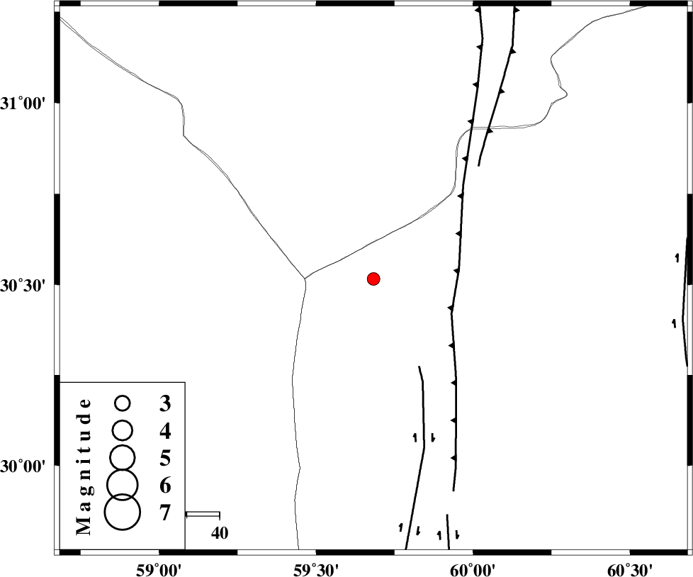
| Location | Lat:30.516 Lon: 59.683 |
| Region | Sistan va Baloochestan Province, 118 km South-West of Nehbandan |
Nearest Cities |
|
| 80 km North West of Nosratabad, Sistan va Baloochestan Province | |
| 118 km South West of Nehbandan, Khorasan(south) Province | |
| 129 km North West of Hesaruyeh, Sistan va Baloochestan Province | |
| 147 km North West of Tasuki, Sistan va Baloochestan Province | |
| 147 km North West of Mohamadabad, Sistan va Baloochestan Province | |
| Depth | 14 km |
| Agency | |
Faults within 150 km: |
|
| W_NEH_F (Length: 158 km) , Distance to epicenter: 26 km | |
| KANURAK_F (Length: 135 km) , Distance to epicenter: 30 km | |
| E_NEH_F (Length: 148 km) , Distance to epicenter: 47 km | |
| Number of Phases | 4 |
| RMS | 0 |
| Number of Stations | 3 |
| Error in Latitude | >3 km |
| Error in Longitude | 9.3 km |
| Error in Depth | 6.5 km |
Download waveform in seisan format
to download seisan software Click here
to access information about IIEES stations Click here
Amplitude | ||||||||
| UID | Agency | Station | Component | Amplitude | Period | Arrival Time | Proccessing Time | Signal Clip |
| 118702 | IIEES | BSRN | N | 52.7 | 0.37 | 2017-08-16 05:32:55 | 2017-08-21 06:41:00 | n |
| 118703 | IIEES | TABS | N | 8.8 | 0.56 | 2017-08-16 05:34:12 | 2017-08-21 06:41:00 | n |
Phase | ||||||||||||
| Agency | Station | Component | Phase Type | Phase Quality | First Motion | Observed Arrival Time | Time Residual | Loc. Flag | Input Weight | Distance | Azimuth | |
| IIEES | BSRN | Z | Pg | E | 2017-08-16 05:32:29 | 0 | y | 169 | 342 | |||
| IIEES | BSRN | N | Sg | E | 2017-08-16 05:32:50 | 0 | y | 169 | 342 | |||
| IIEES | KRBR | Z | Pn | E | 2017-08-16 05:32:45 | 0 | y | 287 | 259 | |||
| IIEES | TABS | Z | Pn | E | 2017-08-16 05:33:02 | 0 | y | 423 | 326 | |||

 IIEES All Rights Reserved