
Magnitude |
2.5 |
| Date & Time (UTC) | 2017-10-31 19:20:05.7 |
| Date & Time (Local) | 1396/8/9 22:50:05.7 |
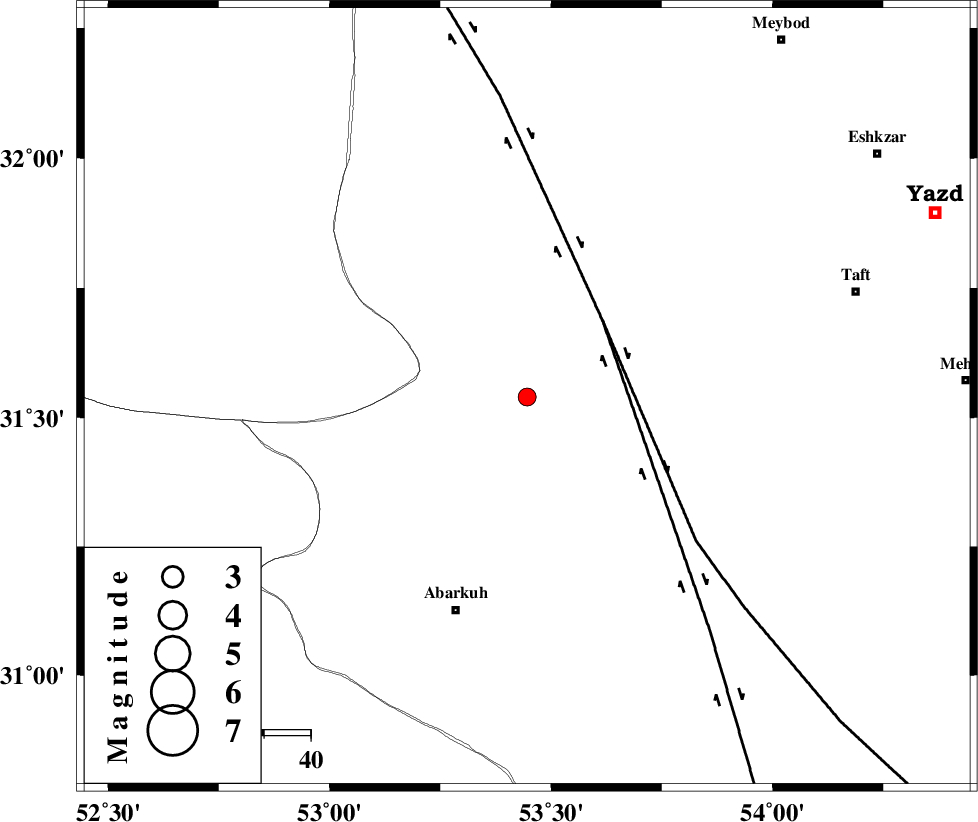
| Location | Lat:31.539 Lon: 53.446 |
| Region | Yazd Province, 48 km North-East of Abarkuh |
Nearest Cities |
|
| 30 km North West of Dehshir, Yazd Province | |
| 46 km South West of Nasrabad, Yazd Province | |
| 48 km North East of Abarkuh, Yazd Province | |
| 57 km South of Nadushan, Yazd Province | |
| 58 km North of Mehrabad, Yazd Province | |
| Depth | 14 km |
| Agency | |
Faults within 150 km: |
|
| SHAHR_E_BABAK_F1 (Length: 392 km) , Distance to epicenter: 23 km | |
| SHAHR_E_BABAK_F2 (Length: 272 km) , Distance to epicenter: 23 km | |
| MAIN_ZAGROS_R_F (Length: 1106 km) , Distance to epicenter: 105 km | |
| Number of Phases | 6 |
| RMS | 0.1 |
| Number of Stations | 4 |
| Error in Latitude | >4 km |
| Error in Longitude | 2.1 km |
| Error in Depth | 8.7 km |
Download waveform in seisan format
to download seisan software Click here
to access information about IIEES stations Click here
Amplitude | ||||||||
| UID | Agency | Station | Component | Amplitude | Period | Arrival Time | Proccessing Time | Signal Clip |
| 120960 | IIEES | YZKH | E | 52 | 0.17 | 2017-10-31 19:20:48 | 2017-11-01 07:11:00 | n |
| 120961 | IIEES | KRBR | E | 11.9 | 0.29 | 2017-10-31 19:21:55 | 2017-11-01 07:11:00 | n |
| 120962 | IIEES | KRBR | N | 9.1 | 0.65 | 2017-10-31 19:22:07 | 2017-11-01 07:11:00 | n |
Phase | ||||||||||||
| Agency | Station | Component | Phase Type | Phase Quality | First Motion | Observed Arrival Time | Time Residual | Loc. Flag | Input Weight | Distance | Azimuth | |
| IIEES | YZKH | Z | Pg | E | 2017-10-31 19:20:29 | 0.06 | y | 144 | 49 | |||
| IIEES | YZKH | E | Sg | E | 2017-10-31 19:20:47 | -0.08 | y | 144 | 49 | |||
| IIEES | NASN | Z | Pg | E | 2017-10-31 19:20:31 | -0.08 | y | 152 | 337 | |||
| IIEES | NASN | N | Sg | E | 2017-10-31 19:20:49 | 0.04 | y | 152 | 337 | |||
| IIEES | KRBR | Z | Pn | E | 2017-10-31 19:20:58 | -0.15 | y | 361 | 118 | |||
| IIEES | BSRN | Z | Pn | E | 2017-10-31 19:21:20 | 0.31 | y | 540 | 83 | |||