
Magnitude |
2.5 |
| Date & Time (UTC) | 2017-11-12 20:43:56.9 |
| Date & Time (Local) | 1396/8/22 00:13:56.9 |
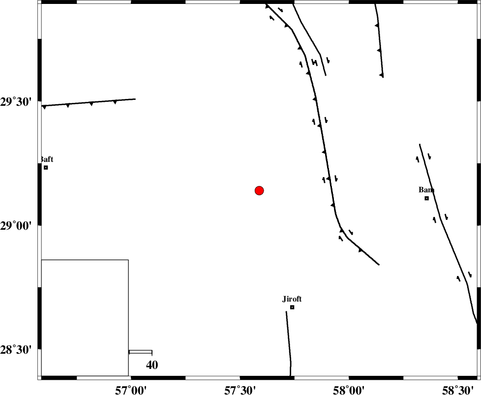
| Location | Lat:29.14 Lon: 57.588 |
| Region | Kerman Province, 54 km North-West of Jiroft |
Nearest Cities |
|
| 11 km North of Sahebabad, Kerman Province | |
| 16 km North of Delfard, Kerman Province | |
| 28 km North East of Eslamabad, Kerman Province | |
| 32 km South East of Groh, Kerman Province | |
| 41 km North West of Mohammadabad, Kerman Province | |
| Depth | 14 km |
| Agency | |
Faults within 150 km: |
|
| GOWK_F (Length: 152 km) , Distance to epicenter: 34 km | |
| SABZEVARAN_F (Length: 190 km) , Distance to epicenter: 55 km | |
| GOLBAF_SIRCH_F (Length: 114 km) , Distance to epicenter: 59 km | |
| Number of Phases | 5 |
| RMS | 0.2 |
| Number of Stations | 3 |
| Error in Latitude | >1.5 km |
| Error in Longitude | 6 km |
| Error in Depth | 8.5 km |
Download waveform in seisan format
to download seisan software Click here
to access information about IIEES stations Click here
Amplitude | ||||||||
| UID | Agency | Station | Component | Amplitude | Period | Arrival Time | Proccessing Time | Signal Clip |
| 121915 | IIEES | KRBR | E | 132.6 | 0.11 | 2017-11-12 20:44:35 | 2017-11-18 08:31:00 | n |
| 121916 | IIEES | KRBR | N | 115.3 | 0.24 | 2017-11-12 20:44:36 | 2017-11-18 08:31:00 | n |
| 121917 | IIEES | BNDS | E | 32.4 | 0.62 | 2017-11-12 20:45:06 | 2017-11-18 08:31:00 | n |
| 121918 | IIEES | BSRN | N | 6.2 | 0.56 | 2017-11-12 20:45:40 | 2017-11-18 08:31:00 | n |
| 121919 | IIEES | BSRN | E | 9.5 | 0.23 | 2017-11-12 20:45:41 | 2017-11-18 08:31:00 | n |
Phase | ||||||||||||
| Agency | Station | Component | Phase Type | Phase Quality | First Motion | Observed Arrival Time | Time Residual | Loc. Flag | Input Weight | Distance | Azimuth | |
| IIEES | KRBR | Z | Pg | E | 2017-11-12 20:44:17 | -0.12 | y | 123 | 320 | |||
| IIEES | KRBR | N | Sg | E | 2017-11-12 20:44:33 | 0.12 | y | 123 | 320 | |||
| IIEES | BNDS | Z | Pn | E | 2017-11-12 20:44:34 | 0.24 | y | 238 | 216 | |||
| IIEES | BNDS | E | Sg | E | 2017-11-12 20:45:04 | -0.13 | y | 238 | 216 | |||
| IIEES | BSRN | Z | Pn | E | 2017-11-12 20:44:47 | -0.12 | y | 346 | 25 | |||