
Magnitude |
2.7 |
| Date & Time (UTC) | 2018-07-27 03:36:25.2 |
| Date & Time (Local) | 1397/5/5 08:06:25.2 |
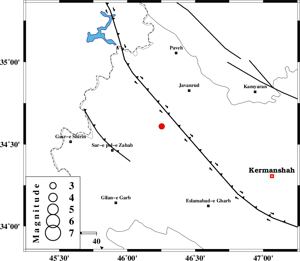
| Location | Lat:34.609 Lon: 46.253 |
| Region | Kermanshah Province, 30 km South-West of Javanrud |
Nearest Cities |
|
| 10 km of Mirabad, Kermanshah Province | |
| 14 km North of Zavleh olia, Kermanshah Province | |
| 15 km South of Qolqoleh, Kermanshah Province | |
| 22 km West of Dolatabad, Kermanshah Province | |
| 25 km South West of Sarukhan, Kermanshah Province | |
| Depth | 16 km |
| Agency | |
Faults within 150 km: |
|
| HZF4 (Length: 492 km) , Distance to epicenter: 15 km | |
| MFF8 (Length: 48 km) , Distance to epicenter: 32 km | |
| SARTAKHT_F (Length: 78 km) , Distance to epicenter: 62 km | |
| Number of Phases | 7 |
| RMS | 0.2 |
| Number of Stations | 5 |
| Error in Latitude | >3.1 km |
| Error in Longitude | 6 km |
| Error in Depth | 4.2 km |
Download waveform in seisan format
to download seisan software Click here
to access information about IIEES stations Click here
Amplitude | ||||||||
| UID | Agency | Station | Component | Amplitude | Period | Arrival Time | Proccessing Time | Signal Clip |
| 135208 | IIEES | ILBA | N | 175 | 0.5 | 2018-07-27 03:37:05 | 2018-07-28 08:15:00 | n |
| 135209 | IIEES | ILBA | E | 225.9 | 0.5 | 2018-07-27 03:37:05 | 2018-07-28 08:15:00 | n |
| 135210 | IIEES | SNGE | E | 188.8 | 0.25 | 2018-07-27 03:37:02 | 2018-07-28 08:15:00 | n |
| 135211 | IIEES | SNGE | N | 231 | 0.31 | 2018-07-27 03:37:02 | 2018-07-28 08:15:00 | n |
Phase | ||||||||||||
| Agency | Station | Component | Phase Type | Phase Quality | First Motion | Observed Arrival Time | Time Residual | Loc. Flag | Input Weight | Distance | Azimuth | |
| IIEES | ILBA | Z | Pg | E | 2018-07-27 03:36:43 | -0.26 | y | 109 | 182 | |||
| IIEES | ILBA | E | Sg | E | 2018-07-27 03:36:57 | 0.24 | y | 109 | 182 | |||
| IIEES | SNGE | Z | Pg | E | 2018-07-27 03:36:44 | -0.02 | y | 114 | 61 | |||
| IIEES | SNGE | N | Sg | E | 2018-07-27 03:36:58 | 0.03 | y | 114 | 61 | |||
| IIEES | ZNJK | Z | Pn | E | 2018-07-27 03:37:12 | 0.18 | y | 318 | 43 | |||
| IIEES | ASAO | Z | Pn | E | 2018-07-27 03:37:16 | 0.03 | y | 346 | 90 | |||
| IIEES | KHMZ | Z | Pn | E | 2018-07-27 03:37:16 | -0.22 | y | 355 | 105 | |||