
Magnitude |
2.6 |
| Date & Time (UTC) | 2018-07-26 16:40:29.6 |
| Date & Time (Local) | 1397/5/4 21:10:29.6 |
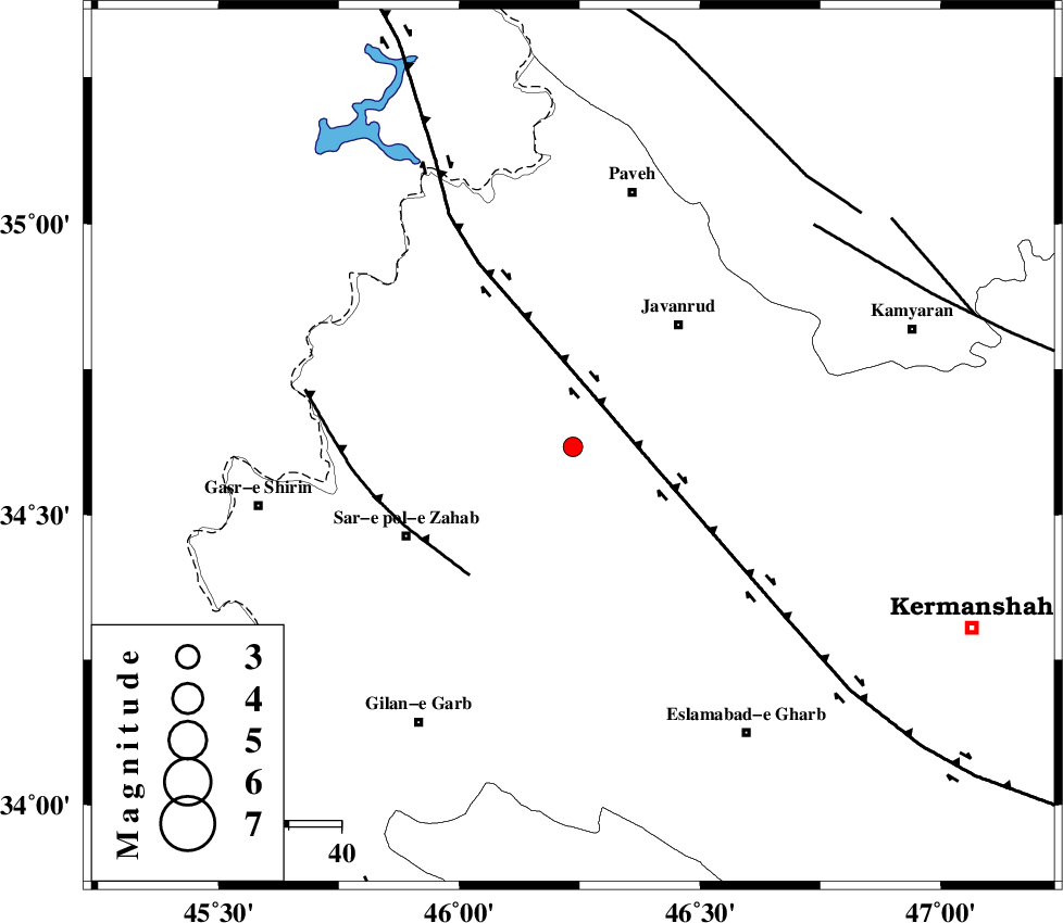
| Location | Lat:34.617 Lon: 46.236 |
| Region | Kermanshah Province, 31 km South-West of Javanrud |
Nearest Cities |
|
| 10 km of Mirabad, Kermanshah Province | |
| 14 km South of Qolqoleh, Kermanshah Province | |
| 15 km North of Zavleh olia, Kermanshah Province | |
| 23 km West of Dolatabad, Kermanshah Province | |
| 25 km South West of Sarukhan, Kermanshah Province | |
| Depth | 6 km |
| Agency | |
Faults within 150 km: |
|
| HZF4 (Length: 492 km) , Distance to epicenter: 15 km | |
| MFF8 (Length: 48 km) , Distance to epicenter: 31 km | |
| SARTAKHT_F (Length: 78 km) , Distance to epicenter: 62 km | |
| Number of Phases | 7 |
| RMS | 0.2 |
| Number of Stations | 5 |
| Error in Latitude | >3.2 km |
| Error in Longitude | 6.3 km |
| Error in Depth | 4.2 km |
Download waveform in seisan format
to download seisan software Click here
to access information about IIEES stations Click here
Amplitude | ||||||||
| UID | Agency | Station | Component | Amplitude | Period | Arrival Time | Proccessing Time | Signal Clip |
| 135306 | IIEES | ILBA | N | 129.3 | 0.39 | 2018-07-26 16:41:09 | 2018-07-29 08:19:00 | n |
| 135307 | IIEES | ILBA | E | 202.2 | 0.49 | 2018-07-26 16:41:10 | 2018-07-29 08:19:00 | n |
| 135308 | IIEES | SNGE | N | 132.3 | 0.3 | 2018-07-26 16:41:06 | 2018-07-29 08:19:00 | n |
Phase | ||||||||||||
| Agency | Station | Component | Phase Type | Phase Quality | First Motion | Observed Arrival Time | Time Residual | Loc. Flag | Input Weight | Distance | Azimuth | |
| IIEES | ILBA | Z | Pg | E | 2018-07-26 16:40:48 | -0.22 | y | 110 | 181 | |||
| IIEES | ILBA | N | Sg | E | 2018-07-26 16:41:02 | 0.12 | y | 110 | 181 | |||
| IIEES | SNGE | Z | Pg | E | 2018-07-26 16:40:49 | -0.07 | y | 114 | 62 | |||
| IIEES | SNGE | N | Sg | E | 2018-07-26 16:41:04 | -0.08 | y | 114 | 62 | |||
| IIEES | ZNJK | Z | Pn | E | 2018-07-26 16:41:18 | 0.42 | y | 318 | 44 | |||
| IIEES | ASAO | Z | Pn | E | 2018-07-26 16:41:21 | -0.06 | y | 348 | 90 | |||
| IIEES | KHMZ | Z | Pn | E | 2018-07-26 16:41:22 | -0.08 | y | 357 | 105 | |||