
Magnitude |
2.7 |
| Date & Time (UTC) | 2018-07-31 21:04:07.6 |
| Date & Time (Local) | 1397/5/10 01:34:07.6 |
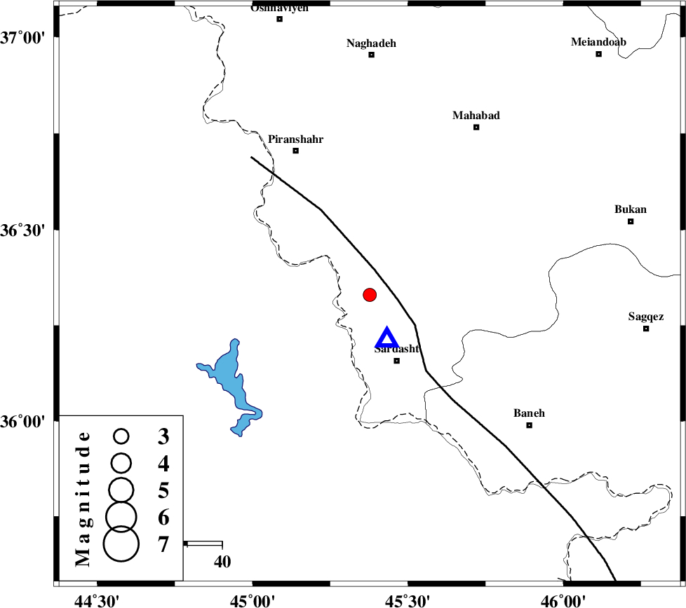
| Location | Lat:36.33 Lon: 45.377 |
| Region | Azarbaijan Gharbi Province, 21 km North of Sardasht |
Nearest Cities |
|
| 8 km of Mirabad, Azarbaijan Gharbi Province | |
| 10 km North of Felas, Azarbaijan Gharbi Province | |
| 17 km North of Bivaran-e sofla, Azarbaijan Gharbi Province | |
| 19 km North West of Rabat, Azarbaijan Gharbi Province | |
| 21 km North of Sardasht, Azarbaijan Gharbi Province | |
| Depth | 6 km |
| Agency | |
Faults within 150 km: |
|
| PIRANSHAHR_F (Length: 253 km) , Distance to epicenter: 8 km | |
| HZF4 (Length: 492 km) , Distance to epicenter: 88 km | |
| Number of Phases | 7 |
| RMS | 0.3 |
| Number of Stations | 6 |
| Error in Latitude | >4.3 km |
| Error in Longitude | 6.2 km |
| Error in Depth | 6.5 km |
Download waveform in seisan format
to download seisan software Click here
to access information about IIEES stations Click here
Amplitude | ||||||||
| UID | Agency | Station | Component | Amplitude | Period | Arrival Time | Proccessing Time | Signal Clip |
| 135415 | IIEES | SRSL | E | 2135.6 | 0.33 | 2018-07-31 21:04:14 | 2018-08-01 03:10:00 | n |
| 135416 | IIEES | SRSL | N | 2761.3 | 0.49 | 2018-07-31 21:04:15 | 2018-08-01 03:10:00 | n |
| 135417 | IIEES | ILBA | E | 34.6 | 0.49 | 2018-07-31 21:05:44 | 2018-08-01 03:10:00 | n |
| 135418 | IIEES | ILBA | N | 20.9 | 0.55 | 2018-07-31 21:05:48 | 2018-08-01 03:10:00 | n |
Phase | ||||||||||||
| Agency | Station | Component | Phase Type | Phase Quality | First Motion | Observed Arrival Time | Time Residual | Loc. Flag | Input Weight | Distance | Azimuth | |
| IIEES | SRSL | Z | Pg | E | 2018-07-31 21:04:10 | -0.21 | y | 14 | 158 | |||
| IIEES | SNGE | Z | Pn | E | 2018-07-31 21:04:44 | 0.59 | y | 225 | 127 | |||
| IIEES | SNGE | N | Sg | E | 2018-07-31 21:05:14 | -0.29 | y | 225 | 127 | |||
| IIEES | ZNJK | Z | Pn | E | 2018-07-31 21:04:53 | 0 | y | 299 | 82 | |||
| IIEES | ILBA | Z | Pn | E | 2018-07-31 21:04:54 | 0.12 | y | 310 | 166 | |||
| IIEES | MAKU | Z | Pn | E | 2018-07-31 21:04:58 | -0.39 | y | 341 | 350 | |||
| IIEES | GRMI | Z | Pn | E | 2018-07-31 21:05:00 | 0.17 | y | 354 | 38 | |||