
Magnitude |
2.8 |
| Date & Time (UTC) | 2018-10-16 02:52:47.4 |
| Date & Time (Local) | 1397/7/24 06:22:47.4 |
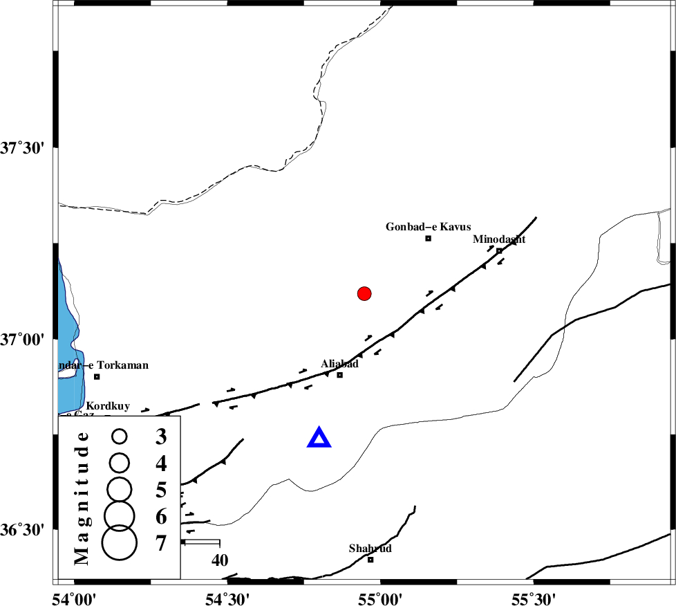
| Location | Lat:37.118 Lon: 54.947 |
| Region | Golestan Province, 21 km -West of Azadshahr |
Nearest Cities |
|
| 11 km West of Baghli marma, Golestan Province | |
| 12 km North of Khanbebin, Golestan Province | |
| 13 km North West of Deland, Golestan Province | |
| 19 km North East of Gariduji, Golestan Province | |
| 19 km West of Nezamabad, Golestan Province | |
| Depth | 23 km |
| Agency | |
Faults within 150 km: |
|
| KHAZAR_F (Length: 523 km) , Distance to epicenter: 12 km | |
| SHAVAR_F (Length: 87 km) , Distance to epicenter: 44 km | |
| ROBATE_QARABIL_F (Length: 168 km) , Distance to epicenter: 50 km | |
| Number of Phases | 7 |
| RMS | 0.3 |
| Number of Stations | 5 |
| Error in Latitude | >2.8 km |
| Error in Longitude | 5.1 km |
| Error in Depth | 7.5 km |
Download waveform in seisan format
to download seisan software Click here
to access information about IIEES stations Click here
Amplitude | ||||||||
| UID | Agency | Station | Component | Amplitude | Period | Arrival Time | Proccessing Time | Signal Clip |
| 137831 | IIEES | MRVT | E | 252 | 0.16 | 2018-10-16 02:53:26 | 2018-10-16 08:25:00 | n |
| 137832 | IIEES | SHRO | E | 106.9 | 0.34 | 2018-10-16 02:53:35 | 2018-10-16 08:25:00 | n |
| 137833 | IIEES | GHVR | N | 7.8 | 0.46 | 2018-10-16 02:54:59 | 2018-10-16 08:25:00 | n |
| 137834 | IIEES | GHVR | E | 11 | 0.46 | 2018-10-16 02:55:04 | 2018-10-16 08:25:00 | n |
Phase | ||||||||||||
| Agency | Station | Component | Phase Type | Phase Quality | First Motion | Observed Arrival Time | Time Residual | Loc. Flag | Input Weight | Distance | Azimuth | |
| IIEES | MRVT | Z | Pg | E | 2018-10-16 02:53:07 | 0.12 | y | 118 | 59 | |||
| IIEES | SHRO | Z | Pg | E | 2018-10-16 02:53:13 | 0.36 | y | 156 | 142 | |||
| IIEES | SHRO | E | Sg | E | 2018-10-16 02:53:31 | -0.17 | y | 156 | 142 | |||
| IIEES | BJRD | Z | Pn | E | 2018-10-16 02:53:22 | 0.2 | y | 227 | 73 | |||
| IIEES | BJRD | N | Sg | E | 2018-10-16 02:53:50 | -0.3 | y | 227 | 73 | |||
| IIEES | TABS | Z | Pn | E | 2018-10-16 02:53:48 | 0.09 | y | 432 | 152 | |||
| IIEES | GHVR | Z | Pn | E | 2018-10-16 02:53:49 | -0.38 | y | 444 | 230 | |||