
Magnitude |
2.6 |
| Date & Time (UTC) | 2018-12-05 00:38:36.3 |
| Date & Time (Local) | 1397/9/14 04:08:36.3 |
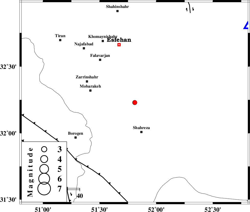
| Location | Lat:32.23 Lon: 51.81 |
| Region | Esfahan Province, 25 km North of Shahreza |
Nearest Cities |
|
| 5 km of Mahyar, Esfahan Province | |
| 19 km North East of Qambovan, Esfahan Province | |
| 23 km East of Talkhoncheh, Esfahan Province | |
| 25 km North of Shahreza, Esfahan Province | |
| 28 km South East of Kholanjan, Esfahan Province | |
| Depth | 6 km |
| Agency | |
Faults within 150 km: |
|
| MAIN_ZAGROS_R_F (Length: 1106 km) , Distance to epicenter: 66 km | |
| DENA_F (Length: 137 km) , Distance to epicenter: 76 km | |
| DOPOLAN_F (Length: 107 km) , Distance to epicenter: 87 km | |
| Number of Phases | 8 |
| RMS | 0.3 |
| Number of Stations | 5 |
| Error in Latitude | >5.9 km |
| Error in Longitude | 3.2 km |
| Error in Depth | 6.5 km |
Download waveform in seisan format
to download seisan software Click here
to access information about IIEES stations Click here
Amplitude | ||||||||
| UID | Agency | Station | Component | Amplitude | Period | Arrival Time | Proccessing Time | Signal Clip |
| 139055 | IIEES | YZKH | N | 28 | 0.59 | 2018-12-05 00:39:54 | 2018-12-05 10:00:00 | n |
| 139056 | IIEES | YZKH | E | 31 | 0.22 | 2018-12-05 00:39:57 | 2018-12-05 10:00:00 | n |
| 139057 | IIEES | ASAO | N | 14.2 | 0.65 | 2018-12-05 00:40:11 | 2018-12-05 10:00:00 | n |
Phase | ||||||||||||
| Agency | Station | Component | Phase Type | Phase Quality | First Motion | Observed Arrival Time | Time Residual | Loc. Flag | Input Weight | Distance | Azimuth | |
| IIEES | NASN | Z | Pg | E | 2018-12-05 00:38:55 | -0.19 | y | 113 | 56 | |||
| IIEES | NASN | N | Sg | E | 2018-12-05 00:39:10 | 0.31 | y | 113 | 56 | |||
| IIEES | KHMZ | Z | Pn | E | 2018-12-05 00:39:15 | 0.17 | y | 240 | 315 | |||
| IIEES | GHVR | Z | Pn | E | 2018-12-05 00:39:16 | -0.21 | y | 255 | 348 | |||
| IIEES | GHVR | N | Sg | E | 2018-12-05 00:39:51 | -0.23 | y | 255 | 348 | |||
| IIEES | YZKH | Z | Pn | E | 2018-12-05 00:39:17 | -0.42 | y | 263 | 85 | |||
| IIEES | YZKH | N | S | E | 2018-12-05 00:39:48 | 0.13 | y | 263 | 85 | |||
| IIEES | ASAO | Z | Pn | E | 2018-12-05 00:39:23 | 0.47 | y | 306 | 328 | |||

 IIEES All Rights Reserved