
Magnitude |
2.5 |
| Date & Time (UTC) | 2018-12-22 22:19:10.2 |
| Date & Time (Local) | 1397/10/2 01:49:10.2 |
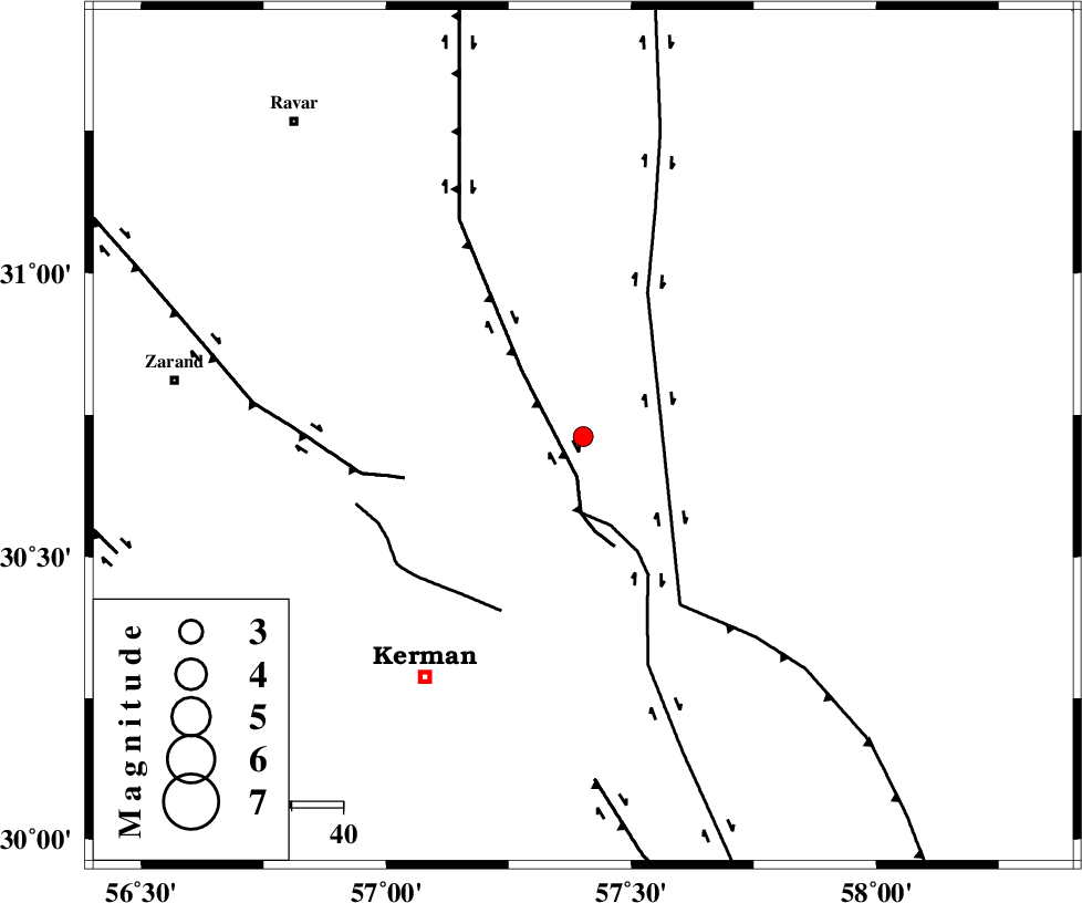
| Location | Lat:30.712 Lon: 57.402 |
| Region | Kerman Province, 56 km North-East of Kerman |
Nearest Cities |
|
| 26 km North East of Dehlulu, Kerman Province | |
| 26 km North East of Harjand, Kerman Province | |
| 41 km East of Hejdak, Kerman Province | |
| 44 km North West of Shahdad, Kerman Province | |
| 47 km North East of Hutak, Kerman Province | |
| Depth | 14 km |
| Agency | |
Faults within 150 km: |
|
| LAKARKUH_F (Length: 138 km) , Distance to epicenter: 8 km | |
| GOLBAF_SIRCH_F (Length: 114 km) , Distance to epicenter: 15 km | |
| NAYBAND_F (Length: 258 km) , Distance to epicenter: 31 km | |
| Number of Phases | 6 |
| RMS | 0.2 |
| Number of Stations | 4 |
| Error in Latitude | >4.8 km |
| Error in Longitude | 4.6 km |
| Error in Depth | 8.1 km |
Download waveform in seisan format
to download seisan software Click here
to access information about IIEES stations Click here
Amplitude | ||||||||
| UID | Agency | Station | Component | Amplitude | Period | Arrival Time | Proccessing Time | Signal Clip |
| 139563 | IIEES | BSRN | E | 31.7 | 0.29 | 2018-12-22 22:20:13 | 2018-12-23 06:25:00 | n |
Phase | ||||||||||||
| Agency | Station | Component | Phase Type | Phase Quality | First Motion | Observed Arrival Time | Time Residual | Loc. Flag | Input Weight | Distance | Azimuth | |
| IIEES | KRBR | Z | Pg | E | 2018-12-22 22:19:27 | 0.1 | y | 102 | 218 | |||
| IIEES | BSRN | Z | Pn | E | 2018-12-22 22:19:44 | 0.07 | y | 215 | 49 | |||
| IIEES | BSRN | N | Sg | E | 2018-12-22 22:20:11 | 0.06 | y | 215 | 49 | |||
| IIEES | YZKH | Z | Pn | E | 2018-12-22 22:19:58 | -0.44 | y | 325 | 306 | |||
| IIEES | YZKH | N | S | E | 2018-12-22 22:20:34 | 0.29 | y | 325 | 306 | |||
| IIEES | TABS | Z | Pn | E | 2018-12-22 22:19:58 | -0.1 | y | 327 | 355 | |||

 IIEES All Rights Reserved