
Magnitude |
3.3 |
| Date & Time (UTC) | 2025-12-26 07:55:40.9 |
| Date & Time (Local) | 1404/10/5 11:25:40.9 |
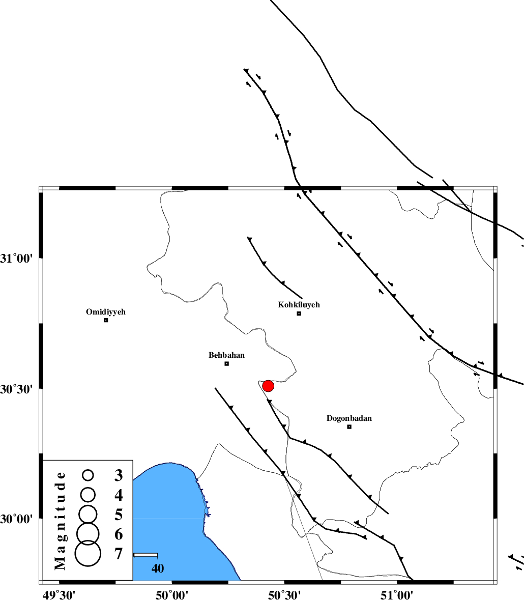
| Location | Lat:30.51 Lon: 50.427 |
| Region | Kohkiluieh va boyerahmad Province, 20 km -East of Behbahan |
Nearest Cities |
|
| 18 km South East of Mansuriyeh, Khoozestan Province | |
| 20 km East of Behbahan, Khoozestan Province | |
| 29 km North East of Sardasht, Khoozestan Province | |
| 33 km South East of Dodange-ye bozorg, Khoozestan Province | |
| 34 km South West of Dehdasht, Kohkiluieh va boyerahmad Province | |
| Depth | 12 km |
| Agency | |
Faults within 150 km: |
|
| MISHAN_F (Length: 76 km) , Distance to epicenter: 25 km | |
| MFF4 (Length: 62 km) , Distance to epicenter: 34 km | |
| RAG_E_SEFID_F (Length: 84 km) , Distance to epicenter: 40 km | |
| Number of Phases | 5 |
| RMS | 0.6 |
| Number of Stations | 5 |
| Error in Latitude | >30.5 km |
| Error in Longitude | 50.4 km |
| Error in Depth | 12 km |
Download waveform in seisan format
to download seisan software Click here
to access information about IIEES stations Click here
Amplitude | ||||||||
| UID | Agency | Station | Component | Amplitude | Period | Arrival Time | Proccessing Time | Signal Clip |
| 200745 | IIEES SC | AHRM | Z | 0.2 | 1 | 2025-12-26 07:56:12 | 2025-12-27 08:11:00 | n |
| 200746 | IIEES SC | GHVR | Z | 0.07 | 1 | 2025-12-26 07:56:44 | 2025-12-27 08:11:00 | n |
| 200747 | IIEES SC | YZKH | Z | 0.1 | 1 | 2025-12-26 07:56:44 | 2025-12-27 08:11:00 | n |
Phase | ||||||||||||
| Agency | Station | Component | Phase Type | Phase Quality | First Motion | Observed Arrival Time | Time Residual | Loc. Flag | Input Weight | Distance | Azimuth | |
| IIEES SC | AHRM | Z | EPn | E | 2025-12-26 07:56:12 | -0.8 | y | 0 | 201 | 155 | ||
| IIEES SC | NASN | Z | EPn | E | 2025-12-26 07:56:36 | 5.2 | n | 4 | 340 | 42 | ||
| IIEES SC | GHIR | Z | EPn | E | 2025-12-26 07:56:33 | 0.8 | y | 0 | 350 | 135 | ||
| IIEES SC | GHVR | Z | EPn | E | 2025-12-26 07:56:44 | -0.1 | y | 0 | 447 | 10 | ||
| IIEES SC | YZKH | Z | EPn | E | 2025-12-26 07:56:44 | 0.1 | y | 0 | 447 | 62 | ||