
Magnitude |
2.5 |
| Date & Time (UTC) | 2007-09-16 17:50:03.8 |
| Date & Time (Local) | 1386/6/25 21:20:03.8 |
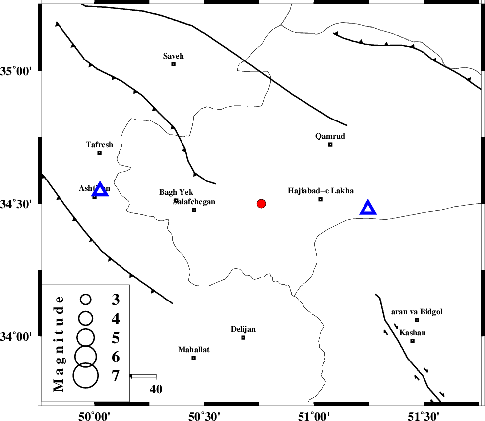
| Location | Lat:34.5 Lon: 50.76 |
| Region | 19 km South-West of Qom, Qom Province |
Nearest Cities |
|
| 17 km North West of Kahak, Qom Province | |
| 19 km South West of Qom, Qom Province | |
| 25 km West of Hajiabad-e lakha, Qom Province | |
| 28 km North East of Salafchegan, Qom Province | |
| 36 km East of Bagh yek, Qom Province | |
| Depth | 22 km |
| Agency | |
Faults within 150 km: |
|
| INDES_F (Length: 98 km) , Distance to epicenter: 21 km | |
| KUSHK_E_NOSRAT_F (Length: 230 km) , Distance to epicenter: 46 km | |
| TAFRESH_F (Length: 117 km) , Distance to epicenter: 56 km | |
| Number of Phases | 7 |
| RMS | 0.1 |
| Number of Stations | 4 |
| Error in Latitude | >1.4 km |
| Error in Longitude | 1.2 km |
| Error in Depth | 3.2 km |
Download waveform in seisan format
to download seisan software Click here
to access information about IIEES stations Click here
Amplitude | ||||||||
| UID | Agency | Station | Component | Amplitude | Period | Arrival Time | Proccessing Time | Signal Clip |
| 39267 | IIEES | GHVR | N | 1029.2 | 0.44 | 2007-09-16 17:50:19 | 2007-11-04 01:43:00 | n |
| 39268 | IIEES | GHVR | E | 791.4 | 0.16 | 2007-09-16 17:50:19 | 2007-11-04 01:43:00 | n |
| 39269 | IIEES | ASAO | N | 111.4 | 0.41 | 2007-09-16 17:50:25 | 2007-11-04 01:43:00 | n |
| 39270 | IIEES | ASAO | E | 89 | 0.45 | 2007-09-16 17:50:25 | 2007-11-04 01:43:00 | n |
Phase | ||||||||||||
| Agency | Station | Component | Phase Type | Phase Quality | First Motion | Observed Arrival Time | Time Residual | Loc. Flag | Input Weight | Distance | Azimuth | |
| IIEES | GHVR | Z | Pg | E | 2007-09-16 17:50:12 | -0.2 | y | 45 | 93 | |||
| IIEES | GHVR | N | Sg | E | 2007-09-16 17:50:18 | 0.1 | y | 45 | 93 | |||
| IIEES | ASAO | Z | Pg | E | 2007-09-16 17:50:15 | -0.1 | y | 67.3 | 275 | |||
| IIEES | ASAO | N | Sg | E | 2007-09-16 17:50:24 | 0.1 | y | 67.3 | 275 | |||
| IIEES | THKV | Z | Pg | E | 2007-09-16 17:50:29 | 0.1 | y | 157 | 4 | |||
| IIEES | THKV | N | Sg | E | 2007-09-16 17:50:48 | 0 | y | 157 | 4 | |||
| IIEES | NASN | Z | Pn | E | 2007-09-16 17:50:44 | 0 | y | 268 | 134 | |||