
Magnitude |
2.7 |
| Date & Time (UTC) | 2007-11-30 18:49:19.2 |
| Date & Time (Local) | 1386/9/9 22:19:19.2 |
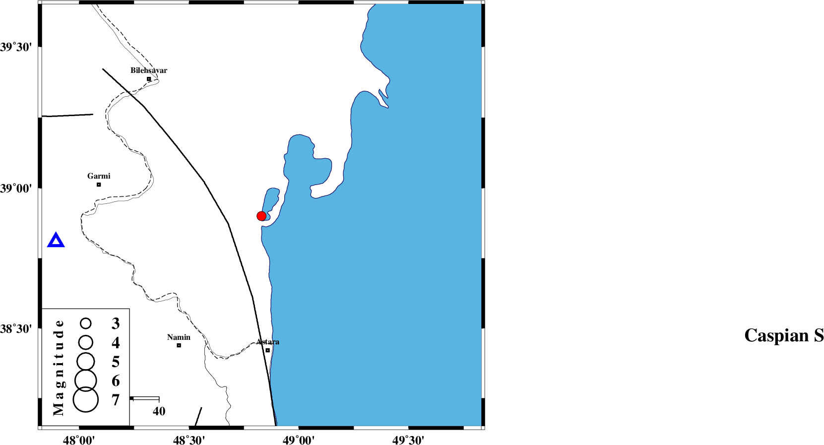
| Location | Lat:38.9 Lon: 48.83 |
| Region | 53 km North of Astara, Gilan Province |
Nearest Cities |
|
| 50 km South East of Hasan khanlu, Ardebil Province | |
| 53 km North of Astara, Gilan Province | |
| 55 km North East of Anbaran, Ardebil Province | |
| 56 km North East of Lurun, Ardebil Province | |
| 60 km North East of Kiladeh, Gilan Province | |
| Depth | 6 km |
| Agency | |
Faults within 150 km: |
|
| TALESH_F (Length: 258 km) , Distance to epicenter: 13 km | |
| DASHT_E_MOGHAN__ (Length: 104 km) , Distance to epicenter: 77 km | |
| SANGAVAR_F (Length: 61 km) , Distance to epicenter: 80 km | |
| Number of Phases | 5 |
| RMS | 0 |
| Number of Stations | 4 |
| Error in Latitude | >3.4 km |
| Error in Longitude | 2.7 km |
| Error in Depth | 4.6 km |
Download waveform in seisan format
to download seisan software Click here
to access information about IIEES stations Click here
Amplitude | ||||||||
| UID | Agency | Station | Component | Amplitude | Period | Arrival Time | Proccessing Time | Signal Clip |
| 40331 | IIEES | GRMI | E | 532.7 | 0.12 | 2007-11-30 18:49:44 | 2008-04-12 10:47:00 | n |
| 40332 | IIEES | ZNJK | N | 30.7 | 0.47 | 2007-11-30 18:50:29 | 2008-04-12 10:47:00 | n |
| 40333 | IIEES | ZNJK | E | 31.6 | 0.28 | 2007-11-30 18:50:30 | 2008-04-12 10:47:00 | n |
Phase | ||||||||||||
| Agency | Station | Component | Phase Type | Phase Quality | First Motion | Observed Arrival Time | Time Residual | Loc. Flag | Input Weight | Distance | Azimuth | |
| IIEES | GRMI | Z | Pg | E | 2007-11-30 18:49:33 | 0 | y | 82.1 | 263 | |||
| IIEES | GRMI | N | Sg | E | 2007-11-30 18:49:44 | -0.1 | y | 82.1 | 263 | |||
| IIEES | ZNJK | Z | Pn | E | 2007-11-30 18:49:58 | 0 | y | 248 | 183 | |||
| IIEES | MAKU | Z | Pn | E | 2007-11-30 18:50:13 | 0 | y | 362 | 279 | |||
| IIEES | MRVT | Z | Pn | E | 2007-11-30 18:50:48 | -0.1 | y | 650 | 100 | |||