
Magnitude |
3.5 |
| Date & Time (UTC) | 2007-12-06 20:30:53.0 |
| Date & Time (Local) | 1386/9/16 00:00:53.0 |
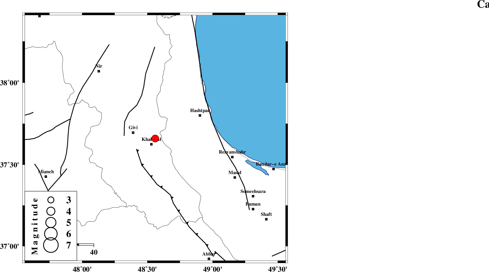
| Location | Lat:37.66 Lon: 48.56 |
| Region | 4 km Khalkhal, Ardebil Province |
Nearest Cities |
|
| 5 km North of Khalkhal, Ardebil Province | |
| 6 km North of Khojin, Ardebil Province | |
| 15 km East of Givi, Ardebil Province | |
| 19 km North East of Gazaz, Ardebil Province | |
| 26 km East of Ganjgah, Ardebil Province | |
| Depth | 14 km |
| Agency | |
Faults within 150 km: |
|
| MASULEL_F (Length: 90 km) , Distance to epicenter: 15 km | |
| SANGAVAR_F (Length: 61 km) , Distance to epicenter: 21 km | |
| TALESH_F (Length: 258 km) , Distance to epicenter: 40 km | |
| Number of Phases | 8 |
| RMS | 0.5 |
| Number of Stations | 7 |
| Error in Latitude | >5.3 km |
| Error in Longitude | 13.9 km |
| Error in Depth | 16.3 km |
Download waveform in seisan format
to download seisan software Click here
to access information about IIEES stations Click here
Amplitude | ||||||||
| UID | Agency | Station | Component | Amplitude | Period | Arrival Time | Proccessing Time | Signal Clip |
| 40457 | IIEES | GRMI | N | 836.4 | 0.2 | 2007-12-06 20:31:36 | 2008-04-12 10:47:00 | n |
| 40458 | IIEES | SNGE | E | 157 | 0.53 | 2007-12-06 20:32:20 | 2008-04-12 10:47:00 | n |
Phase | ||||||||||||
| Agency | Station | Component | Phase Type | Phase Quality | First Motion | Observed Arrival Time | Time Residual | Loc. Flag | Input Weight | Distance | Azimuth | |
| IIEES | ZNJK | Z | Pg | E | 2007-12-06 20:31:10 | -1.3 | y | 110 | 174 | |||
| IIEES | GRMI | Z | Pg | E | 2007-12-06 20:31:16 | -0.1 | y | 140 | 336 | |||
| IIEES | CHTH | Z | Pn | E | 2007-12-06 20:31:38 | 0.3 | y | 301 | 130 | |||
| IIEES | SNGE | Z | Pn | E | 2007-12-06 20:31:39 | 0.2 | y | 305 | 201 | |||
| IIEES | SNGE | N | Sg | E | 2007-12-06 20:32:19 | 0.4 | y | 305 | 201 | |||
| IIEES | ASAO | Z | Pn | E | 2007-12-06 20:31:47 | 0.2 | y | 370 | 159 | |||
| IIEES | DAMV | Z | Pn | E | 2007-12-06 20:31:48 | 0.2 | y | 379 | 125 | |||
| IIEES | GHVR | Z | Pn | E | 2007-12-06 20:31:54 | 0.2 | y | 428 | 145 | |||