
Magnitude |
3.7 |
| Date & Time (UTC) | 2008-04-23 21:28:12.2 |
| Date & Time (Local) | 1387/2/5 01:58:12.2 |
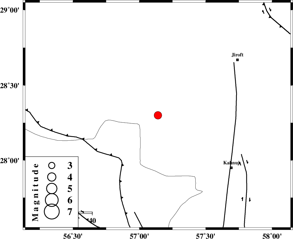
| Location | Lat:28.3 Lon: 57.14 |
| Region | 67 km North-West of Kahnuj, Kerman Province |
Nearest Cities |
|
| 21 km North West of Hurpasefid, Kerman Province | |
| 26 km East of Sarkhan, Kerman Province | |
| 29 km North West of Faryab, Kerman Province | |
| 35 km North West of Mehrueye-e paeen, Kerman Province | |
| 41 km North West of Bolock, Kerman Province | |
| Depth | 24 km |
| Agency | |
Faults within 150 km: |
|
| MAIN_ZAGROS_R_F (Length: 1106 km) , Distance to epicenter: 43 km | |
| SABZEVARAN_F (Length: 190 km) , Distance to epicenter: 58 km | |
| JIROFT_F (Length: 144 km) , Distance to epicenter: 68 km | |
| Number of Phases | 4 |
| RMS | 0 |
| Number of Stations | 4 |
| Error in Latitude | >2 km |
| Error in Longitude | 2.7 km |
| Error in Depth | 3.9 km |
Download waveform in seisan format
to download seisan software Click here
to access information about IIEES stations Click here
Amplitude | ||||||||
| UID | Agency | Station | Component | Amplitude | Period | Arrival Time | Proccessing Time | Signal Clip |
| 48978 | IIEES | BNDS | N | 1749.2 | 0.48 | 2008-04-23 21:28:54 | 2009-01-18 12:56:00 | n |
| 48979 | IIEES | KRBR | E | 900.4 | 0.36 | 2008-04-23 21:29:14 | 2009-01-18 12:56:00 | n |
| 48980 | IIEES | KRBR | N | 696.8 | 0.24 | 2008-04-23 21:29:14 | 2009-01-18 12:56:00 | n |
| 48981 | IIEES | GHIR | N | 112.7 | 0.44 | 2008-04-23 21:29:57 | 2009-01-18 12:56:00 | n |
| 48982 | IIEES | GHIR | E | 68.8 | 0.68 | 2008-04-23 21:30:03 | 2009-01-18 12:56:00 | n |
Phase | ||||||||||||
| Agency | Station | Component | Phase Type | Phase Quality | First Motion | Observed Arrival Time | Time Residual | Loc. Flag | Input Weight | Distance | Azimuth | |
| IIEES | BNDS | Z | Pg | E | 2008-04-23 21:28:34 | 0 | y | 138 | 224 | |||
| IIEES | KRBR | Z | Pg | E | 2008-04-23 21:28:43 | 0 | y | 190 | 349 | |||
| IIEES | ZHSF | Z | Pn | E | 2008-04-23 21:29:06 | 0 | y | 383 | 67 | |||
| IIEES | GHIR | Z | Pn | E | 2008-04-23 21:29:09 | 0 | y | 407 | 271 | |||