
Magnitude |
3.8 |
| Date & Time (UTC) | 2008-10-27 11:25:40.3 |
| Date & Time (Local) | 1387/8/6 14:55:40.3 |
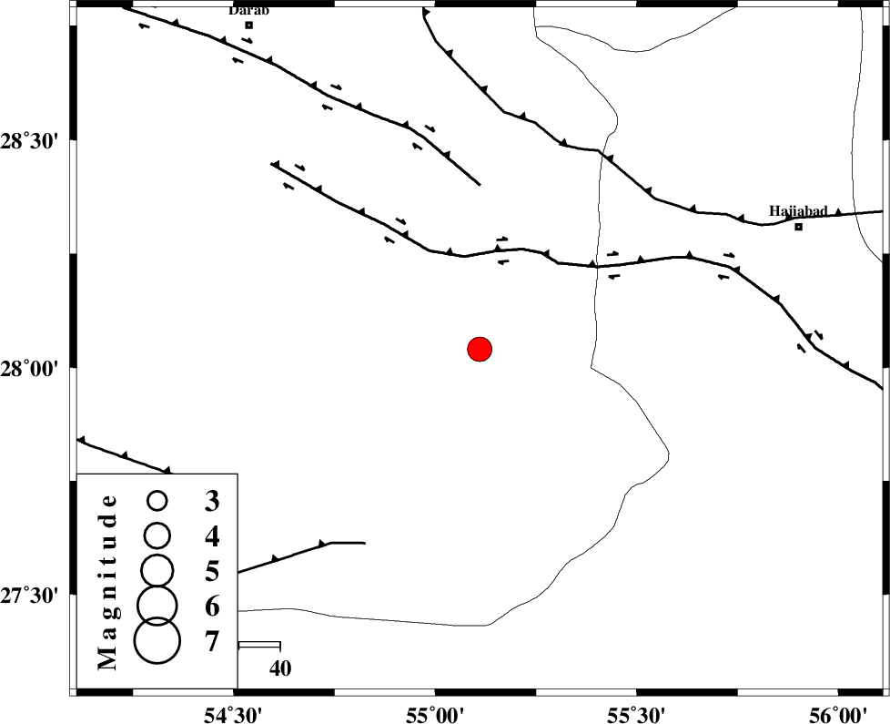
| Location | Lat:28.04 Lon: 55.11 |
| Region | 83 km South-West of Hajiabad, Hormozgan Province |
Nearest Cities |
|
| 20 km South of Fadami, Fars Province | |
| 31 km South of Doborji, Fars Province | |
| 37 km North West of Darz, Fars Province | |
| 45 km South of Rostaq, Fars Province | |
| 63 km South West of Tal bargah, Fars Province | |
| Depth | 15 km |
| Agency | |
Faults within 150 km: |
|
| HZF2 (Length: 437 km) , Distance to epicenter: 23 km | |
| HZF1 (Length: 102 km) , Distance to epicenter: 40 km | |
| MAIN_ZAGROS_R_F (Length: 1106 km) , Distance to epicenter: 54 km | |
| Number of Phases | 5 |
| RMS | 0.3 |
| Number of Stations | 4 |
| Error in Latitude | >3.5 km |
| Error in Longitude | 6.2 km |
| Error in Depth | 0 km |
Download waveform in seisan format
to download seisan software Click here
to access information about IIEES stations Click here
Amplitude | ||||||||
| UID | Agency | Station | Component | Amplitude | Period | Arrival Time | Proccessing Time | Signal Clip |
| 50989 | IIEES | BNDS | E | 2604.7 | 0.67 | 2008-10-27 11:26:27 | 2009-05-17 10:07:00 | n |
| 50990 | IIEES | BNDS | N | 1542.2 | 0.38 | 2008-10-27 11:26:27 | 2009-05-17 10:07:00 | n |
| 50991 | IIEES | KRBR | N | 531.9 | 0.58 | 2008-10-27 11:27:05 | 2009-05-17 10:07:00 | n |
Phase | ||||||||||||
| Agency | Station | Component | Phase Type | Phase Quality | First Motion | Observed Arrival Time | Time Residual | Loc. Flag | Input Weight | Distance | Azimuth | |
| IIEES | BNDS | Z | Pg | E | 2008-10-27 11:26:01 | -0.1 | y | 127 | 124 | |||
| IIEES | KRBR | Z | Pn | E | 2008-10-27 11:26:22 | 0.5 | y | 269 | 36 | |||
| IIEES | KRBR | N | Sg | E | 2008-10-27 11:26:56 | -0.2 | y | 269 | 36 | |||
| IIEES | NASN | Z | Pn | E | 2008-10-27 11:26:58 | -0.4 | y | 572 | 338 | |||
| IIEES | TABS | Z | Pn | E | 2008-10-27 11:27:08 | 0.1 | y | 651 | 17 | |||