
Magnitude |
2.8 |
| Date & Time (UTC) | 2008-12-07 12:51:38.7 |
| Date & Time (Local) | 1387/9/17 16:21:38.7 |
| Location | Lat:33.94 Lon: 48.72 |
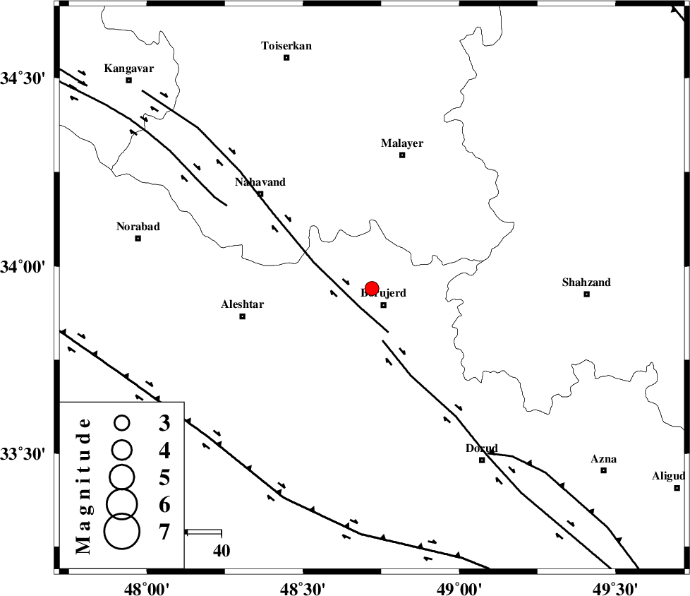
| Region | 5 km Borujerd, Lorestan Province |
Nearest Cities |
|
| 6 km of Bon dizeh, Lorestan Province | |
| 6 km North of Borujerd, Lorestan Province | |
| 11 km of Ashtarinan, Lorestan Province | |
| 12 km South of Darre-ye gorg, Lorestan Province | |
| 14 km North of Hemmatabad, Lorestan Province | |
| Depth | 14 km |
| Agency | |
Faults within 150 km: |
|
| NAHAVAND_F (Length: 102 km) , Distance to epicenter: 7 km | |
| DORUD (Length: 100 km) , Distance to epicenter: 16 km | |
| SAHANEH_F (Length: 77 km) , Distance to epicenter: 49 km | |
| Number of Phases | 6 |
| RMS | 0.1 |
| Number of Stations | 4 |
| Error in Latitude | >1 km |
| Error in Longitude | 1.6 km |
| Error in Depth | 4 km |
Download waveform in seisan format
to download seisan software Click here
to access information about IIEES stations Click here
Amplitude | ||||||||
| UID | Agency | Station | Component | Amplitude | Period | Arrival Time | Proccessing Time | Signal Clip |
| 51365 | IIEES | ASAO | N | 207.7 | 0.48 | 2008-12-07 12:52:23 | 2009-05-17 10:07:00 | n |
| 51366 | IIEES | SHGR | N | 72.1 | 0.36 | 2008-12-07 12:52:39 | 2009-05-17 10:07:00 | n |
| 51367 | IIEES | DAMV | N | 18.6 | 0.48 | 2008-12-07 12:53:30 | 2009-05-17 10:07:00 | n |
Phase | ||||||||||||
| Agency | Station | Component | Phase Type | Phase Quality | First Motion | Observed Arrival Time | Time Residual | Loc. Flag | Input Weight | Distance | Azimuth | |
| IIEES | ASAO | Z | Pg | E | 2008-12-07 12:52:01 | -0.1 | y | 138 | 60 | |||
| IIEES | ASAO | N | Sg | E | 2008-12-07 12:52:18 | 0.1 | y | 138 | 60 | |||
| IIEES | SNGE | Z | Pg | E | 2008-12-07 12:52:08 | 0 | y | 180 | 316 | |||
| IIEES | SHGR | Z | Pg | E | 2008-12-07 12:52:12 | 0 | y | 203 | 178 | |||
| IIEES | SHGR | N | Sg | E | 2008-12-07 12:52:36 | 0 | y | 203 | 178 | |||
| IIEES | DAMV | Z | Pn | E | 2008-12-07 12:52:30 | 0 | y | 352 | 57 | |||