
Magnitude |
3.1 |
| Date & Time (UTC) | 2008-12-20 06:13:06.3 |
| Date & Time (Local) | 1387/9/30 09:43:06.3 |
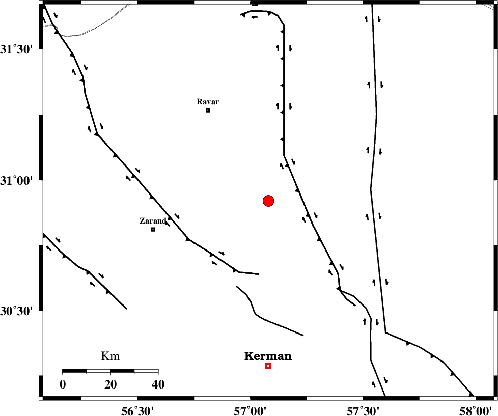
| Location | Lat:30.92 Lon: 57.08 |
| Region | 45 km South-East of Ravar, Kerman Province |
Nearest Cities |
|
| 20 km North East of Hejdak, Kerman Province | |
| 29 km North East of Hatkan, Kerman Province | |
| 30 km North of Harjand, Kerman Province | |
| 36 km North East of Khankuk, Kerman Province | |
| 39 km North East of Chatrud, Kerman Province | |
| Depth | 15 km |
| Agency | |
Faults within 150 km: |
|
| LAKARKUH_F (Length: 138 km) , Distance to epicenter: 21 km | |
| KUHBANAN_F (Length: 189 km) , Distance to epicenter: 32 km | |
| CHATRUD_F (Length: 37 km) , Distance to epicenter: 39 km | |
| Number of Phases | 6 |
| RMS | 0.3 |
| Number of Stations | 5 |
| Error in Latitude | >5.5 km |
| Error in Longitude | 9.9 km |
| Error in Depth | 12 km |
Download waveform in seisan format
to download seisan software Click here
to access information about IIEES stations Click here
Amplitude | ||||||||
| UID | Agency | Station | Component | Amplitude | Period | Arrival Time | Proccessing Time | Signal Clip |
| 51492 | IIEES | KRBR | N | 666 | 0.21 | 2008-12-20 06:13:40 | 2009-05-17 10:07:00 | n |
| 51493 | IIEES | TABS | N | 130.1 | 0.54 | 2008-12-20 06:14:36 | 2009-05-17 10:07:00 | n |
| 51494 | IIEES | BNDS | N | 24.9 | 0.53 | 2008-12-20 06:15:14 | 2009-05-17 10:07:00 | n |
| 51495 | IIEES | NASN | N | 23 | 0.47 | 2008-12-20 06:15:16 | 2009-05-17 10:07:00 | n |
Phase | ||||||||||||
| Agency | Station | Component | Phase Type | Phase Quality | First Motion | Observed Arrival Time | Time Residual | Loc. Flag | Input Weight | Distance | Azimuth | |
| IIEES | KRBR | Z | Pg | E | 2008-12-20 06:13:24 | -0.3 | y | 109 | 196 | |||
| IIEES | KRBR | N | Sg | E | 2008-12-20 06:13:38 | 0 | y | 109 | 196 | |||
| IIEES | TABS | Z | Pn | E | 2008-12-20 06:13:50 | -0.5 | y | 302 | 1 | |||
| IIEES | BNDS | Z | Pn | E | 2008-12-20 06:14:03 | 0.2 | y | 400 | 193 | |||
| IIEES | SHRT | Z | PN5 | E | 2008-12-20 06:14:07 | 0.3 | y | 428 | 44 | |||
| IIEES | NASN | Z | PN5 | E | 2008-12-20 06:14:10 | 0.4 | y | 454 | 298 | |||