
Magnitude |
3 |
| Date & Time (UTC) | 2009-01-07 05:48:28.5 |
| Date & Time (Local) | 1387/10/18 09:18:28.5 |
| Location | Lat:31.96 Lon: 49.72 |
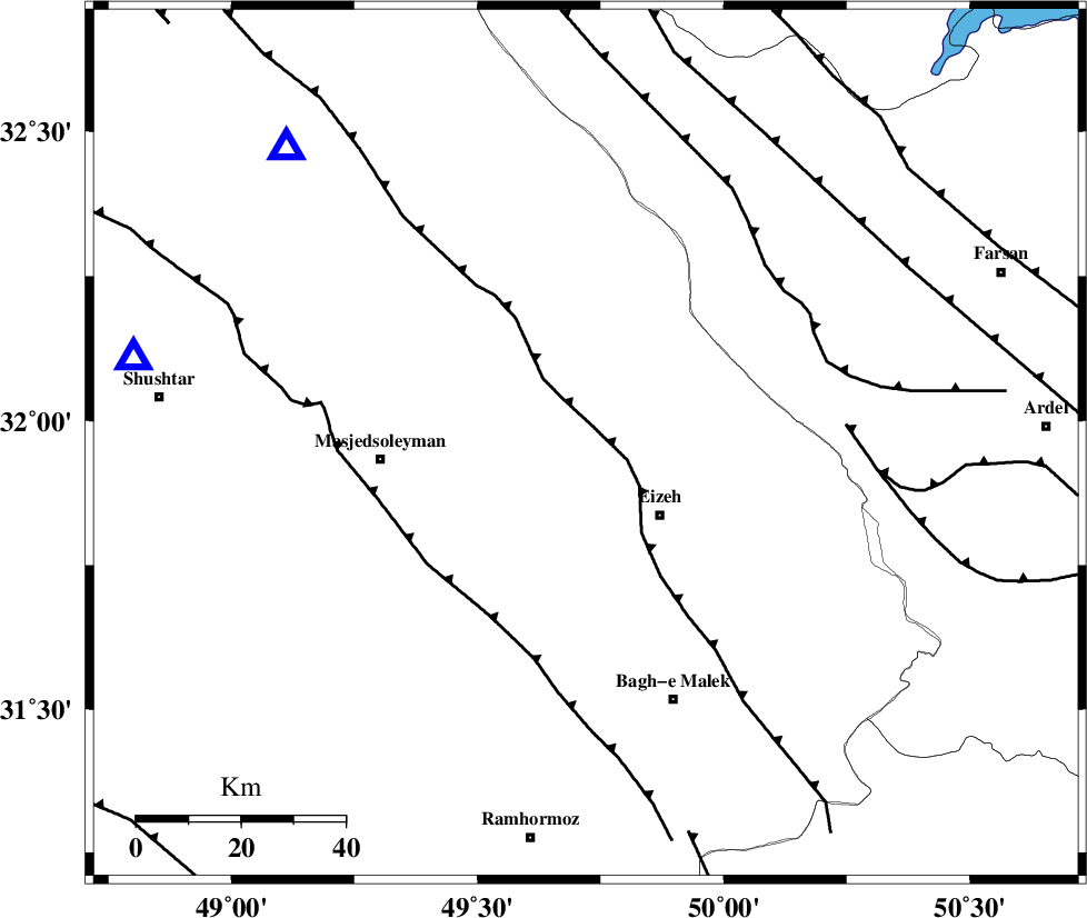
| Region | 19 km North-West of Izeh, Khoozestan Province |
Nearest Cities |
|
| 11 km West of Torshak, Khoozestan Province | |
| 14 km North of Rasvand, Khoozestan Province | |
| 20 km North West of Izeh, Khoozestan Province | |
| 20 km North of Chenarestan, Khoozestan Province | |
| 38 km South East of Qale-yekhvaju, Khoozestan Province | |
| Depth | 38 km |
| Agency | |
Faults within 150 km: |
|
| MFF2 (Length: 205 km) , Distance to epicenter: 4 km | |
| DEZFUL_EMBAYMENT (Length: 228 km) , Distance to epicenter: 38 km | |
| ZARDKUH_F (Length: 139 km) , Distance to epicenter: 48 km | |
| Number of Phases | 6 |
| RMS | 0.4 |
| Number of Stations | 5 |
| Error in Latitude | >8.7 km |
| Error in Longitude | 7.9 km |
| Error in Depth | 9.2 km |
Download waveform in seisan format
to download seisan software Click here
to access information about IIEES stations Click here
Amplitude | ||||||||
| UID | Agency | Station | Component | Amplitude | Period | Arrival Time | Proccessing Time | Signal Clip |
| 51653 | IIEES | SHGR | E | 789.6 | 0.26 | 2009-01-07 05:49:00 | 2009-06-27 08:52:00 | n |
| 51654 | IIEES | SHGR | N | 683.9 | 0.27 | 2009-01-07 05:49:03 | 2009-06-27 08:52:00 | n |
| 51655 | IIEES | GHVR | N | 41.2 | 0.67 | 2009-01-07 05:50:03 | 2009-06-27 08:52:00 | n |
| 51656 | IIEES | GHVR | E | 50 | 0.53 | 2009-01-07 05:50:05 | 2009-06-27 08:52:00 | n |
Phase | ||||||||||||
| Agency | Station | Component | Phase Type | Phase Quality | First Motion | Observed Arrival Time | Time Residual | Loc. Flag | Input Weight | Distance | Azimuth | |
| IIEES | SHGR | Z | Pg | E | 2009-01-07 05:48:44 | 0.1 | y | 88.2 | 281 | |||
| IIEES | ASAO | Z | Pn | E | 2009-01-07 05:49:10 | 0.2 | y | 289 | 6 | |||
| IIEES | NASN | Z | Pn | E | 2009-01-07 05:49:11 | -0.3 | y | 305 | 71 | |||
| IIEES | GHVR | Z | Pn | E | 2009-01-07 05:49:13 | 0.6 | y | 314 | 27 | |||
| IIEES | GHVR | N | Sg | E | 2009-01-07 05:49:54 | -0.1 | y | 314 | 27 | |||
| IIEES | SNGE | Z | Pn | E | 2009-01-07 05:49:24 | -0.5 | y | 412 | 328 | |||