
Magnitude |
2.8 |
| Date & Time (UTC) | 2009-01-07 15:46:18.7 |
| Date & Time (Local) | 1387/10/18 19:16:18.7 |
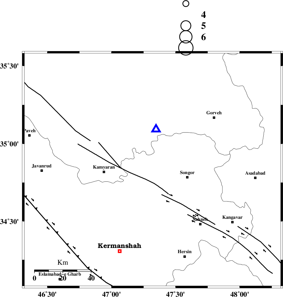
| Location | Lat:34.83 Lon: 47.32 |
| Region | 25 km West of Sonqor, Kermanshah Province |
Nearest Cities |
|
| 4 km of Shirkuh, Kermanshah Province | |
| 11 km of Agah olia, Kermanshah Province | |
| 15 km North of Mueeneh, Kermanshah Province | |
| 16 km North East of Kiunan, Kermanshah Province | |
| 22 km South West of Void, Kermanshah Province | |
| Depth | 9 km |
| Agency | |
Faults within 150 km: |
|
| SARTAKHT_F (Length: 78 km) , Distance to epicenter: 8 km | |
| DINEHVAR_F (Length: 46 km) , Distance to epicenter: 19 km | |
| MORVARID_F (Length: 24 km) , Distance to epicenter: 23 km | |
| Number of Phases | 7 |
| RMS | 0.3 |
| Number of Stations | 5 |
| Error in Latitude | >2.8 km |
| Error in Longitude | 7.7 km |
| Error in Depth | 0 km |
Download waveform in seisan format
to download seisan software Click here
to access information about IIEES stations Click here
Amplitude | ||||||||
| UID | Agency | Station | Component | Amplitude | Period | Arrival Time | Proccessing Time | Signal Clip |
| 51657 | IIEES | SNGE | E | 2469 | 0.56 | 2009-01-07 15:46:29 | 2009-06-27 08:52:00 | n |
| 51658 | IIEES | GHVR | E | 16 | 0.6 | 2009-01-07 15:48:10 | 2009-06-27 08:52:00 | n |
Phase | ||||||||||||
| Agency | Station | Component | Phase Type | Phase Quality | First Motion | Observed Arrival Time | Time Residual | Loc. Flag | Input Weight | Distance | Azimuth | |
| IIEES | SNGE | Z | Pg | E | 2009-01-07 15:46:24 | 0 | y | 29 | 5 | |||
| IIEES | SNGE | E | Sg | E | 2009-01-07 15:46:28 | 0.2 | y | 29 | 5 | |||
| IIEES | ZNJK | Z | Pg | E | 2009-01-07 15:46:59 | -0.7 | y | 238 | 31 | |||
| IIEES | ZNJK | N | Sg | E | 2009-01-07 15:47:29 | 0.1 | y | 238 | 31 | |||
| IIEES | ASAO | Z | PN5 | E | 2009-01-07 15:46:58 | 0 | y | 250 | 96 | |||
| IIEES | GHVR | Z | Pn | E | 2009-01-07 15:47:12 | 0.1 | y | 362 | 95 | |||
| IIEES | CHTH | Z | Pn | E | 2009-01-07 15:47:12 | 0.3 | y | 366 | 70 | |||