
Magnitude |
3.1 |
| Date & Time (UTC) | 2009-02-14 04:24:39.6 |
| Date & Time (Local) | 1387/11/26 07:54:39.6 |
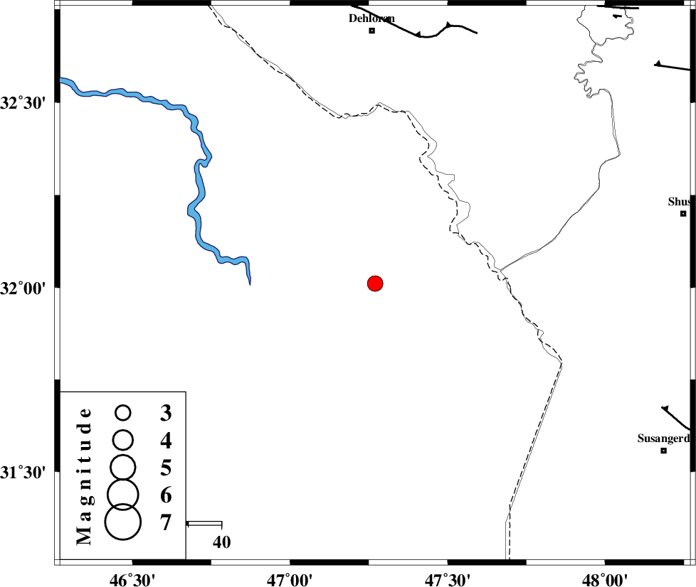
| Location | Lat:32.01 Lon: 47.27 |
| Region | 76 km South of Dehloran, Ilam Province |
Nearest Cities |
|
| 60 km South of Musian, Ilam Province | |
| 75 km North West of Bostan, Khoozestan Province | |
| 76 km South of Dehloran, Ilam Province | |
| 95 km South West of Shush, Khoozestan Province | |
| 95 km South East of Bishehzar, Ilam Province | |
| Depth | 34 km |
| Agency | |
Faults within 150 km: |
|
| MFF6 (Length: 144 km) , Distance to epicenter: 75 km | |
| AHVAZ_F (Length: 99 km) , Distance to epicenter: 94 km | |
| BALARUD_F_Z1 (Length: 87 km) , Distance to epicenter: 104 km | |
| Number of Phases | 6 |
| RMS | 0.1 |
| Number of Stations | 5 |
| Error in Latitude | >6.4 km |
| Error in Longitude | 4.6 km |
| Error in Depth | 4.5 km |
Download waveform in seisan format
to download seisan software Click here
to access information about IIEES stations Click here
Amplitude | ||||||||
| UID | Agency | Station | Component | Amplitude | Period | Arrival Time | Proccessing Time | Signal Clip |
| 51948 | IIEES | SNGE | N | 62.1 | 0.57 | 2009-02-14 04:26:19 | 2009-06-27 08:52:00 | n |
| 51949 | IIEES | NASN | E | 12.3 | 0.56 | 2009-02-14 04:27:11 | 2009-06-27 08:52:00 | n |
Phase | ||||||||||||
| Agency | Station | Component | Phase Type | Phase Quality | First Motion | Observed Arrival Time | Time Residual | Loc. Flag | Input Weight | Distance | Azimuth | |
| IIEES | SHGR | Z | Pg | E | 2009-02-14 04:25:03 | 0 | y | 145 | 85 | |||
| IIEES | SHGR | E | Sg | E | 2009-02-14 04:25:20 | 0 | y | 145 | 85 | |||
| IIEES | KHMZ | Z | Pn | E | 2009-02-14 04:25:24 | -0.1 | y | 317 | 52 | |||
| IIEES | SNGE | Z | Pn | E | 2009-02-14 04:25:28 | 0 | y | 342 | 1 | |||
| IIEES | ASAO | Z | Pn | E | 2009-02-14 04:25:33 | 0.1 | y | 381 | 42 | |||
| IIEES | NASN | Z | Pn | E | 2009-02-14 04:25:51 | 0.1 | y | 528 | 79 | |||