
Magnitude |
2.7 |
| Date & Time (UTC) | 2009-03-26 07:05:56.7 |
| Date & Time (Local) | 1388/1/6 11:35:56.7 |
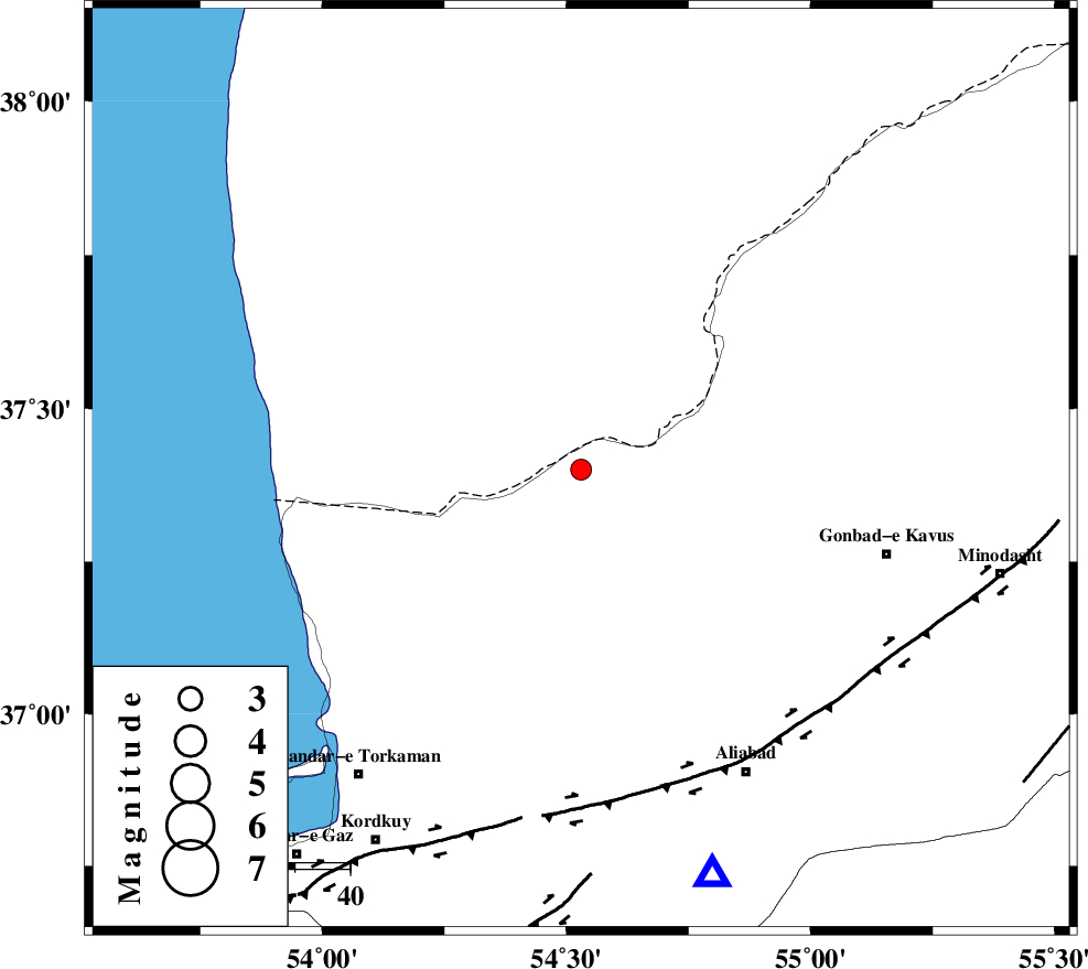
| Location | Lat:37.4 Lon: 54.53 |
| Region | 43 km North of Aq Qaleh, Golestan Province |
Nearest Cities |
|
| 18 km West of Enchehborun, Golestan Province | |
| 37 km South West of Dashliborun, Golestan Province | |
| 40 km North West of Gariduji, Golestan Province | |
| 43 km North of Qanqarmeh, Golestan Province | |
| 44 km North of Aq Qaleh, Golestan Province | |
| Depth | 15 km |
| Agency | |
Faults within 150 km: |
|
| KHAZAR_F (Length: 523 km) , Distance to epicenter: 58 km | |
| N_ALBORZ_F (Length: 360 km) , Distance to epicenter: 89 km | |
| SHAVAR_F (Length: 87 km) , Distance to epicenter: 90 km | |
| Number of Phases | 6 |
| RMS | 0 |
| Number of Stations | 5 |
| Error in Latitude | >4.1 km |
| Error in Longitude | 2.2 km |
| Error in Depth | 4.4 km |
Download waveform in seisan format
to download seisan software Click here
to access information about IIEES stations Click here
Amplitude | ||||||||
| UID | Agency | Station | Component | Amplitude | Period | Arrival Time | Proccessing Time | Signal Clip |
| 52282 | IIEES | DAMV | N | 47.9 | 0.48 | 2009-03-26 07:07:32 | 2009-06-27 08:52:00 | n |
| 52283 | IIEES | CHTH | E | 15 | 0.68 | 2009-03-26 07:07:44 | 2009-06-27 08:52:00 | n |
Phase | ||||||||||||
| Agency | Station | Component | Phase Type | Phase Quality | First Motion | Observed Arrival Time | Time Residual | Loc. Flag | Input Weight | Distance | Azimuth | |
| IIEES | MRVT | Z | Pg | E | 2009-03-26 07:06:20 | 0 | y | 141 | 78 | |||
| IIEES | MRVT | N | Sg | E | 2009-03-26 07:06:37 | 0 | y | 141 | 78 | |||
| IIEES | BJRD | Z | PN5 | E | 2009-03-26 07:06:36 | 0 | y | 257 | 82 | |||
| IIEES | DAMV | Z | Pn | E | 2009-03-26 07:06:42 | 0 | y | 302 | 230 | |||
| IIEES | CHTH | Z | Pn | E | 2009-03-26 07:06:47 | 0 | y | 346 | 242 | |||
| IIEES | TABS | Z | Pn | E | 2009-03-26 07:07:03 | 0 | y | 478 | 150 | |||