
Magnitude |
3.6 |
| Date & Time (UTC) | 2009-04-08 13:36:21.7 |
| Date & Time (Local) | 1388/1/19 18:06:21.7 |
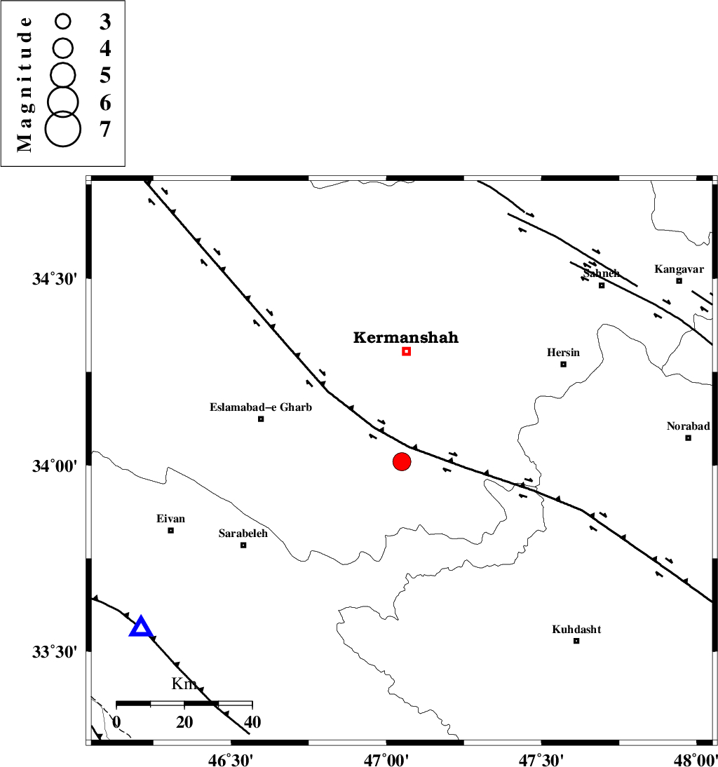
| Location | Lat:34.01 Lon: 47.05 |
| Region | 32 km South of Kermanshah, Kermanshah Province |
Nearest Cities |
|
| 10 km North of Buzhan, Kermanshah Province | |
| 12 km North of Chenar, Kermanshah Province | |
| 21 km South East of Helshi, Kermanshah Province | |
| 23 km North East of Qale-ye harsam, Kermanshah Province | |
| 27 km North East of Hamil, Kermanshah Province | |
| Depth | 18 km |
| Agency | |
Faults within 150 km: |
|
| HZF4 (Length: 492 km) , Distance to epicenter: 5 km | |
| SAHANEH_F (Length: 77 km) , Distance to epicenter: 77 km | |
| DINEHVAR_F (Length: 46 km) , Distance to epicenter: 80 km | |
| Number of Phases | 7 |
| RMS | 0.3 |
| Number of Stations | 5 |
| Error in Latitude | >6.3 km |
| Error in Longitude | 8.2 km |
| Error in Depth | 12.8 km |
Download waveform in seisan format
to download seisan software Click here
to access information about IIEES stations Click here
Amplitude | ||||||||
| UID | Agency | Station | Component | Amplitude | Period | Arrival Time | Proccessing Time | Signal Clip |
| 52404 | IIEES | SHGR | N | 328.4 | 0.8 | 2009-04-08 13:37:51 | 2009-07-13 01:52:00 | n |
| 52405 | IIEES | SHGR | E | 256.2 | 0.52 | 2009-04-08 13:37:53 | 2009-07-13 01:52:00 | n |
| 52406 | IIEES | GHVR | N | 125.6 | 0.48 | 2009-04-08 13:38:15 | 2009-07-13 01:52:00 | n |
| 52407 | IIEES | GHVR | E | 123.6 | 0.6 | 2009-04-08 13:38:17 | 2009-07-13 01:52:00 | n |
Phase | ||||||||||||
| Agency | Station | Component | Phase Type | Phase Quality | First Motion | Observed Arrival Time | Time Residual | Loc. Flag | Input Weight | Distance | Azimuth | |
| IIEES | SNGE | Z | Pg | E | 2009-04-08 13:36:42 | 0 | y | 123 | 13 | |||
| IIEES | SNGE | E | Sg | E | 2009-04-08 13:36:57 | 0.1 | y | 123 | 13 | |||
| IIEES | SHGR | Z | Pn | E | 2009-04-08 13:37:02 | 0 | y | 267 | 142 | |||
| IIEES | GHVR | Z | Pn | E | 2009-04-08 13:37:18 | 0.7 | y | 390 | 81 | |||
| IIEES | GHVR | N | Sg | E | 2009-04-08 13:38:10 | 0 | y | 390 | 81 | |||
| IIEES | THKV | Z | Pn | E | 2009-04-08 13:37:19 | -0.4 | y | 409 | 58 | |||
| IIEES | DAMV | Z | Pn | E | 2009-04-08 13:37:29 | -0.4 | y | 485 | 67 | |||