
Magnitude |
2.5 |
| Date & Time (UTC) | 2009-04-23 00:03:51.4 |
| Date & Time (Local) | 1388/2/3 04:33:51.4 |
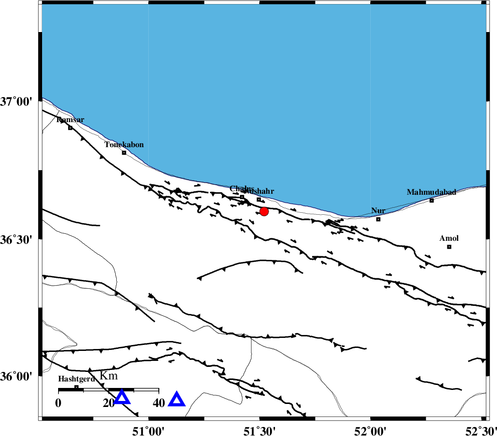
| Location | Lat:36.6 Lon: 51.52 |
| Region | 5 km Nowshahr, Mazandaran Province |
Nearest Cities |
|
| 5 km of Nowshahr, Mazandaran Province | |
| 11 km of Chalus, Mazandaran Province | |
| 17 km North West of Andarud, Mazandaran Province | |
| 23 km North of Pul, Mazandaran Province | |
| 26 km East of Kelarabad, Mazandaran Province | |
| Depth | 16 km |
| Agency | |
Faults within 150 km: |
|
| KHAZAR_F (Length: 523 km) , Distance to epicenter: 2 km | |
| N_ALBORZ_F (Length: 360 km) , Distance to epicenter: 11 km | |
| KOJOOR (Length: 75 km) , Distance to epicenter: 22 km | |
| Number of Phases | 6 |
| RMS | 0.1 |
| Number of Stations | 4 |
| Error in Latitude | >3.8 km |
| Error in Longitude | 2.3 km |
| Error in Depth | 7.5 km |
Download waveform in seisan format
to download seisan software Click here
to access information about IIEES stations Click here
Amplitude | ||||||||
| UID | Agency | Station | Component | Amplitude | Period | Arrival Time | Proccessing Time | Signal Clip |
| 52523 | IIEES | THKV | N | 222.7 | 0.44 | 2009-04-23 00:04:20 | 2009-07-13 01:52:00 | n |
| 52524 | IIEES | THKV | E | 120 | 0.2 | 2009-04-23 00:04:20 | 2009-07-13 01:52:00 | n |
| 52525 | IIEES | DAMV | N | 125.6 | 0.52 | 2009-04-23 00:04:25 | 2009-07-13 01:52:00 | n |
| 52526 | IIEES | DAMV | E | 114.6 | 0.16 | 2009-04-23 00:04:26 | 2009-07-13 01:52:00 | n |
Phase | ||||||||||||
| Agency | Station | Component | Phase Type | Phase Quality | First Motion | Observed Arrival Time | Time Residual | Loc. Flag | Input Weight | Distance | Azimuth | |
| IIEES | CHTH | Z | Pg | E | 2009-04-23 00:04:05 | -0.2 | y | 84.4 | 205 | |||
| IIEES | THKV | Z | Pg | E | 2009-04-23 00:04:07 | 0.1 | y | 95.2 | 218 | |||
| IIEES | THKV | N | Sg | E | 2009-04-23 00:04:19 | 0 | y | 95.2 | 218 | |||
| IIEES | DAMV | Z | Pg | E | 2009-04-23 00:04:10 | 0.1 | y | 115 | 159 | |||
| IIEES | DAMV | N | Sg | E | 2009-04-23 00:04:25 | 0 | y | 115 | 159 | |||
| IIEES | ZNJK | Z | Pn | E | 2009-04-23 00:04:30 | 0 | y | 254 | 273 | |||