
Magnitude |
3.2 |
| Date & Time (UTC) | 2009-04-26 05:43:59.0 |
| Date & Time (Local) | 1388/2/6 10:13:59.0 |
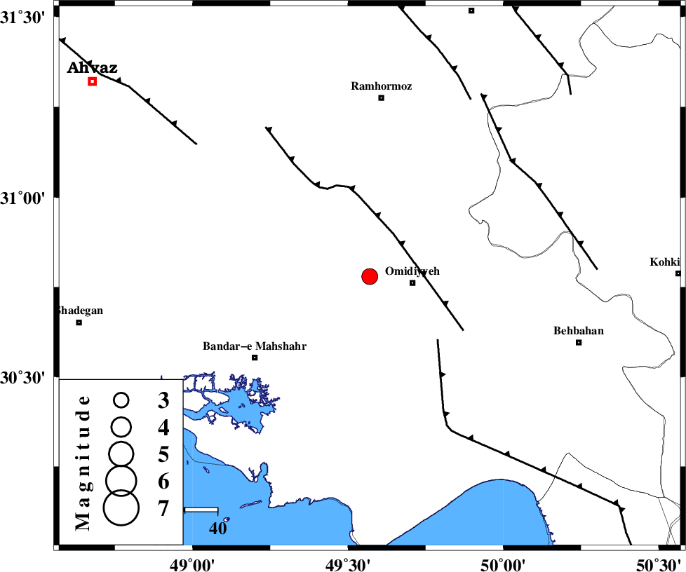
| Location | Lat:30.78 Lon: 49.57 |
| Region | 13 km West of Omidiyeh, Khoozestan Province |
Nearest Cities |
|
| 13 km North West of Omidiyeh, Khoozestan Province | |
| 15 km East of Abdoliyeh, Khoozestan Province | |
| 17 km North West of Chah-e salem, Khoozestan Province | |
| 20 km South East of Ramshir, Khoozestan Province | |
| 27 km North West of Aghajari, Khoozestan Province | |
| Depth | 36 km |
| Agency | |
Faults within 150 km: |
|
| AGHAJARI_F (Length: 88 km) , Distance to epicenter: 15 km | |
| RAG_E_SEFID_F (Length: 84 km) , Distance to epicenter: 29 km | |
| MFF4 (Length: 62 km) , Distance to epicenter: 56 km | |
| Number of Phases | 5 |
| RMS | 0 |
| Number of Stations | 4 |
| Error in Latitude | >6.9 km |
| Error in Longitude | 9.4 km |
| Error in Depth | 7.3 km |
Download waveform in seisan format
to download seisan software Click here
to access information about IIEES stations Click here
Amplitude | ||||||||
| UID | Agency | Station | Component | Amplitude | Period | Arrival Time | Proccessing Time | Signal Clip |
| 52543 | IIEES | SHGR | N | 424.9 | 0.58 | 2009-04-26 05:44:54 | 2009-07-13 01:52:00 | n |
| 52544 | IIEES | GHVR | E | 26.9 | 0.58 | 2009-04-26 05:45:58 | 2009-07-13 01:52:00 | n |
| 52545 | IIEES | GHVR | N | 27.2 | 0.64 | 2009-04-26 05:46:09 | 2009-07-13 01:52:00 | n |
Phase | ||||||||||||
| Agency | Station | Component | Phase Type | Phase Quality | First Motion | Observed Arrival Time | Time Residual | Loc. Flag | Input Weight | Distance | Azimuth | |
| IIEES | SHGR | Z | Pg | E | 2009-04-26 05:44:25 | 0 | y | 164 | 334 | |||
| IIEES | SHGR | N | Sg | E | 2009-04-26 05:44:45 | 0 | y | 164 | 334 | |||
| IIEES | KHMZ | Z | Pn | E | 2009-04-26 05:44:45 | 0 | y | 330 | 6 | |||
| IIEES | NASN | Z | Pn | E | 2009-04-26 05:44:52 | 0 | y | 379 | 53 | |||
| IIEES | GHVR | Z | Pn | E | 2009-04-26 05:44:59 | -0.1 | y | 439 | 21 | |||