
Magnitude |
2.5 |
| Date & Time (UTC) | 2009-06-13 06:25:45.5 |
| Date & Time (Local) | 1388/3/23 10:55:45.5 |
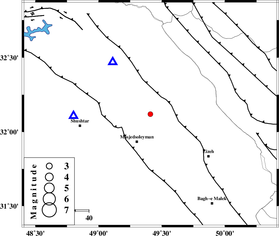
| Location | Lat:32.12 Lon: 49.41 |
| Region | 22 km North-East of Masjed Soleyman, Khoozestan Province |
Nearest Cities |
|
| 10 km of Qale-yekhvaju, Khoozestan Province | |
| 23 km North East of Masjed Soleyman, Khoozestan Province | |
| 24 km South West of Paabshalal, Khoozestan Province | |
| 32 km South East of Jaefarabad, Khoozestan Province | |
| 32 km East of Haft shahidan, Khoozestan Province | |
| Depth | 14 km |
| Agency | |
Faults within 150 km: |
|
| MFF2 (Length: 205 km) , Distance to epicenter: 15 km | |
| DEZFUL_EMBAYMENT (Length: 228 km) , Distance to epicenter: 24 km | |
| ZARDKUH_F (Length: 139 km) , Distance to epicenter: 65 km | |
| Number of Phases | 5 |
| RMS | 0.1 |
| Number of Stations | 3 |
| Error in Latitude | >5.4 km |
| Error in Longitude | 5 km |
| Error in Depth | 6.4 km |
Download waveform in seisan format
to download seisan software Click here
to access information about IIEES stations Click here
Amplitude | ||||||||
| UID | Agency | Station | Component | Amplitude | Period | Arrival Time | Proccessing Time | Signal Clip |
| 52965 | IIEES | SHGR | N | 368.9 | 0.29 | 2009-06-13 06:26:03 | 2009-07-13 01:52:00 | n |
| 52966 | IIEES | KHMZ | N | 57.3 | 0.44 | 2009-06-13 06:26:40 | 2009-07-13 01:52:00 | n |
| 52967 | IIEES | KHMZ | E | 66.9 | 0.44 | 2009-06-13 06:26:41 | 2009-07-13 01:52:00 | n |
| 52968 | IIEES | ASAO | E | 21.4 | 0.4 | 2009-06-13 06:27:04 | 2009-07-13 01:52:00 | n |
Phase | ||||||||||||
| Agency | Station | Component | Phase Type | Phase Quality | First Motion | Observed Arrival Time | Time Residual | Loc. Flag | Input Weight | Distance | Azimuth | |
| IIEES | SHGR | Z | Pg | E | 2009-06-13 06:25:55 | 0.1 | y | 57.8 | 269 | |||
| IIEES | SHGR | N | Sg | E | 2009-06-13 06:26:03 | 0 | y | 57.8 | 269 | |||
| IIEES | KHMZ | Z | Pg | E | 2009-06-13 06:26:16 | -0.2 | y | 187 | 16 | |||
| IIEES | KHMZ | N | Sg | E | 2009-06-13 06:26:39 | 0.1 | y | 187 | 16 | |||
| IIEES | ASAO | Z | Pn | E | 2009-06-13 06:26:27 | 0.1 | y | 275 | 12 | |||