
Magnitude |
2.9 |
| Date & Time (UTC) | 2010-03-10 18:02:12.7 |
| Date & Time (Local) | 1388/12/19 21:32:12.7 |
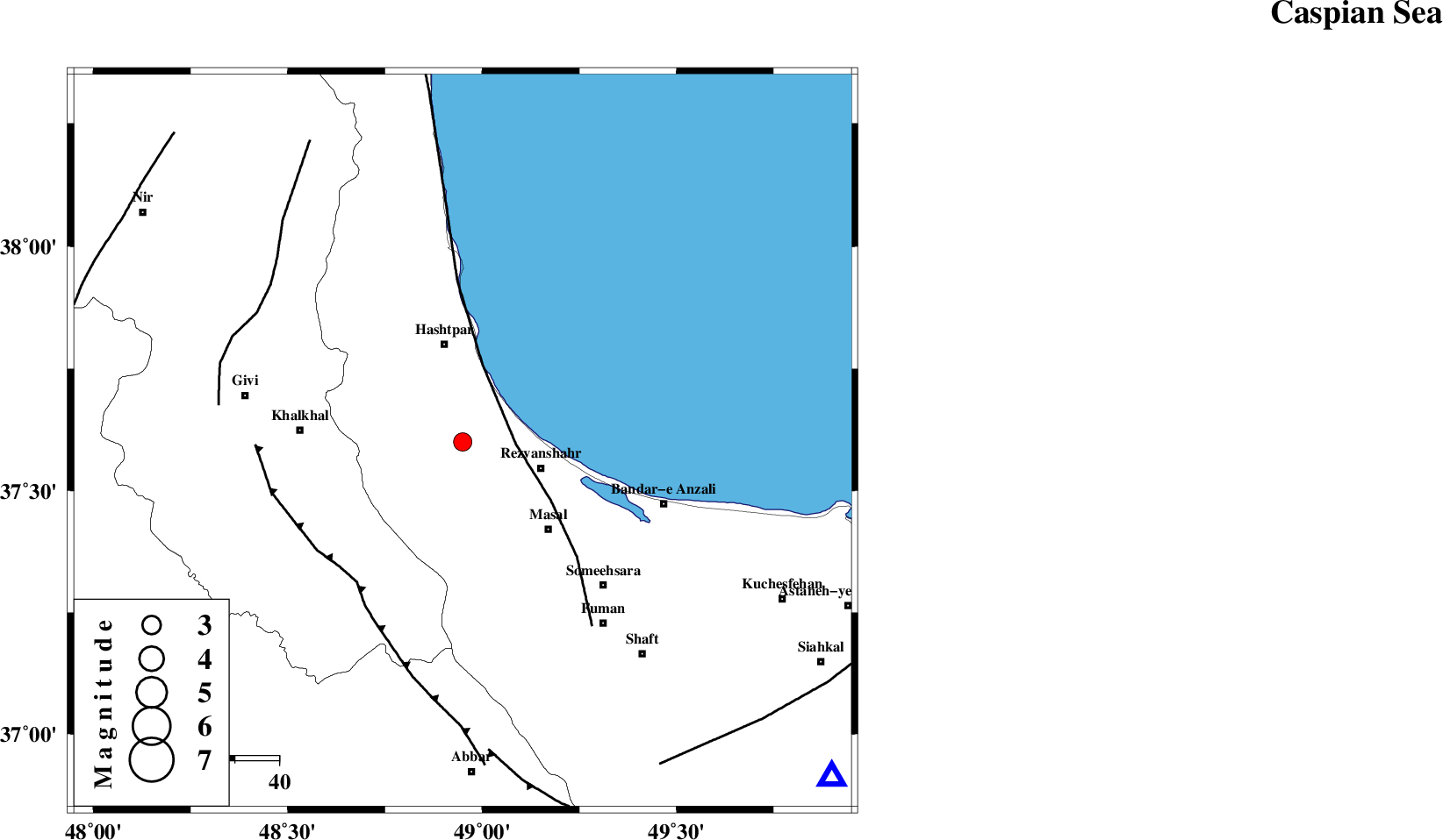
| Location | Lat:37.6 Lon: 48.95 |
| Region | Gilan Province, 18 km West of Rezvanshahr |
Nearest Cities |
|
| 8 km North of Ardeh, Gilan Province | |
| 11 km North West of Parrehsar, Gilan Province | |
| 11 km West of Void, Gilan Province | |
| 17 km South of Tularud, Gilan Province | |
| 19 km North West of Rezvanshahr, Gilan Province | |
| Depth | 14 km |
| Agency | |
Faults within 150 km: |
|
| TALESH_F (Length: 258 km) , Distance to epicenter: 12 km | |
| MASULEL_F (Length: 90 km) , Distance to epicenter: 40 km | |
| SANGAVAR_F (Length: 61 km) , Distance to epicenter: 55 km | |
| Number of Phases | 7 |
| RMS | 0.2 |
| Number of Stations | 6 |
| Error in Latitude | >4.5 km |
| Error in Longitude | 5.6 km |
| Error in Depth | 8.4 km |
Download waveform in seisan format
to download seisan software Click here
to access information about IIEES stations Click here
Amplitude | ||||||||
| UID | Agency | Station | Component | Amplitude | Period | Arrival Time | Proccessing Time | Signal Clip |
| 56890 | IIEES | CHTH | N | 55 | 0.48 | 2010-03-10 18:03:31 | 2010-03-10 06:57:00 | n |
| 56891 | IIEES | DAMV | E | 31.4 | 0.52 | 2010-03-10 18:03:53 | 2010-03-10 06:57:00 | n |
| 56892 | IIEES | DAMV | N | 28.8 | 0.72 | 2010-03-10 18:03:56 | 2010-03-10 06:57:00 | n |
Phase | ||||||||||||
| Agency | Station | Component | Phase Type | Phase Quality | First Motion | Observed Arrival Time | Time Residual | Loc. Flag | Input Weight | Distance | Azimuth | |
| IIEES | GRMI | Z | P | E | 2010-03-10 18:02:39 | -0.1 | y | 164 | 326 | |||
| IIEES | CHTH | Z | Pn | E | 2010-03-10 18:02:54 | 0.2 | y | 270 | 133 | |||
| IIEES | SNGE | Z | P | E | 2010-03-10 18:02:59 | -0.1 | y | 313 | 208 | |||
| IIEES | DAMV | Z | Pn | E | 2010-03-10 18:03:03 | 0.2 | y | 347 | 128 | |||
| IIEES | DAMV | N | Sg | E | 2010-03-10 18:03:49 | -0.3 | y | 347 | 128 | |||
| IIEES | ASAO | Z | Pn | E | 2010-03-10 18:03:04 | 0 | y | 352 | 164 | |||
| IIEES | GHVR | Z | P | E | 2010-03-10 18:03:10 | 0.2 | y | 403 | 148 | |||