
Magnitude |
2.9 |
| Date & Time (UTC) | 2009-08-10 12:28:32.0 |
| Date & Time (Local) | 1388/5/19 16:58:32.0 |
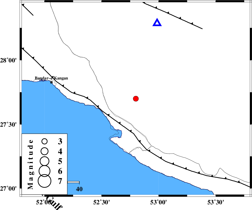
| Location | Lat:27.7 Lon: 52.8 |
| Region | Fars Province, 19 km North of Mehr |
Nearest Cities |
|
| 13 km North of Ardavan-e olia, Fars Province | |
| 13 km East of Asir, Fars Province | |
| 14 km North East of Gallehdar, Fars Province | |
| 18 km North West of Alamarvdasht, Fars Province | |
| 19 km North of Mehr, Fars Province | |
| Depth | 14 km |
| Agency | |
Faults within 150 km: |
|
| MFF3 (Length: 292 km) , Distance to epicenter: 31 km | |
| QIR_F (Length: 130 km) , Distance to epicenter: 79 km | |
| LAR_F (Length: 99 km) , Distance to epicenter: 106 km | |
| Number of Phases | 5 |
| RMS | 0.1 |
| Number of Stations | 3 |
| Error in Latitude | >5.7 km |
| Error in Longitude | 6.4 km |
| Error in Depth | 4.9 km |
Download waveform in seisan format
to download seisan software Click here
to access information about IIEES stations Click here
Amplitude | ||||||||
| UID | Agency | Station | Component | Amplitude | Period | Arrival Time | Proccessing Time | Signal Clip |
| 58176 | IIEES | GHIR | N | 908.1 | 0.43 | 2009-08-10 12:28:55 | 2009-10-27 01:20:00 | n |
| 58177 | IIEES | GHIR | E | 772.6 | 0.57 | 2009-08-10 12:29:01 | 2009-10-27 01:20:00 | n |
| 58178 | IIEES | BNDS | N | 32.4 | 0.92 | 2009-08-10 12:30:12 | 2009-10-27 01:20:00 | n |
| 58179 | IIEES | BNDS | E | 31.2 | 0.48 | 2009-08-10 12:30:13 | 2009-10-27 01:20:00 | n |
Phase | ||||||||||||
| Agency | Station | Component | Phase Type | Phase Quality | First Motion | Observed Arrival Time | Time Residual | Loc. Flag | Input Weight | Distance | Azimuth | |
| IIEES | GHIR | Z | Pg | E | 2009-08-10 12:28:43 | -0.1 | y | 67.4 | 16 | |||
| IIEES | BNDS | Z | Pn | E | 2009-08-10 12:29:21 | 0.1 | y | 335 | 95 | |||
| IIEES | BNDS | N | Sg | E | 2009-08-10 12:30:05 | 0 | y | 335 | 95 | |||
| IIEES | NASN | Z | Pn | E | 2009-08-10 12:29:50 | -0.2 | y | 565 | 0 | |||
| IIEES | NASN | N | Sn | 2009-08-10 12:30:47 | 0.2 | y | 565 | 0 | ||||