
Magnitude |
3 |
| Date & Time (UTC) | 2010-07-24 14:31:35.8 |
| Date & Time (Local) | 1389/5/2 19:01:35.8 |
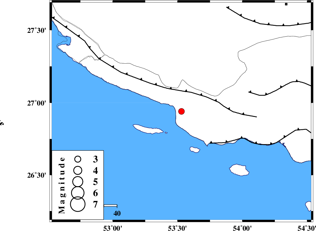
| Location | Lat:26.94 Lon: 53.53 |
| Region | Hormozgan Province, 57 km South-East of Lamerd |
Nearest Cities |
|
| 32 km South of Ashkenan, Fars Province | |
| 33 km South West of Ahl, Fars Province | |
| 54 km South of Beyram, Fars Province | |
| 57 km South East of Lamerd, Fars Province | |
| 72 km South of Fedagh, Fars Province | |
| Depth | 40 km |
| Agency | |
Faults within 150 km: |
|
| MFF3 (Length: 292 km) , Distance to epicenter: 16 km | |
| ZFF1 (Length: 165 km) , Distance to epicenter: 32 km | |
| MFF1 (Length: 180 km) , Distance to epicenter: 53 km | |
| Number of Phases | 4 |
| RMS | 0 |
| Number of Stations | 3 |
| Error in Latitude | >6.2 km |
| Error in Longitude | 5.9 km |
| Error in Depth | 4.2 km |
Download waveform in seisan format
to download seisan software Click here
to access information about IIEES stations Click here
Amplitude | ||||||||
| UID | Agency | Station | Component | Amplitude | Period | Arrival Time | Proccessing Time | Signal Clip |
| 66650 | IIEES | GHIR | N | 288.2 | 1.01 | 2010-07-24 14:32:23 | 2010-07-25 03:11:00 | n |
| 66651 | IIEES | GHIR | E | 305.6 | 0.42 | 2010-07-24 14:32:29 | 2010-07-25 03:11:00 | n |
| 66652 | IIEES | BNDS | N | 39.2 | 2.97 | 2010-07-24 14:33:08 | 2010-07-25 03:11:00 | n |
| 66653 | IIEES | KRBR | N | 14.3 | 1 | 2010-07-24 14:33:42 | 2010-07-25 03:11:00 | n |
Phase | ||||||||||||
| Agency | Station | Component | Phase Type | Phase Quality | First Motion | Observed Arrival Time | Time Residual | Loc. Flag | Input Weight | Distance | Azimuth | |
| IIEES | GHIR | Z | Pg | E | 2010-07-24 14:32:02 | 0 | y | 159 | 340 | |||
| IIEES | GHIR | E | Sg | E | 2010-07-24 14:32:21 | 0 | y | 159 | 340 | |||
| IIEES | BNDS | Z | Pg | E | 2010-07-24 14:32:18 | 0 | y | 267 | 78 | |||
| IIEES | KRBR | Z | Pn | E | 2010-07-24 14:32:38 | 0 | y | 463 | 42 | |||