
Magnitude |
3.1 |
| Date & Time (UTC) | 2010-08-24 12:50:24.4 |
| Date & Time (Local) | 1389/6/2 17:20:24.4 |
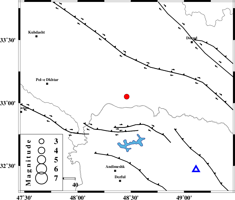
| Location | Lat:33.05 Lon: 48.46 |
| Region | Lorestan Province, 49 km South of Khorramabad |
Nearest Cities |
|
| 33 km North East of Sorkhakan, Khoozestan Province | |
| 36 km South West of Chamsangar, Lorestan Province | |
| 39 km North East of Bidruyeh, Khoozestan Province | |
| 39 km South East of Daraei, Lorestan Province | |
| 40 km South West of Emanabad, Lorestan Province | |
| Depth | 14 km |
| Agency | |
Faults within 150 km: |
|
| BALARUD_F_Z2 (Length: 58 km) , Distance to epicenter: 26 km | |
| BALARUD_F_Z3 (Length: 53 km) , Distance to epicenter: 31 km | |
| HZF4 (Length: 492 km) , Distance to epicenter: 33 km | |
| Number of Phases | 4 |
| RMS | 0.2 |
| Number of Stations | 4 |
| Error in Latitude | >29.1 km |
| Error in Longitude | 11 km |
| Error in Depth | 13.5 km |
Download waveform in seisan format
to download seisan software Click here
to access information about IIEES stations Click here
Amplitude | ||||||||
| UID | Agency | Station | Component | Amplitude | Period | Arrival Time | Proccessing Time | Signal Clip |
| 69557 | IIEES | KHMZ | E | 194.1 | 0.19 | 2010-08-24 12:51:22 | 2010-08-29 12:45:00 | n |
| 69558 | IIEES | ASAO | N | 148 | 1.63 | 2010-08-24 12:51:38 | 2010-08-29 12:45:00 | n |
| 69559 | IIEES | ASAO | E | 112.1 | 1.18 | 2010-08-24 12:51:39 | 2010-08-29 12:45:00 | n |
| 69560 | IIEES | SNGE | E | 143.6 | 1.37 | 2010-08-24 12:51:49 | 2010-08-29 12:45:00 | n |
| 69561 | IIEES | SNGE | N | 109.6 | 0.12 | 2010-08-24 12:51:53 | 2010-08-29 12:45:00 | n |
Phase | ||||||||||||
| Agency | Station | Component | Phase Type | Phase Quality | First Motion | Observed Arrival Time | Time Residual | Loc. Flag | Input Weight | Distance | Azimuth | |
| IIEES | KHMZ | Z | Pg | E | 2010-08-24 12:50:50 | -0.3 | y | 160 | 61 | |||
| IIEES | ASAO | Z | Pg | E | 2010-08-24 12:51:00 | 0.1 | y | 221 | 41 | |||
| IIEES | SNGE | Z | Pg | E | 2010-08-24 12:51:05 | -0.1 | y | 249 | 336 | |||
| IIEES | GHVR | Z | Pn | E | 2010-08-24 12:51:10 | 0.2 | y | 303 | 58 | |||