
Magnitude |
4.4 |
| Date & Time (UTC) | 2011-01-05 16:32:25.4 |
| Date & Time (Local) | 1389/10/15 20:02:25.4 |
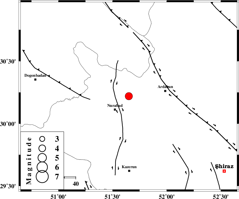
| Location | Lat:30.22 Lon: 51.65 |
| Region | Fars Province, 17 km North-East of Nurabad |
Nearest Cities |
|
| 14 km East of Masiri, Fars Province | |
| 17 km North East of Nurabad, Fars Province | |
| 19 km North East of Fahlian-e olia, Fars Province | |
| 19 km North East of Gachgaran, Fars Province | |
| 24 km North East of Ahangari, Fars Province | |
| Depth | 45 km |
| Agency | |
Faults within 150 km: |
|
| KAZERUN_F (Length: 96 km) , Distance to epicenter: 12 km | |
| HZF3 (Length: 197 km) , Distance to epicenter: 33 km | |
| MISHAN_F (Length: 76 km) , Distance to epicenter: 34 km | |
| Number of Phases | 7 |
| RMS | 0.1 |
| Number of Stations | 6 |
| Error in Latitude | >2.6 km |
| Error in Longitude | 3.3 km |
| Error in Depth | 5.7 km |
Download waveform in seisan format
to download seisan software Click here
to access information about IIEES stations Click here
Amplitude | ||||||||
| UID | Agency | Station | Component | Amplitude | Period | Arrival Time | Proccessing Time | Signal Clip |
| 76884 | IIEES | AHRM | E | 4928.8 | 0.92 | 2011-01-05 16:33:13 | 2011-01-05 04:50:00 | n |
| 76885 | IIEES | AHRM | N | 3432.1 | 0.56 | 2011-01-05 16:33:14 | 2011-01-05 04:50:00 | n |
| 76886 | IIEES | GHIR | N | 2179.6 | 0.72 | 2011-01-05 16:33:46 | 2011-01-05 04:50:00 | n |
| 76887 | IIEES | GHIR | E | 1691.1 | 0.56 | 2011-01-05 16:33:52 | 2011-01-05 04:50:00 | n |
| 76888 | IIEES | SHGR | E | 1330.3 | 0.6 | 2011-01-05 16:34:19 | 2011-01-05 04:50:00 | n |
| 76889 | IIEES | SHGR | N | 1080.7 | 0.76 | 2011-01-05 16:34:22 | 2011-01-05 04:50:00 | n |
Phase | ||||||||||||
| Agency | Station | Component | Phase Type | Phase Quality | First Motion | Observed Arrival Time | Time Residual | Loc. Flag | Input Weight | Distance | Azimuth | |
| IIEES | AHRM | Z | Pg | E | 2011-01-05 16:32:51 | 0.1 | y | 154 | 193 | |||
| IIEES | AHRM | E | Sg | E | 2011-01-05 16:33:09 | -0.1 | y | 154 | 193 | |||
| IIEES | GHIR | Z | Pn | E | 2011-01-05 16:33:01 | 0 | y | 251 | 149 | |||
| IIEES | NASN | Z | Pn | E | 2011-01-05 16:33:08 | -0.1 | y | 306 | 21 | |||
| IIEES | SHGR | Z | P | E | 2011-01-05 16:33:12 | 0.1 | y | 343 | 308 | |||
| IIEES | KRBR | Z | P | E | 2011-01-05 16:33:31 | 0.2 | y | 493 | 92 | |||
| IIEES | SNGE | Z | P | E | 2011-01-05 16:33:54 | 0 | y | 675 | 324 | |||