
Magnitude |
3 |
| Date & Time (UTC) | 2011-04-09 02:43:50.1 |
| Date & Time (Local) | 1390/1/20 07:13:50.1 |
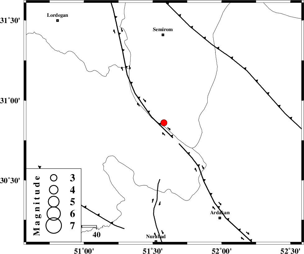
| Location | Lat:30.86 Lon: 51.58 |
| Region | Esfahan Province, 12 km East of Sisakht |
Nearest Cities |
|
| 12 km East of Sisakht, Kohkiluieh va boyerahmad Province | |
| 16 km North East of Kerik, Kohkiluieh va boyerahmad Province | |
| 21 km North of Yasuj, Kohkiluieh va boyerahmad Province | |
| 22 km West of Bideh, Esfahan Province | |
| 23 km South of Kameh, Esfahan Province | |
| Depth | 15 km |
| Agency | |
Faults within 150 km: |
|
| DENA_F (Length: 137 km) , Distance to epicenter: 10 km | |
| HZF3 (Length: 197 km) , Distance to epicenter: 18 km | |
| KAZERUN_F (Length: 96 km) , Distance to epicenter: 39 km | |
| Number of Phases | 5 |
| RMS | 0 |
| Number of Stations | 4 |
| Error in Latitude | >1.8 km |
| Error in Longitude | 1.5 km |
| Error in Depth | 4.3 km |
Download waveform in seisan format
to download seisan software Click here
to access information about IIEES stations Click here
Amplitude | ||||||||
| UID | Agency | Station | Component | Amplitude | Period | Arrival Time | Proccessing Time | Signal Clip |
| 78640 | IIEES | SHGR | N | 84.3 | 0.48 | 2011-04-09 02:45:26 | 2011-04-09 03:15:00 | n |
| 78641 | IIEES | SHGR | E | 102.1 | 0.52 | 2011-04-09 02:45:33 | 2011-04-09 03:15:00 | n |
| 78642 | IIEES | GHIR | E | 41.3 | 0.4 | 2011-04-09 02:45:36 | 2011-04-09 03:15:00 | n |
| 78643 | IIEES | GHIR | N | 64 | 0.36 | 2011-04-09 02:45:38 | 2011-04-09 03:15:00 | n |
| 78644 | IIEES | ASAO | N | 20.4 | 0.76 | 2011-04-09 02:46:02 | 2011-04-09 03:15:00 | n |
| 78645 | IIEES | ASAO | E | 19.8 | 0.76 | 2011-04-09 02:46:09 | 2011-04-09 03:15:00 | n |
Phase | ||||||||||||
| Agency | Station | Component | Phase Type | Phase Quality | First Motion | Observed Arrival Time | Time Residual | Loc. Flag | Input Weight | Distance | Azimuth | |
| IIEES | NASN | Z | Pn | E | 2011-04-09 02:44:28 | 0 | y | 245 | 28 | |||
| IIEES | NASN | E | Sg | E | 2011-04-09 02:44:59 | 0 | y | 245 | 28 | |||
| IIEES | SHGR | N | Sg | E | 2011-04-09 02:45:13 | 0 | y | 298 | 298 | |||
| IIEES | GHIR | Z | Pn | E | 2011-04-09 02:44:37 | 0 | y | 316 | 154 | |||
| IIEES | ASAO | Z | Pn | E | 2011-04-09 02:44:51 | 0 | y | 434 | 341 | |||