
Magnitude |
2.5 |
| Date & Time (UTC) | 2011-05-17 02:29:55.2 |
| Date & Time (Local) | 1390/2/27 06:59:55.2 |
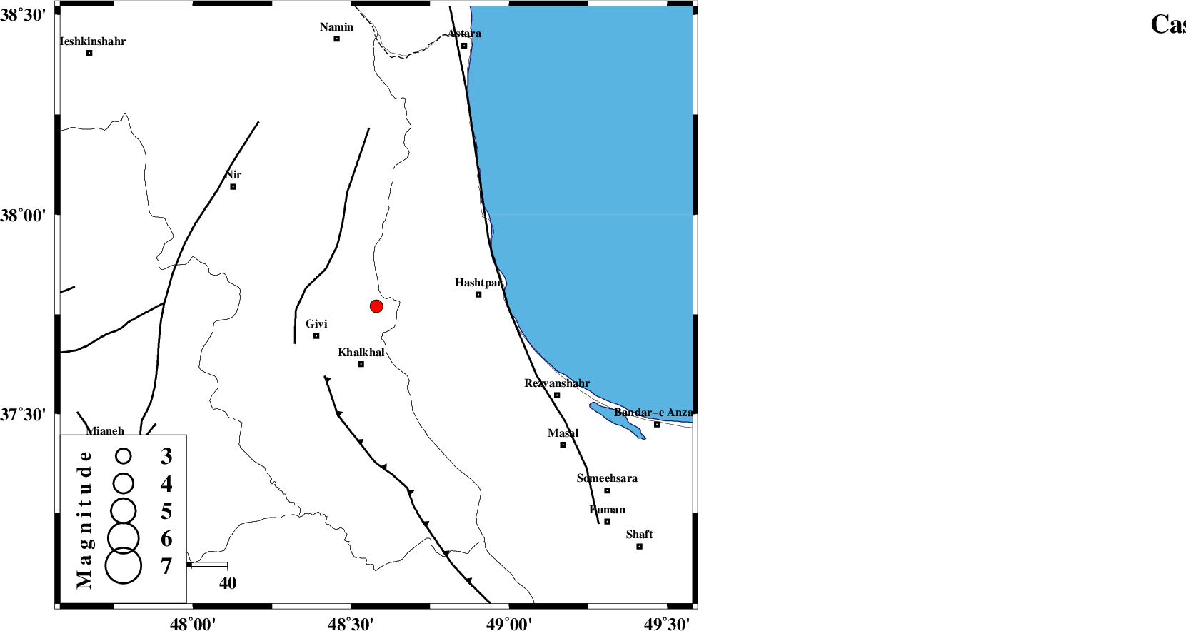
| Location | Lat:37.77 Lon: 48.58 |
| Region | Ardebil Province, 17 km North of Khalkhal |
Nearest Cities |
|
| 17 km North of Khalkhal, Ardebil Province | |
| 19 km North East of Givi, Ardebil Province | |
| 19 km North of Khojin, Ardebil Province | |
| 21 km West of Kish dini, Gilan Province | |
| 28 km North East of Gazaz, Ardebil Province | |
| Depth | 29 km |
| Agency | |
Faults within 150 km: |
|
| SANGAVAR_F (Length: 61 km) , Distance to epicenter: 18 km | |
| MASULEL_F (Length: 90 km) , Distance to epicenter: 24 km | |
| TALESH_F (Length: 258 km) , Distance to epicenter: 36 km | |
| Number of Phases | 5 |
| RMS | 0.2 |
| Number of Stations | 4 |
| Error in Latitude | >2.7 km |
| Error in Longitude | 7.3 km |
| Error in Depth | 6.1 km |
Download waveform in seisan format
to download seisan software Click here
to access information about IIEES stations Click here
Amplitude | ||||||||
| UID | Agency | Station | Component | Amplitude | Period | Arrival Time | Proccessing Time | Signal Clip |
| 79035 | IIEES | ZNJK | N | 61.9 | 0.2 | 2011-05-17 02:30:33 | 2011-05-17 02:44:00 | n |
| 79036 | IIEES | ZNJK | E | 96.8 | 0.4 | 2011-05-17 02:30:33 | 2011-05-17 02:44:00 | n |
| 79037 | IIEES | GRMI | E | 119.8 | 0.2 | 2011-05-17 02:30:36 | 2011-05-17 02:44:00 | n |
| 79038 | IIEES | GRMI | N | 185.5 | 0.48 | 2011-05-17 02:30:37 | 2011-05-17 02:44:00 | n |
Phase | ||||||||||||
| Agency | Station | Component | Phase Type | Phase Quality | First Motion | Observed Arrival Time | Time Residual | Loc. Flag | Input Weight | Distance | Azimuth | |
| IIEES | ZNJK | Z | Pg | E | 2011-05-17 02:30:15 | 0 | y | 123 | 176 | |||
| IIEES | GRMI | Z | Pg | E | 2011-05-17 02:30:16 | -0.3 | y | 130 | 333 | |||
| IIEES | GRMI | E | Sg | E | 2011-05-17 02:30:32 | 0.2 | y | 130 | 333 | |||
| IIEES | CHTH | Z | Pn | E | 2011-05-17 02:30:39 | 0 | y | 307 | 132 | |||
| IIEES | SNGE | Z | Pn | E | 2011-05-17 02:30:41 | 0 | y | 317 | 201 | |||