
Magnitude |
4 |
| Date & Time (UTC) | 2011-08-21 01:54:46.4 |
| Date & Time (Local) | 1390/5/30 06:24:46.4 |
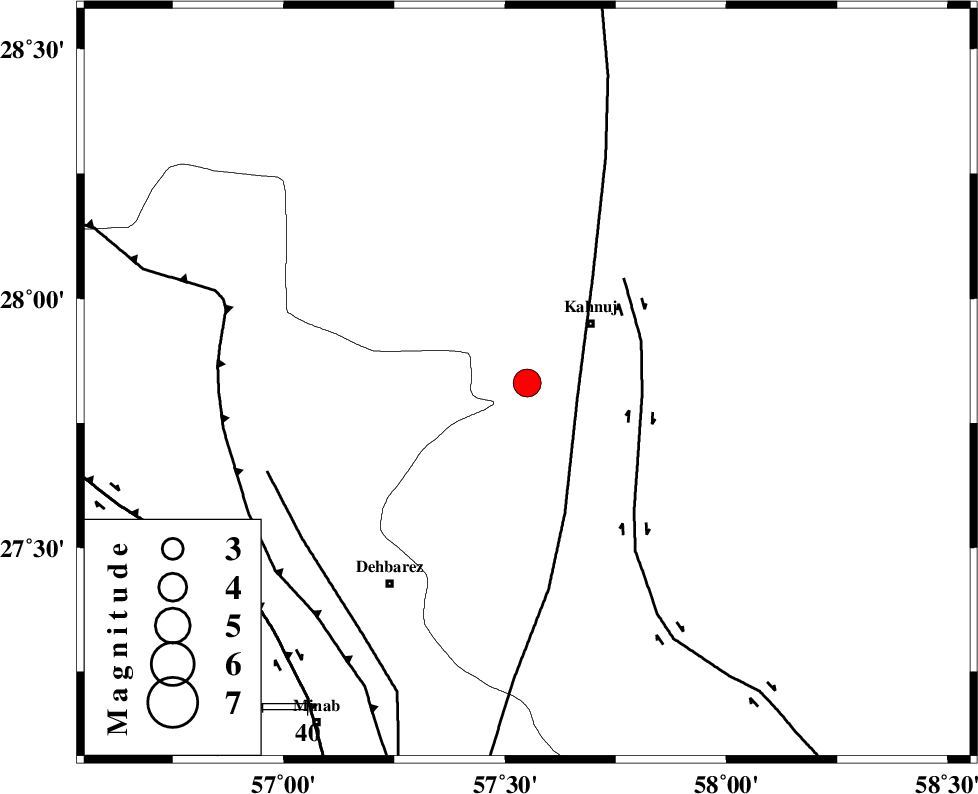
| Location | Lat:27.83 Lon: 57.55 |
| Region | Kerman Province, 19 km South-West of Kahnuj |
Nearest Cities |
|
| 19 km South West of Kahnuj, Kerman Province | |
| 24 km North West of Bargah, Kerman Province | |
| 27 km North East of Fariab, Hormozgan Province | |
| 27 km North of Bejogan, Kerman Province | |
| 32 km South East of Mehrueye-e paeen, Kerman Province | |
| Depth | 31 km |
| Agency | |
Faults within 150 km: |
|
| SABZEVARAN_F (Length: 190 km) , Distance to epicenter: 12 km | |
| JIROFT_F (Length: 144 km) , Distance to epicenter: 26 km | |
| ZENDAN_MINAB_F_Z1 (Length: 183 km) , Distance to epicenter: 61 km | |
| Number of Phases | 4 |
| RMS | 0 |
| Number of Stations | 4 |
| Error in Latitude | >2.9 km |
| Error in Longitude | 3.1 km |
| Error in Depth | 4.2 km |
Download waveform in seisan format
to download seisan software Click here
to access information about IIEES stations Click here
Amplitude | ||||||||
| UID | Agency | Station | Component | Amplitude | Period | Arrival Time | Proccessing Time | Signal Clip |
| 80050 | IIEES | BNDS | N | 2744.4 | 0.21 | 2011-08-21 01:55:33 | 2011-08-21 02:26:00 | n |
| 80051 | IIEES | BNDS | E | 2959.2 | 0.1 | 2011-08-21 01:55:35 | 2011-08-21 02:26:00 | n |
| 80052 | IIEES | KRBR | E | 564.8 | 0.3 | 2011-08-21 01:56:03 | 2011-08-21 02:26:00 | n |
| 80053 | IIEES | KRBR | N | 1357 | 0.9 | 2011-08-21 01:56:06 | 2011-08-21 02:26:00 | n |
| 80054 | IIEES | GHIR | E | 111.6 | 0.73 | 2011-08-21 01:56:45 | 2011-08-21 02:26:00 | n |
Phase | ||||||||||||
| Agency | Station | Component | Phase Type | Phase Quality | First Motion | Observed Arrival Time | Time Residual | Loc. Flag | Input Weight | Distance | Azimuth | |
| IIEES | BNDS | Z | Pg | E | 2011-08-21 01:55:10 | 0 | y | 144 | 251 | |||
| IIEES | KRBR | Z | Pg | E | 2011-08-21 01:55:26 | 0 | y | 251 | 342 | |||
| IIEES | ZHSF | Z | Pn | E | 2011-08-21 01:55:38 | 0 | y | 372 | 57 | |||
| IIEES | GHIR | Z | Pn | E | 2011-08-21 01:55:48 | 0 | y | 452 | 277 | |||