
Magnitude |
2.8 |
| Date & Time (UTC) | 2011-11-02 14:18:12.7 |
| Date & Time (Local) | 1390/8/11 17:48:12.7 |
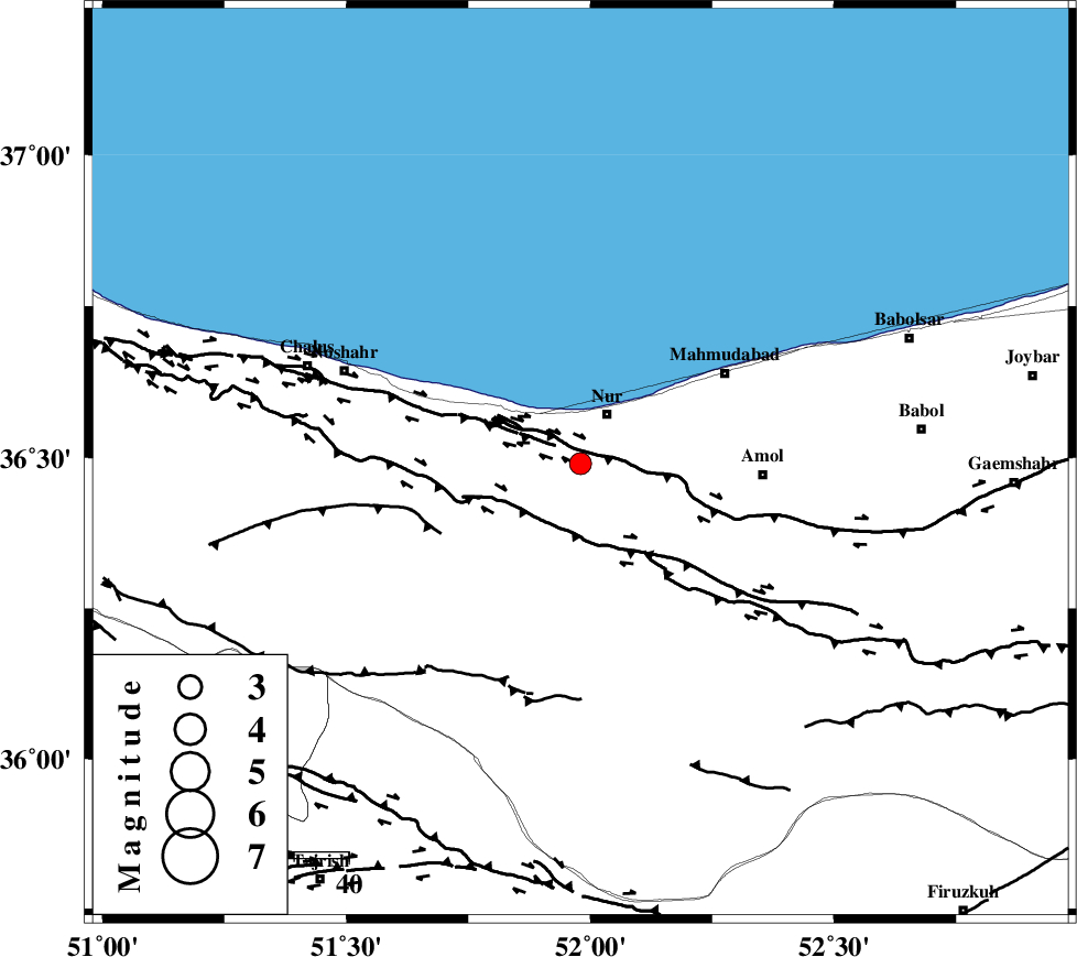
| Location | Lat:36.49 Lon: 51.98 |
| Region | Mazandaran Province, 11 km Nur |
Nearest Cities |
|
| 10 km of Nur, Mazandaran Province | |
| 11 km East of Narenj bon, Mazandaran Province | |
| 12 km North West of Chamestan, Mazandaran Province | |
| 18 km West of Eizdeh, Mazandaran Province | |
| 26 km North East of Kujur, Mazandaran Province | |
| Depth | 16 km |
| Agency | |
Faults within 150 km: |
|
| KHAZAR_F (Length: 523 km) , Distance to epicenter: 7 km | |
| N_ALBORZ_F (Length: 360 km) , Distance to epicenter: 13 km | |
| KOJOOR (Length: 75 km) , Distance to epicenter: 29 km | |
| Number of Phases | 6 |
| RMS | 0 |
| Number of Stations | 4 |
| Error in Latitude | >3.4 km |
| Error in Longitude | 4.6 km |
| Error in Depth | 4.3 km |
Download waveform in seisan format
to download seisan software Click here
to access information about IIEES stations Click here
Amplitude | ||||||||
| UID | Agency | Station | Component | Amplitude | Period | Arrival Time | Proccessing Time | Signal Clip |
| 80597 | IIEES | THKV | N | 190.4 | 0.36 | 2011-11-02 14:18:48 | 2011-11-02 02:04:00 | n |
| 80598 | IIEES | THKV | E | 325.1 | 0.48 | 2011-11-02 14:18:48 | 2011-11-02 02:04:00 | n |
Phase | ||||||||||||
| Agency | Station | Component | Phase Type | Phase Quality | First Motion | Observed Arrival Time | Time Residual | Loc. Flag | Input Weight | Distance | Azimuth | |
| IIEES | CHTH | Z | Pg | E | 2011-11-02 14:18:29 | 0 | y | 100 | 230 | |||
| IIEES | THKV | Z | Pg | E | 2011-11-02 14:18:32 | 0 | y | 118 | 238 | |||
| IIEES | THKV | N | Sg | E | 2011-11-02 14:18:47 | 0.01 | y | 118 | 238 | |||
| IIEES | GHVR | Z | Pn | E | 2011-11-02 14:18:49 | 0.02 | y | 233 | 197 | |||
| IIEES | ASAO | Z | Pn | E | 2011-11-02 14:18:55 | -0.01 | y | 279 | 220 | |||
| IIEES | ASAO | E | Sg | E | 2011-11-02 14:19:31 | -0.01 | y | 279 | 220 | |||