
Magnitude |
3.2 |
| Date & Time (UTC) | 2011-12-09 03:34:12.5 |
| Date & Time (Local) | 1390/9/18 07:04:12.5 |
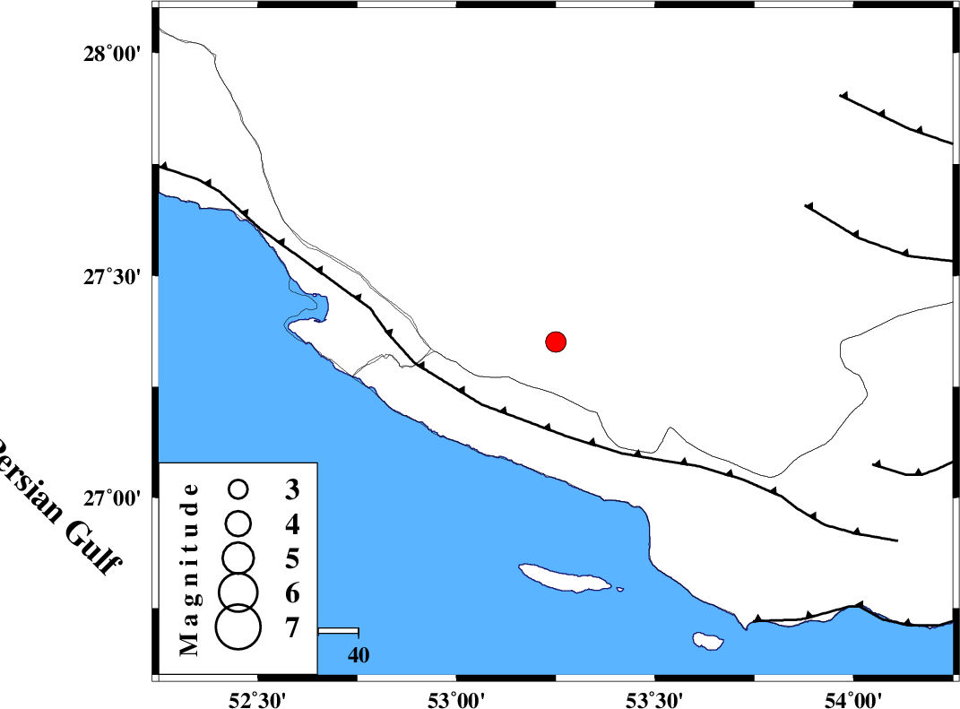
| Location | Lat:27.35 Lon: 53.25 |
| Region | Fars Province, 9 km Lamerd |
Nearest Cities |
|
| 8 km North of Lamerd, Fars Province | |
| 28 km West of Beyram, Fars Province | |
| 29 km East of Khoozi, Fars Province | |
| 38 km South West of Fedagh, Fars Province | |
| 39 km North West of Ashkenan, Fars Province | |
| Depth | 6 km |
| Agency | |
Faults within 150 km: |
|
| MFF3 (Length: 292 km) , Distance to epicenter: 24 km | |
| LAR_F (Length: 99 km) , Distance to epicenter: 71 km | |
| MFF1 (Length: 180 km) , Distance to epicenter: 85 km | |
| Number of Phases | 5 |
| RMS | 0.2 |
| Number of Stations | 4 |
| Error in Latitude | >6.1 km |
| Error in Longitude | 4.4 km |
| Error in Depth | 9 km |
Download waveform in seisan format
to download seisan software Click here
to access information about IIEES stations Click here
Amplitude | ||||||||
| UID | Agency | Station | Component | Amplitude | Period | Arrival Time | Proccessing Time | Signal Clip |
| 80936 | IIEES | GHIR | E | 784.6 | 0.39 | 2011-12-09 03:34:50 | 2011-12-09 03:49:00 | n |
| 80937 | IIEES | GHIR | N | 757.3 | 0.36 | 2011-12-09 03:34:54 | 2011-12-09 03:49:00 | n |
| 80938 | IIEES | KRBR | N | 21.7 | 0.56 | 2011-12-09 03:36:11 | 2011-12-09 03:49:00 | n |
| 80939 | IIEES | KRBR | E | 28.8 | 0.64 | 2011-12-09 03:36:11 | 2011-12-09 03:49:00 | n |
Phase | ||||||||||||
| Agency | Station | Component | Phase Type | Phase Quality | First Motion | Observed Arrival Time | Time Residual | Loc. Flag | Input Weight | Distance | Azimuth | |
| IIEES | GHIR | Z | Pg | E | 2011-12-09 03:34:30 | -0.21 | y | 107 | 346 | |||
| IIEES | GHIR | N | Sg | E | 2011-12-09 03:34:45 | 0.17 | y | 107 | 346 | |||
| IIEES | AHRM | N | Pn | E | 2011-12-09 03:34:52 | 0.04 | y | 255 | 312 | |||
| IIEES | BNDS | Z | Pn | E | 2011-12-09 03:34:57 | 0.22 | y | 289 | 88 | |||
| IIEES | KRBR | Z | Pn | E | 2011-12-09 03:35:17 | -0.27 | y | 450 | 49 | |||