
Magnitude |
3.6 |
| Date & Time (UTC) | 2012-01-07 15:12:23.2 |
| Date & Time (Local) | 1390/10/17 18:42:23.2 |
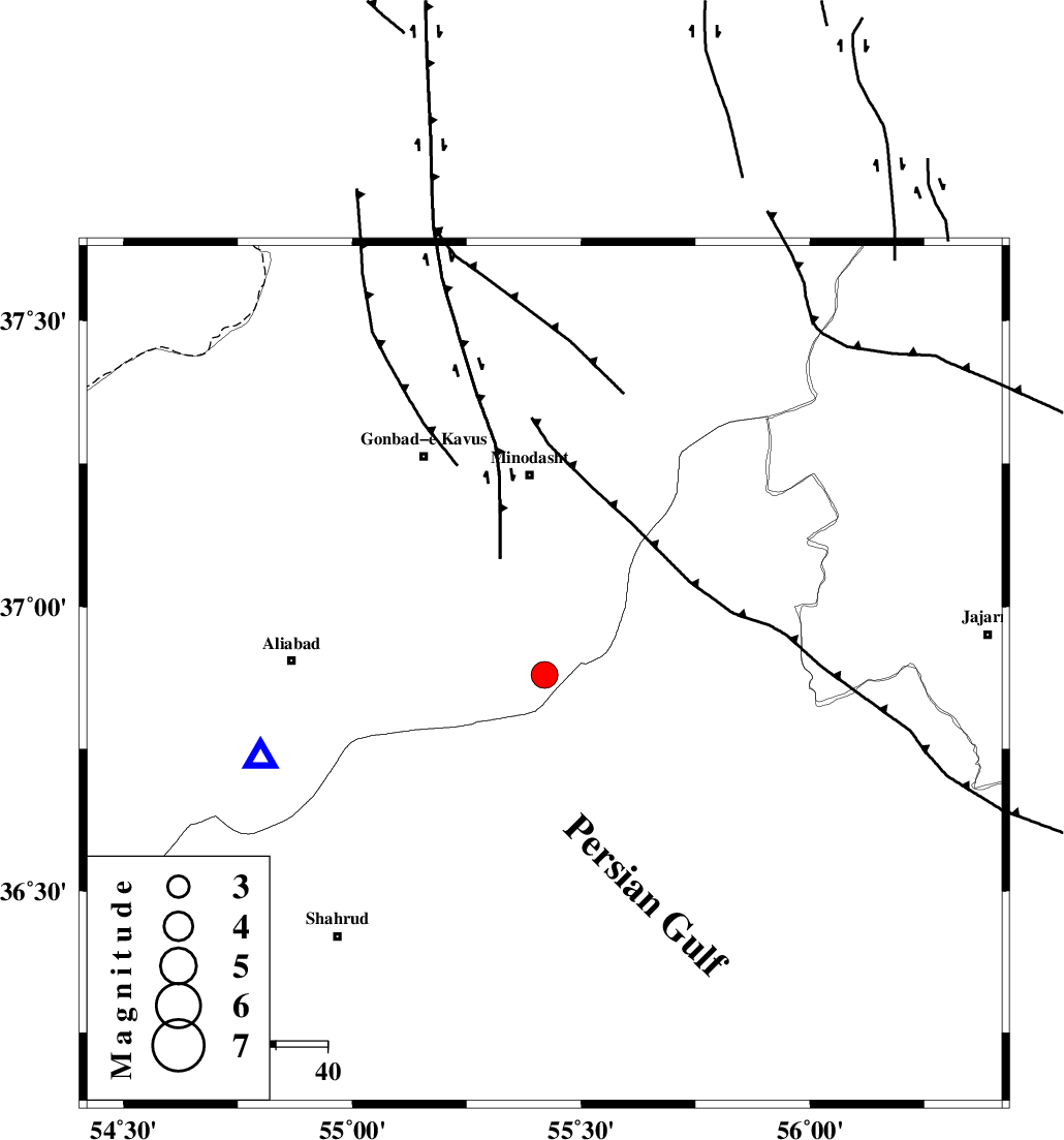
| Location | Lat:36.88 Lon: 55.42 |
| Region | Golestan Province, 39 km South of Minodasht |
Nearest Cities |
|
| 8 km of Farsian, Golestan Province | |
| 19 km South of Qale-ye qafeh, Golestan Province | |
| 23 km South West of Qaleh qafeh, Semnan Province | |
| 25 km North East of Kalateh khanj, Semnan Province | |
| 28 km South East of Khanduz, Golestan Province | |
| Depth | 14 km |
| Agency | |
Faults within 150 km: |
|
| ROBATE_QARABIL_F (Length: 168 km) , Distance to epicenter: 2 km | |
| SHAVAR_F (Length: 87 km) , Distance to epicenter: 22 km | |
| KHAZAR_F (Length: 523 km) , Distance to epicenter: 43 km | |
| Number of Phases | 6 |
| RMS | 0.3 |
| Number of Stations | 6 |
| Error in Latitude | >2.6 km |
| Error in Longitude | 5.8 km |
| Error in Depth | 9.3 km |
Download waveform in seisan format
to download seisan software Click here
to access information about IIEES stations Click here
Amplitude | ||||||||
| UID | Agency | Station | Component | Amplitude | Period | Arrival Time | Proccessing Time | Signal Clip |
| 81281 | IIEES | GHVR | E | 70.4 | 0.6 | 2012-01-07 15:14:49 | 2012-01-07 02:44:00 | n |
| 81282 | IIEES | ZNJK | E | 16.6 | 0.48 | 2012-01-07 15:14:10 | 2012-01-07 02:44:00 | n |
| 81283 | IIEES | GRMI | N | 25.4 | 0.56 | 2012-01-07 15:15:07 | 2012-01-07 02:44:00 | n |
| 81284 | IIEES | GRMI | E | 25.7 | 0.72 | 2012-01-07 15:15:14 | 2012-01-07 02:44:00 | n |
Phase | ||||||||||||
| Agency | Station | Component | Phase Type | Phase Quality | First Motion | Observed Arrival Time | Time Residual | Loc. Flag | Input Weight | Distance | Azimuth | |
| IIEES | MRVT | Z | Pg | E | 2012-01-07 15:12:40 | -0.08 | y | 105 | 34 | |||
| IIEES | SHRO | Z | Pg | E | 2012-01-07 15:12:41 | -0.59 | y | 110 | 151 | |||
| IIEES | SHRO | E | Sg | E | 2012-01-07 15:12:55 | 0.32 | y | 110 | 151 | |||
| IIEES | BJRD | Z | Pn | E | 2012-01-07 15:12:55 | 0.05 | y | 198 | 62 | |||
| IIEES | BJRD | E | Sg | E | 2012-01-07 15:13:19 | 0.1 | y | 198 | 62 | |||
| IIEES | GHVR | Z | Pn | E | 2012-01-07 15:13:28 | 0.26 | y | 462 | 236 | |||