
Magnitude |
3.1 |
| Date & Time (UTC) | 2012-05-18 04:34:45.3 |
| Date & Time (Local) | 1391/2/29 09:04:45.3 |
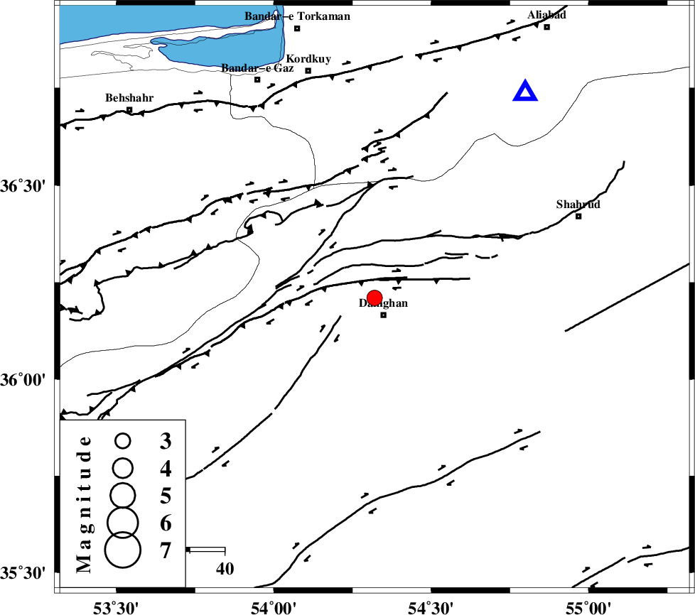
| Location | Lat:36.21 Lon: 54.32 |
| Region | Semnan Province, 6 km Damghan |
Nearest Cities |
|
| 6 km North of Damghan, Semnan Province | |
| 21 km West of Mehmandust, Semnan Province | |
| 23 km North East of Seydabad, Semnan Province | |
| 25 km North East of Amirabad, Semnan Province | |
| 40 km South West of Cheharbagh, Golestan Province | |
| Depth | 38 km |
| Agency | |
Faults within 150 km: |
|
| ATARI_F (Length: 185 km) , Distance to epicenter: 9 km | |
| DAMGHAN_F (Length: 95 km) , Distance to epicenter: 10 km | |
| ASTANEH_F (Length: 72 km) , Distance to epicenter: 22 km | |
| Number of Phases | 7 |
| RMS | 0.1 |
| Number of Stations | 6 |
| Error in Latitude | >3.8 km |
| Error in Longitude | 1.6 km |
| Error in Depth | 2.9 km |
Download waveform in seisan format
to download seisan software Click here
to access information about IIEES stations Click here
Amplitude | ||||||||
| UID | Agency | Station | Component | Amplitude | Period | Arrival Time | Proccessing Time | Signal Clip |
| 83652 | IIEES | DAMV | E | 121.4 | 0.44 | 2012-05-18 04:35:51 | 2012-05-18 05:11:00 | n |
| 83653 | IIEES | THKV | E | 108.7 | 0.56 | 2012-05-18 04:36:26 | 2012-05-18 05:11:00 | n |
| 83654 | IIEES | GHVR | E | 62.8 | 0.44 | 2012-05-18 04:36:27 | 2012-05-18 05:11:00 | n |
| 83655 | IIEES | GHVR | N | 43.1 | 0.52 | 2012-05-18 04:36:33 | 2012-05-18 05:11:00 | n |
Phase | ||||||||||||
| Agency | Station | Component | Phase Type | Phase Quality | First Motion | Observed Arrival Time | Time Residual | Loc. Flag | Input Weight | Distance | Azimuth | |
| IIEES | SHRO | Z | Pg | E | 2012-05-18 04:35:10 | -0.01 | y | 155 | 98 | |||
| IIEES | DAMV | Z | Pn | E | 2012-05-18 04:35:18 | -0.23 | y | 221 | 254 | |||
| IIEES | MRVT | Z | Pn | E | 2012-05-18 04:35:18 | 0.02 | y | 225 | 44 | |||
| IIEES | CHTH | Z | Pn | E | 2012-05-18 04:35:27 | 0.07 | y | 289 | 264 | |||
| IIEES | CHTH | N | Sg | E | 2012-05-18 04:36:05 | 0.01 | y | 289 | 264 | |||
| IIEES | THKV | Z | Pn | E | 2012-05-18 04:35:29 | 0.02 | y | 311 | 265 | |||
| IIEES | GHVR | Z | Pn | E | 2012-05-18 04:35:33 | 0.14 | y | 339 | 236 | |||