
Magnitude |
2.6 |
| Date & Time (UTC) | 2012-09-22 04:53:31.6 |
| Date & Time (Local) | 1391/7/1 08:23:31.6 |
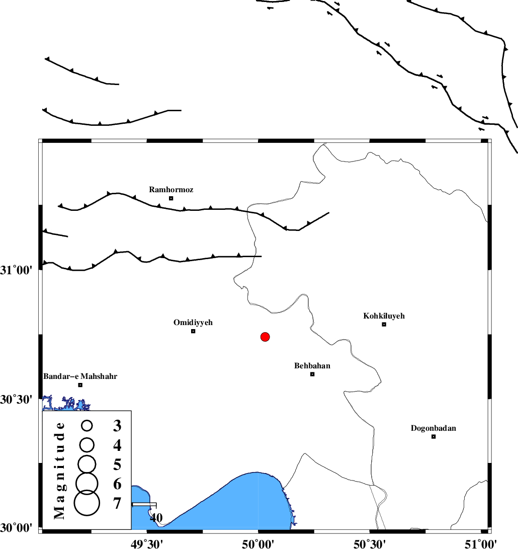
| Location | Lat:30.74 Lon: 50.03 |
| Region | Khoozestan Province, 25 km North-West of Behbahan |
Nearest Cities |
|
| 15 km East of Jolaki, Khoozestan Province | |
| 15 km North West of Dodange-ye bozorg, Khoozestan Province | |
| 19 km North East of Aghajari, Khoozestan Province | |
| 23 km South East of Jayzan, Khoozestan Province | |
| 26 km North West of Behbahan, Khoozestan Province | |
| Depth | 18 km |
| Agency | |
Faults within 150 km: |
|
| AGHAJARI_F (Length: 88 km) , Distance to epicenter: 20 km | |
| MFF4 (Length: 62 km) , Distance to epicenter: 27 km | |
| RAG_E_SEFID_F (Length: 84 km) , Distance to epicenter: 28 km | |
| Number of Phases | 5 |
| RMS | 0 |
| Number of Stations | 4 |
| Error in Latitude | >9.1 km |
| Error in Longitude | 9.1 km |
| Error in Depth | 9.2 km |
Download waveform in seisan format
to download seisan software Click here
to access information about IIEES stations Click here
Amplitude | ||||||||
| UID | Agency | Station | Component | Amplitude | Period | Arrival Time | Proccessing Time | Signal Clip |
| 86242 | IIEES | KHMZ | E | 19.3 | 0.5 | 2012-09-22 04:55:11 | 2012-09-22 06:11:00 | n |
| 86243 | IIEES | KHMZ | N | 16.6 | 0.66 | 2012-09-22 04:55:11 | 2012-09-22 06:11:00 | n |
Phase | ||||||||||||
| Agency | Station | Component | Phase Type | Phase Quality | First Motion | Observed Arrival Time | Time Residual | Loc. Flag | Input Weight | Distance | Azimuth | |
| IIEES | SHGR | Z | Pg | E | 2012-09-22 04:54:03 | 0.01 | y | 192 | 323 | |||
| IIEES | SHGR | E | Sg | E | 2012-09-22 04:54:26 | 0.02 | y | 192 | 323 | |||
| IIEES | KHMZ | Z | Pn | E | 2012-09-22 04:54:20 | -0.07 | y | 333 | 359 | |||
| IIEES | NASN | Z | Pn | E | 2012-09-22 04:54:22 | 0.04 | y | 348 | 48 | |||
| IIEES | YZKH | Z | Pn | E | 2012-09-22 04:54:37 | 0 | y | 470 | 66 | |||