
Magnitude |
3.1 |
| Date & Time (UTC) | 2012-11-01 19:31:01.7 |
| Date & Time (Local) | 1391/8/11 23:01:01.7 |
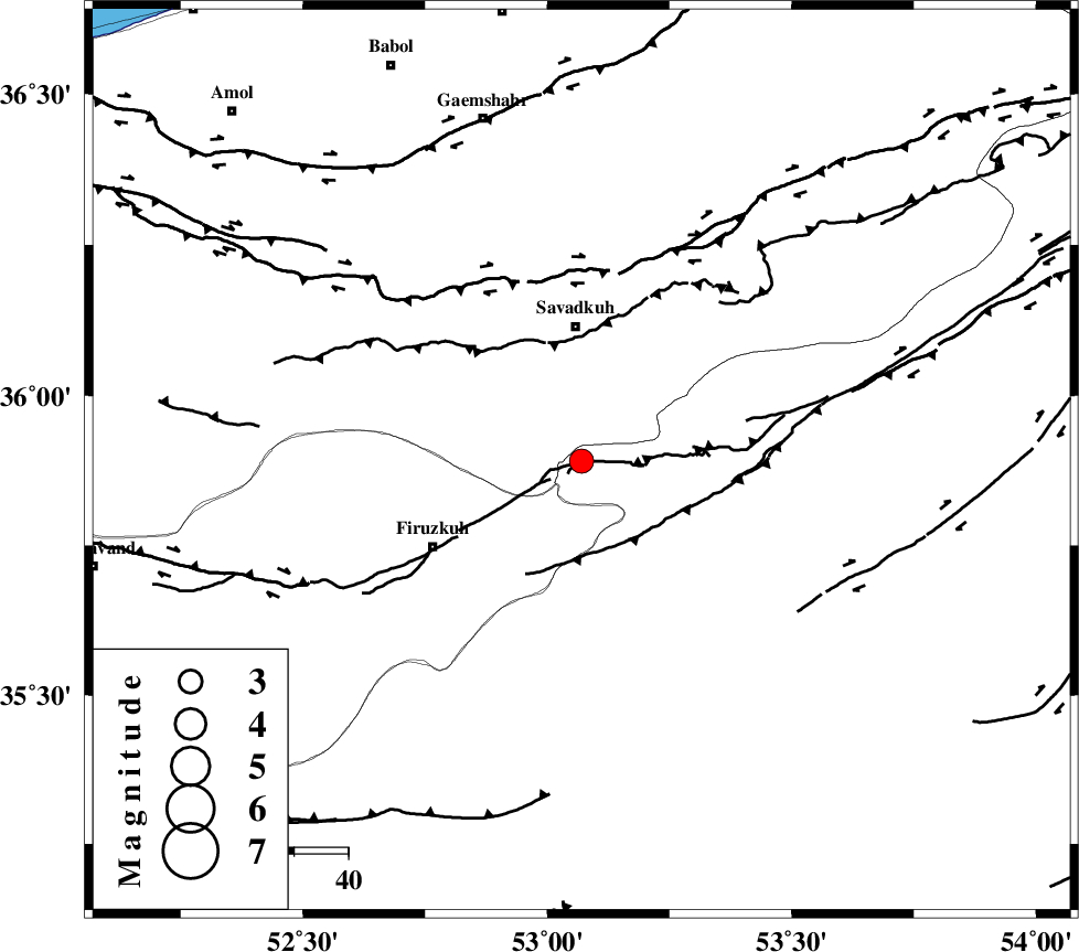
| Location | Lat:35.89 Lon: 53.07 |
| Region | Semnan Province, 25 km South of Pol-E-Sefid |
Nearest Cities |
|
| 17 km West of Chashem, Semnan Province | |
| 22 km South of Shurmast-e peyrudbar, Mazandaran Province | |
| 24 km South of Elahband, Mazandaran Province | |
| 24 km South West of Sangdeh, Mazandaran Province | |
| 25 km South of Pol-E-Sefid, Mazandaran Province | |
| Depth | 15 km |
| Agency | |
Faults within 150 km: |
|
| ATARI_F (Length: 185 km) , Distance to epicenter: 21 km | |
| N_ALBORZ_F (Length: 360 km) , Distance to epicenter: 35 km | |
| MOSHA_F (Length: 234 km) , Distance to epicenter: 44 km | |
| Number of Phases | 6 |
| RMS | 0.3 |
| Number of Stations | 6 |
| Error in Latitude | >8.1 km |
| Error in Longitude | 5.1 km |
| Error in Depth | 7.9 km |
Download waveform in seisan format
to download seisan software Click here
to access information about IIEES stations Click here
Amplitude | ||||||||
| UID | Agency | Station | Component | Amplitude | Period | Arrival Time | Proccessing Time | Signal Clip |
| 86807 | IIEES | GHVR | N | 152.6 | 0.36 | 2012-11-01 19:32:12 | 2012-11-01 07:22:00 | n |
| 86808 | IIEES | GHVR | E | 153.7 | 0.32 | 2012-11-01 19:32:13 | 2012-11-01 07:22:00 | n |
Phase | ||||||||||||
| Agency | Station | Component | Phase Type | Phase Quality | First Motion | Observed Arrival Time | Time Residual | Loc. Flag | Input Weight | Distance | Azimuth | |
| IIEES | CHTH | Z | Pg | E | 2012-11-01 19:31:30 | -0.3 | y | 175 | 271 | |||
| IIEES | THKV | Z | Pn | E | 2012-11-01 19:31:34 | 0.45 | y | 198 | 272 | |||
| IIEES | GHVR | Z | Pn | E | 2012-11-01 19:31:37 | -0.22 | y | 228 | 227 | |||
| IIEES | SHRO | Z | Pn | E | 2012-11-01 19:31:42 | 0.15 | y | 266 | 86 | |||
| IIEES | ASAO | Z | Pn | E | 2012-11-01 19:31:48 | 0.11 | y | 314 | 243 | |||
| IIEES | MRVT | Z | Pn | E | 2012-11-01 19:31:50 | -0.21 | y | 334 | 53 | |||