
Magnitude |
3.3 |
| Date & Time (UTC) | 2012-11-30 04:40:11.3 |
| Date & Time (Local) | 1391/9/10 08:10:11.3 |
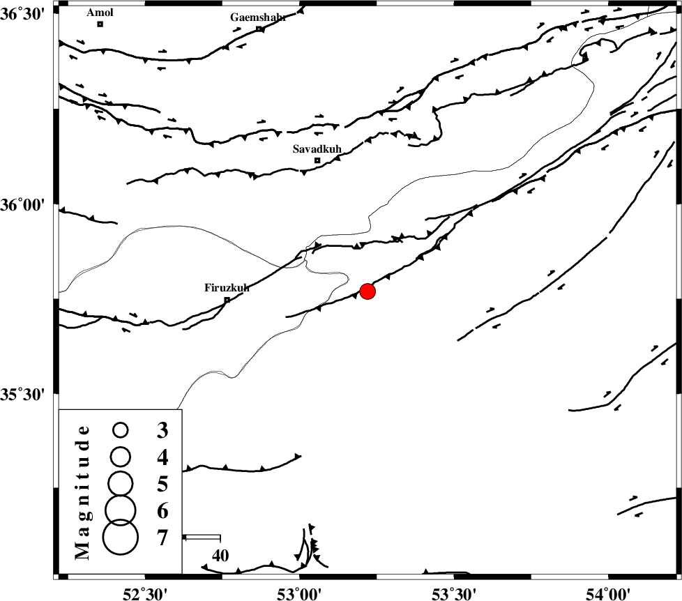
| Location | Lat:35.77 Lon: 53.22 |
| Region | Semnan Province, 28 km North-West of Semnan |
Nearest Cities |
|
| 10 km North West of Shahmirzad, Semnan Province | |
| 13 km North West of Mehdishahr, Semnan Province | |
| 14 km South of Chashem, Semnan Province | |
| 21 km North East of Aftar, Semnan Province | |
| 28 km North West of Semnan, Semnan Province | |
| Depth | 14 km |
| Agency | |
Faults within 150 km: |
|
| ATARI_F (Length: 185 km) , Distance to epicenter: 13 km | |
| N_ALBORZ_F (Length: 360 km) , Distance to epicenter: 49 km | |
| MOSHA_F (Length: 234 km) , Distance to epicenter: 53 km | |
| Number of Phases | 7 |
| RMS | 0.2 |
| Number of Stations | 7 |
| Error in Latitude | >4.6 km |
| Error in Longitude | 3.2 km |
| Error in Depth | 5.9 km |
Download waveform in seisan format
to download seisan software Click here
to access information about IIEES stations Click here
Amplitude | ||||||||
| UID | Agency | Station | Component | Amplitude | Period | Arrival Time | Proccessing Time | Signal Clip |
| 87208 | IIEES | THKV | E | 238.1 | 0.48 | 2012-11-30 04:41:19 | 2012-11-29 05:04:00 | n |
| 87209 | IIEES | GHVR | N | 233.8 | 0.44 | 2012-11-30 04:41:24 | 2012-11-29 05:04:00 | n |
| 87210 | IIEES | GHVR | E | 205.1 | 0.6 | 2012-11-30 04:41:25 | 2012-11-29 05:04:00 | n |
Phase | ||||||||||||
| Agency | Station | Component | Phase Type | Phase Quality | First Motion | Observed Arrival Time | Time Residual | Loc. Flag | Input Weight | Distance | Azimuth | |
| IIEES | DAMV | Z | Pg | E | 2012-11-30 04:40:30 | 0.1 | y | 114 | 262 | |||
| IIEES | CHTH | Z | Pg | E | 2012-11-30 04:40:42 | -0.26 | y | 190 | 275 | |||
| IIEES | THKV | Z | Pn | E | 2012-11-30 04:40:45 | 0.14 | y | 212 | 275 | |||
| IIEES | GHVR | Z | Pn | E | 2012-11-30 04:40:47 | -0.22 | y | 230 | 232 | |||
| IIEES | SHRO | Z | Pn | E | 2012-11-30 04:40:50 | -0.13 | y | 254 | 83 | |||
| IIEES | YZKH | Z | Pn | E | 2012-11-30 04:41:08 | 0.18 | y | 396 | 161 | |||
| IIEES | ZNJK | Z | Pn | E | 2012-11-30 04:41:11 | 0.31 | y | 420 | 285 | |||