
Magnitude |
3.2 |
| Date & Time (UTC) | 2012-12-30 06:41:18.1 |
| Date & Time (Local) | 1391/10/10 10:11:18.1 |
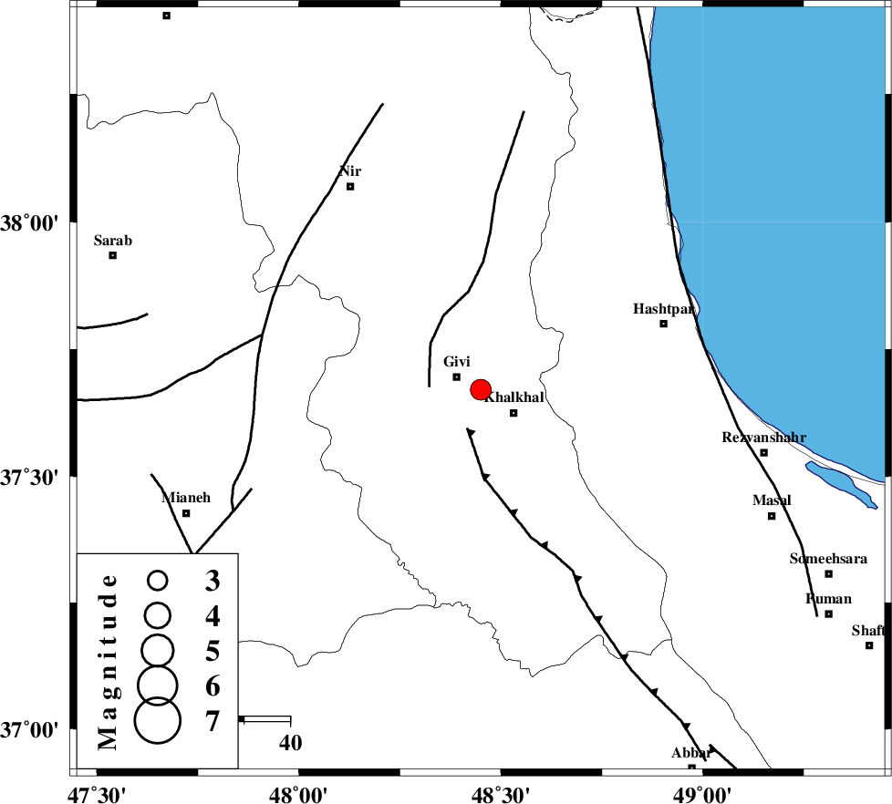
| Location | Lat:37.67 Lon: 48.45 |
| Region | Ardebil Province, 6 km Givi |
Nearest Cities |
|
| 6 km of Givi, Ardebil Province | |
| 9 km North of Khalkhal, Ardebil Province | |
| 12 km North West of Khojin, Ardebil Province | |
| 13 km North of Gazaz, Ardebil Province | |
| 17 km East of Ganjgah, Ardebil Province | |
| Depth | 14 km |
| Agency | |
Faults within 150 km: |
|
| MASULEL_F (Length: 90 km) , Distance to epicenter: 9 km | |
| SANGAVAR_F (Length: 61 km) , Distance to epicenter: 11 km | |
| BOZQUSH (Length: 70 km) , Distance to epicenter: 49 km | |
| Number of Phases | 7 |
| RMS | 0.1 |
| Number of Stations | 5 |
| Error in Latitude | >0.8 km |
| Error in Longitude | 3.1 km |
| Error in Depth | 2.6 km |
Download waveform in seisan format
to download seisan software Click here
to access information about IIEES stations Click here
Amplitude | ||||||||
| UID | Agency | Station | Component | Amplitude | Period | Arrival Time | Proccessing Time | Signal Clip |
| 87482 | IIEES | GRMI | N | 415.4 | 0.19 | 2012-12-30 06:42:02 | 2012-12-30 07:26:00 | n |
Phase | ||||||||||||
| Agency | Station | Component | Phase Type | Phase Quality | First Motion | Observed Arrival Time | Time Residual | Loc. Flag | Input Weight | Distance | Azimuth | |
| IIEES | ZNJK | Z | Pg | E | 2012-12-30 06:41:37 | 0.01 | y | 113 | 169 | |||
| IIEES | GRMI | Z | Pg | E | 2012-12-30 06:41:40 | -0.11 | y | 136 | 339 | |||
| IIEES | GRMI | E | Sg | E | 2012-12-30 06:41:57 | 0.05 | y | 136 | 339 | |||
| IIEES | SNGE | Z | Pn | E | 2012-12-30 06:42:03 | -0.09 | y | 302 | 199 | |||
| IIEES | SNGE | E | Sg | E | 2012-12-30 06:42:43 | 0.01 | y | 302 | 199 | |||
| IIEES | ASAO | Z | Pn | E | 2012-12-30 06:42:12 | 0.07 | y | 374 | 157 | |||
| IIEES | MAKU | Z | Pn | E | 2012-12-30 06:42:12 | 0.08 | y | 378 | 301 | |||