
Magnitude |
3 |
| Date & Time (UTC) | 2013-01-29 16:32:15.1 |
| Date & Time (Local) | 1391/11/10 20:02:15.1 |
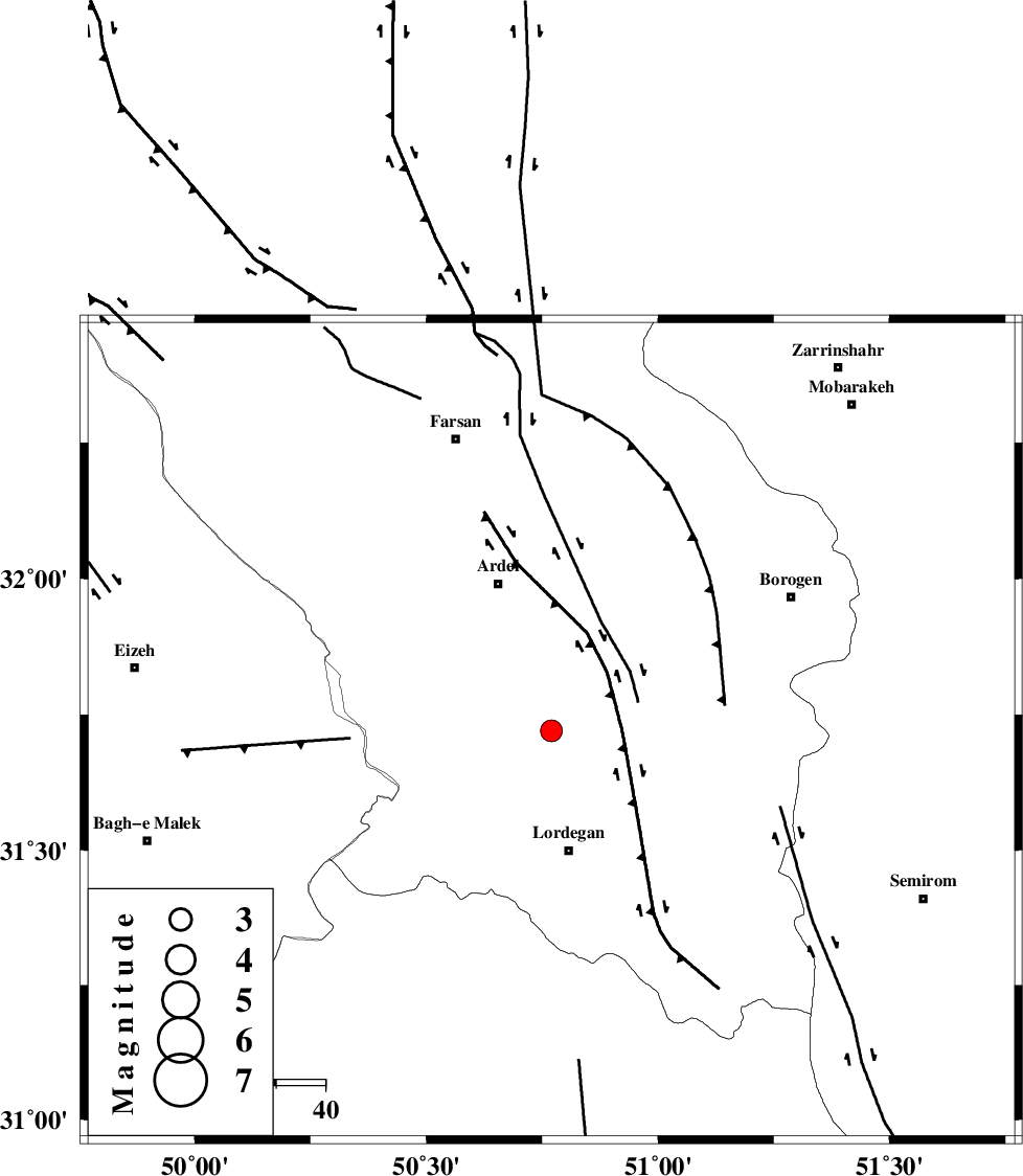
| Location | Lat:31.72 Lon: 50.77 |
| Region | Chaharmahal Bakhtiari Province, 24 km North of Lordegan |
Nearest Cities |
|
| 10 km North of Armand-e olia, Chaharmahal Bakhtiari Province | |
| 21 km East of Sarkhun, Chaharmahal Bakhtiari Province | |
| 25 km South of Naghan, Chaharmahal Bakhtiari Province | |
| 25 km North of Lordegan, Chaharmahal Bakhtiari Province | |
| 27 km South East of Dupelan, Chaharmahal Bakhtiari Province | |
| Depth | 18 km |
| Agency | |
Faults within 150 km: |
|
| SABZKUH_F (Length: 67 km) , Distance to epicenter: 2 km | |
| DOPOLAN_F (Length: 107 km) , Distance to epicenter: 10 km | |
| ARDAL_F (Length: 170 km) , Distance to epicenter: 22 km | |
| Number of Phases | 6 |
| RMS | 0.1 |
| Number of Stations | 4 |
| Error in Latitude | >3.1 km |
| Error in Longitude | 4.8 km |
| Error in Depth | 4.9 km |
Download waveform in seisan format
to download seisan software Click here
to access information about IIEES stations Click here
Amplitude | ||||||||
| UID | Agency | Station | Component | Amplitude | Period | Arrival Time | Proccessing Time | Signal Clip |
| 87767 | IIEES | SHGR | N | 204.7 | 0.56 | 2013-01-29 16:33:26 | 2013-01-29 04:51:00 | n |
| 87768 | IIEES | SHGR | E | 167 | 0.64 | 2013-01-29 16:33:35 | 2013-01-29 04:51:00 | n |
| 87769 | IIEES | KHMZ | N | 74.5 | 0.76 | 2013-01-29 16:33:27 | 2013-01-29 04:51:00 | n |
| 87770 | IIEES | KHMZ | E | 66.8 | 0.64 | 2013-01-29 16:33:28 | 2013-01-29 04:51:00 | n |
Phase | ||||||||||||
| Agency | Station | Component | Phase Type | Phase Quality | First Motion | Observed Arrival Time | Time Residual | Loc. Flag | Input Weight | Distance | Azimuth | |
| IIEES | SHGR | Z | Pg | E | 2013-01-29 16:32:46 | 0.08 | y | 191 | 284 | |||
| IIEES | KHMZ | Z | Pn | E | 2013-01-29 16:32:51 | -0.04 | y | 237 | 342 | |||
| IIEES | KHMZ | N | Sg | E | 2013-01-29 16:33:22 | -0.1 | y | 237 | 342 | |||
| IIEES | GHVR | Z | Pn | E | 2013-01-29 16:33:00 | -0.11 | y | 310 | 8 | |||
| IIEES | GHVR | N | Sg | E | 2013-01-29 16:33:42 | 0.15 | y | 310 | 8 | |||
| IIEES | ASAO | Z | Pn | E | 2013-01-29 16:33:02 | 0.03 | y | 322 | 348 | |||