
Magnitude |
3 |
| Date & Time (UTC) | 2013-01-30 09:00:33.2 |
| Date & Time (Local) | 1391/11/11 12:30:33.2 |
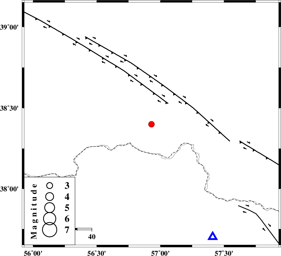
| Location | Lat:38.4 Lon: 56.93 |
| Region | Turkmenistan, 94 km North of Ashkhaneh |
Nearest Cities |
|
| 30 km North East of Yekehsoud-e paeen, Khorasan(north) Province | |
| 50 km North of Tangehzar, Khorasan(north) Province | |
| 54 km North West of Raz, Khorasan(north) Province | |
| 74 km North West of Gifan olia, Khorasan(north) Province | |
| 80 km North East of Qazanqayeh, Golestan Province | |
| Depth | 14 km |
| Agency | |
Faults within 150 km: |
|
| MAIN_KOPEHDAGH_F1 (Length: 318 km) , Distance to epicenter: 18 km | |
| MAIN_KOPEHDAGH_F2 (Length: 131 km) , Distance to epicenter: 28 km | |
| MAIN_KOPEHDAGH_F3 (Length: 96 km) , Distance to epicenter: 61 km | |
| Number of Phases | 5 |
| RMS | 0.2 |
| Number of Stations | 4 |
| Error in Latitude | >8.5 km |
| Error in Longitude | 3.5 km |
| Error in Depth | 4.6 km |
Download waveform in seisan format
to download seisan software Click here
to access information about IIEES stations Click here
Amplitude | ||||||||
| UID | Agency | Station | Component | Amplitude | Period | Arrival Time | Proccessing Time | Signal Clip |
| 87782 | IIEES | MRVT | N | 390.2 | 0.47 | 2013-01-30 09:01:09 | 2013-01-30 09:29:00 | n |
Phase | ||||||||||||
| Agency | Station | Component | Phase Type | Phase Quality | First Motion | Observed Arrival Time | Time Residual | Loc. Flag | Input Weight | Distance | Azimuth | |
| IIEES | BJRD | Z | Pg | E | 2013-01-30 09:00:48 | -0.02 | y | 87.8 | 151 | |||
| IIEES | MRVT | Z | Pg | E | 2013-01-30 09:00:51 | -0.15 | y | 110 | 222 | |||
| IIEES | MRVT | N | Sg | E | 2013-01-30 09:01:05 | 0.03 | y | 110 | 222 | |||
| IIEES | SHRO | Z | Pn | E | 2013-01-30 09:01:15 | 0.26 | y | 277 | 197 | |||
| IIEES | TABS | Z | Pn | E | 2013-01-30 09:01:46 | -0.18 | y | 527 | 178 | |||