
Magnitude |
2.7 |
| Date & Time (UTC) | 2013-02-12 20:46:04.9 |
| Date & Time (Local) | 1391/11/25 00:16:04.9 |
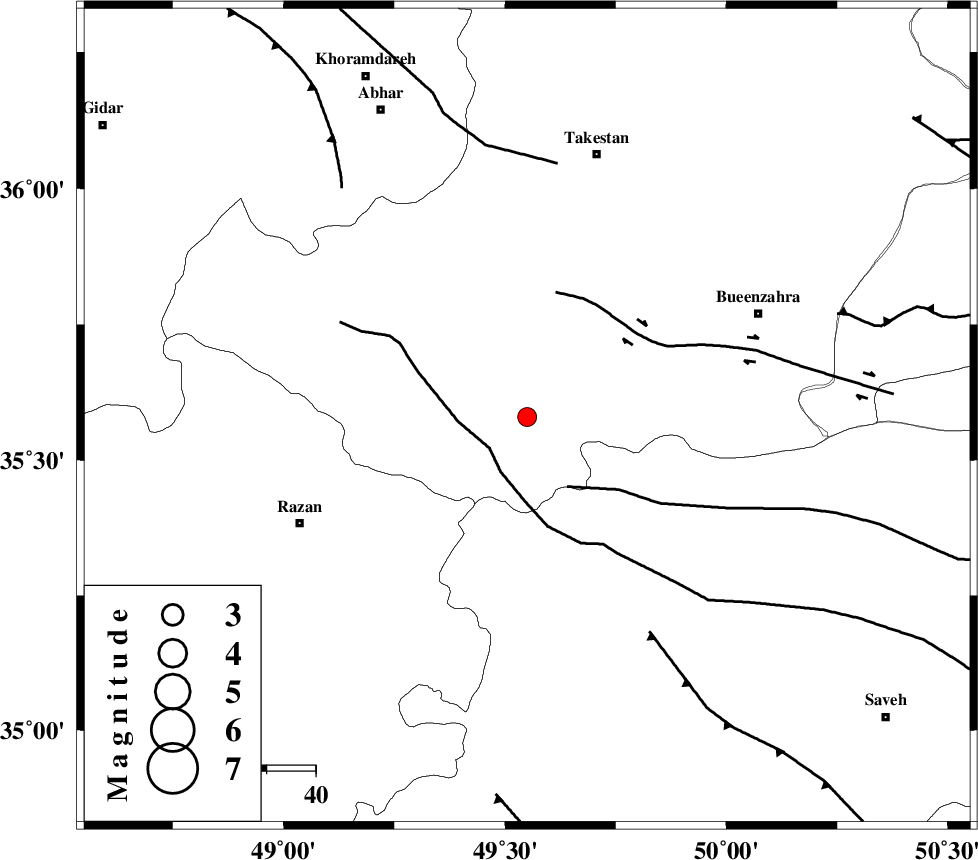
| Location | Lat:35.58 Lon: 49.55 |
| Region | Ghazvin Province, 55 km South-West of Takestan |
Nearest Cities |
|
| 9 km of Kolanjin, Ghazvin Province | |
| 28 km South West of Danesfahan, Ghazvin Province | |
| 28 km East of Avaj, Ghazvin Province | |
| 31 km South East of Ab-e garm, Ghazvin Province | |
| 32 km North West of Duzaj, Markazi Province | |
| Depth | 25 km |
| Agency | |
Faults within 150 km: |
|
| KUSHK_E_NOSRAT_F (Length: 230 km) , Distance to epicenter: 10 km | |
| S_PARANDAK_F (Length: 116 km) , Distance to epicenter: 16 km | |
| IPAK_F (Length: 80 km) , Distance to epicenter: 26 km | |
| Number of Phases | 7 |
| RMS | 0.1 |
| Number of Stations | 6 |
| Error in Latitude | >1.5 km |
| Error in Longitude | 1.7 km |
| Error in Depth | 5 km |
Download waveform in seisan format
to download seisan software Click here
to access information about IIEES stations Click here
Amplitude | ||||||||
| UID | Agency | Station | Component | Amplitude | Period | Arrival Time | Proccessing Time | Signal Clip |
| 87878 | IIEES | THKV | N | 150.7 | 0.28 | 2013-02-12 20:46:48 | 2013-02-12 09:28:00 | n |
Phase | ||||||||||||
| Agency | Station | Component | Phase Type | Phase Quality | First Motion | Observed Arrival Time | Time Residual | Loc. Flag | Input Weight | Distance | Azimuth | |
| IIEES | THKV | Z | Pg | E | 2013-02-12 20:46:25 | 0.15 | y | 126 | 73 | |||
| IIEES | ZNJK | Z | Pg | E | 2013-02-12 20:46:28 | 0 | y | 144 | 327 | |||
| IIEES | CHTH | Z | Pg | E | 2013-02-12 20:46:28 | -0.17 | y | 147 | 75 | |||
| IIEES | CHTH | E | Sg | E | 2013-02-12 20:46:46 | 0 | y | 147 | 75 | |||
| IIEES | GHVR | Z | Pg | E | 2013-02-12 20:46:36 | 0.03 | y | 197 | 128 | |||
| IIEES | SNGE | Z | Pn | E | 2013-02-12 20:46:37 | 0 | y | 207 | 255 | |||
| IIEES | KHMZ | Z | Pg | E | 2013-02-12 20:46:38 | -0.02 | y | 208 | 169 | |||