
Magnitude |
4.2 |
| Date & Time (UTC) | 2013-02-28 11:06:02.4 |
| Date & Time (Local) | 1391/12/10 14:36:02.4 |
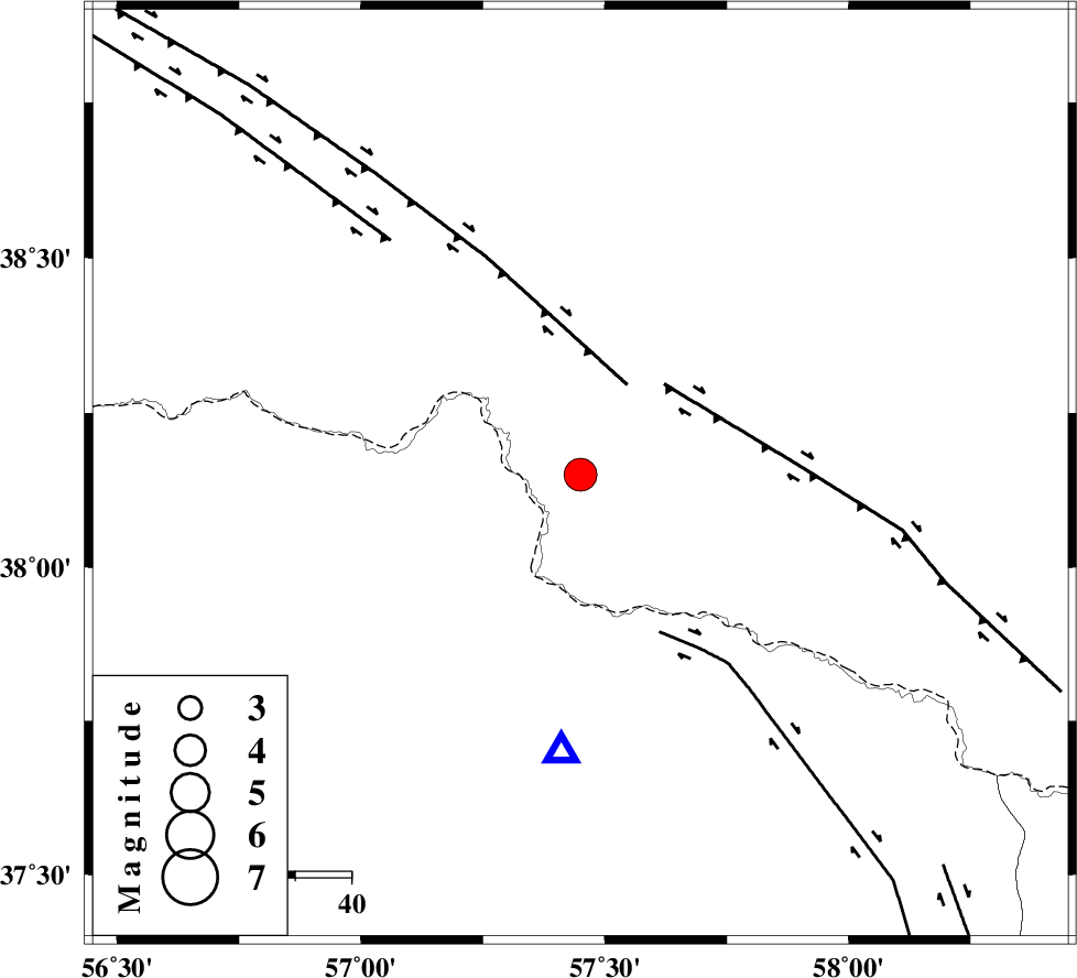
| Location | Lat:38.15 Lon: 57.45 |
| Region | 76 km North-East of Bojnurd |
Nearest Cities |
|
| 28 km North of Gifan olia, Khorasan(north) Province | |
| 37 km North East of Raz, Khorasan(north) Province | |
| 50 km North East of Tangehzar, Khorasan(north) Province | |
| 52 km North West of Yangi ghale-ye bala, Khorasan(north) Province | |
| 63 km East of Yekehsoud-e paeen, Khorasan(north) Province | |
| Depth | 16 km |
| Agency | |
Faults within 150 km: |
|
| MAIN_KOPEHDAGH_F2 (Length: 131 km) , Distance to epicenter: 18 km | |
| MAIN_KOPEHDAGH_F3 (Length: 96 km) , Distance to epicenter: 22 km | |
| BAGHAN_GERMAB_F (Length: 79 km) , Distance to epicenter: 32 km | |
| Number of Phases | 5 |
| RMS | 0.1 |
| Number of Stations | 4 |
| Error in Latitude | >3.4 km |
| Error in Longitude | 4.7 km |
| Error in Depth | 4.3 km |
Download waveform in seisan format
to download seisan software Click here
to access information about IIEES stations Click here
Amplitude | ||||||||
| UID | Agency | Station | Component | Amplitude | Period | Arrival Time | Proccessing Time | Signal Clip |
| 88054 | IIEES | BJRD | E | 18409.9 | 0.4 | 2013-02-28 11:06:20 | 2013-02-28 11:45:00 | n |
| 88055 | IIEES | MRVT | N | 5314.7 | 0.68 | 2013-02-28 11:06:49 | 2013-02-28 11:45:00 | n |
| 88056 | IIEES | SHRO | N | 1235 | 0.88 | 2013-02-28 11:07:23 | 2013-02-28 11:45:00 | n |
Phase | ||||||||||||
| Agency | Station | Component | Phase Type | Phase Quality | First Motion | Observed Arrival Time | Time Residual | Loc. Flag | Input Weight | Distance | Azimuth | |
| IIEES | BJRD | Z | Pg | E | 2013-02-28 11:06:11 | 0.06 | y | 49.9 | 184 | |||
| IIEES | MRVT | Z | Pg | E | 2013-02-28 11:06:24 | -0.05 | y | 132 | 246 | |||
| IIEES | SHRO | Z | Pn | E | 2013-02-28 11:06:43 | 0.16 | y | 270 | 209 | |||
| IIEES | SHRO | E | Sg | E | 2013-02-28 11:07:18 | -0.02 | y | 270 | 209 | |||
| IIEES | TABS | Z | Pn | E | 2013-02-28 11:07:11 | -0.23 | y | 500 | 184 | |||